My Job As An Underwater Archaeologist
Archaeology is a subdivision of Anthropology which studies the cultural behavior and evolution of humans. Specifically, archaeologists systematically recover and study the material evidence remaining from past human lives and cultures to draw conclusions about past societies and how they might have influenced current and future societies.
Subdivisions of Underwater Archaeology
- Maritime Archaeology - The scientific study of material evidence remaining from human activities on the sea.
- Nautical Archaeology - The specialized study of maritime technology (e.g., ships, boats, and other craft).
- Riverine Archaeology - The study of artifacts of early river transportation.
- Submerged Site Archaeology - The study of Inundated Sites (terrestrial sites which have been submerged due to land subsidence or rising sea levels.)
- Water saturated sites - swamps, marshes, and other wetland sites created as a result of changes in the water table due either too natural or human changes to the environment.
Definitions:
- Site - collection of artifacts, features or ecofacts left by people whom once lived in or used a specific place.
- Artifact - A portable object(s) that has been modified, shaped, or utilized by humans.
- Feature - A non-portable product left by people who once lived in or used a specific place.
- Ecofact - Related flora and/or fauna caused by human activity.
- Provenience - Origin, location, arrangement and relationship of a collection of remains with respect to each and themselves.
Steps in an Underwater Investigation
- Research - archival research, local area maps, snag books, local investigation.
- Reconnaissance – Remote-sensing
- Research Design – Goals and objectives – Includes a budget, staffing, safety issues, conservation, analysis, and publication.
- Pre-disturbance Survey - Preliminary investigation of remains to determine the nature and extent of a site.
- Non-intrusive - no excavation or test pits. Visual observations only.
- Artifact recovery - minimal recovery of artifacts to obtain diagnostic or endangered artifacts.
- Test excavation - trench excavation to determine the nature and extent of the remains.
- Full excavation - full-scale excavation
- Conservation - Scientific methods for stabilizing and preserving artifacts brought up from a site.
- Analysis - Examination to develop conclusions about the site and gain insight into the people who constructed or utilized the remains.
- Publication - The end purpose of any investigation is to share the knowledge acquired with the public and other researchers.
Research
Objective: to find source materials that give evidence related to an event or site under study. This information should help shed light on multiple aspects of a question so as to gather as much information as possible before going into the field.
History and archaeology complement each other. Historical information can corroborate or counter archaeological data and vice versa. Both add to the overall story that cannot be told from either source alone.
The more information obtained about a site before going into the field, the more fruitful the initial survey will be and the more information the final report will have for future generations.
Sources of Information
Primary Sources - created at the time of the event. (Ship's log, diaries, reports, cargo manifests, registration, enrollments, court records, wills, deeds, etc.)
Secondary Sources - created after the event. (Reports of the event - Lloyd's Register, Merchant Vessels of the United States, Newspaper accounts, Vessel Certificate of Registry, Vessel Certificate of Enrollment, Vessel Certificate of License, etc.)
- Archives
- Museums
- Repositories
- Libraries
- Newspaper account
Reconnaissance
Until recently, most of the world’s underwater sites have been found by free divers or scuba divers. It has been only with the increasing pace of underwater technologies that the techniques and skills of hydrographic surveying have been routinely used to assist in finding sites through systematic searches over a defined area.
Advantages
- Helps define search area before complete survey is conducted.
- Large areas can be efficiently and quickly surveyed much faster than a diver's visual inspection, thus saving time and money.
- Search areas can now be sampled with greater detail; above and below the seabed.
- Anomalies can be positioned with a higher degree of accuracy allowing divers to return to the same site easily.
Types of Remote-sensing Equipment
- Magnetometer
- Side-scan Sonar
- Sub Bottom Profiler
Magnetometer
A magnetometer is an instrument used to measure variations in the earth's magnetic field. There are many applications for this technology but in underwater archaeology, they can be used to locate archaeological sites such as shipwrecks.
This instrument measures the intensity of the Earth's magnetic field by utilizing the precession of spinning protons, nuclei of the hydrogen atom, in a hydrocarbon fluid. The fluid, typically kerosene or jet fuel is contained within a coil of wire and is momentarily magnetized by direct current in the wire. This current is then removed and the protons process, or wobble like a spinning top, about the direction of the Earth's magnetic field. This difference in frequency can be measured and variations recorded for analysis.
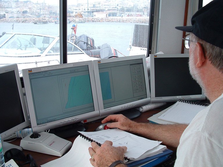
Assuming the Earth's magnetic field intensity is uniform and that an iron object behaves like a short bar magnet in this field, the object will create an anomaly. The variations in frequency, taken at a rate of several times per second, are then transmitted up a cable to a laptop computer where the data is collected and rendered graphically.
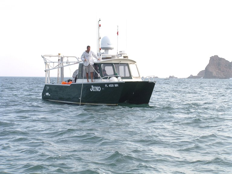
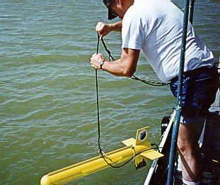
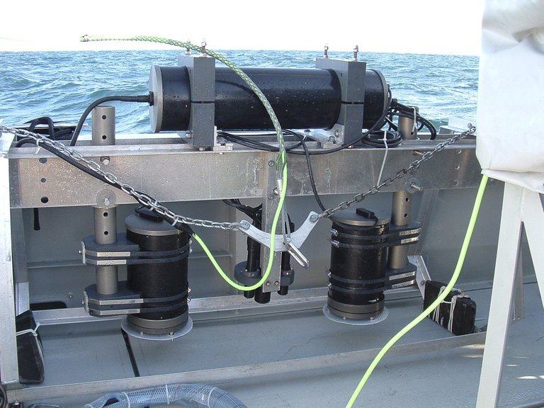
The magnetometer sensor is contained in a housing referred to as a "fish" at the end of a long, electrically suitable and mechanically durable tow cable. The entire sensor and cable are known as the tow system. Remember, it is very important to also collect precise positional data using a GPS so that each anomaly can be easily located at a later date. This not only helps to set up your search area but also helps maintain lane spacing during the survey.
Side-Scan Sonar
This sideways looking sonar has a transducer fixed either to one side of the vessel or towed behind the vessel. In the latter case, the system can be operated so that the sonar beams radiate on either side of the fish to provide a two-way look.
The transducer emits a fan-shaped pulse of sound that has a narrow beam width in the fore and aft direction. The fan-shaped beam lies in a plane at right angles to the track of the fish and the center of the beam is directed slightly downwards towards the maximum anticipated range.
These twin, fan-shaped beams are reflected by topographical features and submerged objects on or near the seabed. The reflected acoustic energy is detected by the transducers and returned up the tow cable and displayed on a computer screen onboard for a continuous, permanent "picture" of the seafloor.
Advantages
- Long range
- Provides high resolution detail
- Helps locate and identify underwater objects, explore and map seabed terrain, assists in planning an informed dive, and creates a permanent record of underwater topography.
- Can be used to isolate certain characteristics of a site or specific parts of a wreck, such as a wheelhouse, propeller, anchor or chain.
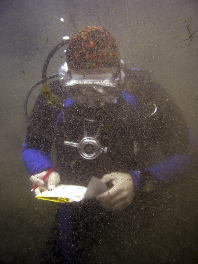
- In a blackwater environment, the images produced may be the only visual clues that can be retrieved from the site and can be very important to the overall record.
Sub-bottom Profiler
Sub-bottom profilers are used to identify layers of sediment or rock under the seafloor. The transducer emits a pulse vertically and a receiver records the return as it is reflected back. The sound pulse is often sent from an air gun towed behind the ship. An air gun uses the sudden release of compressed air to form bubbles and the bubble formation produces a loud sound. The sound from the air gun travels down to the seafloor. Some of the sounds reflect off the seafloor but some of the sounds penetrate the seafloor. The sound that penetrates the seafloor may also reflect off layers of material within the seabed. The reflected sounds travel back up to the surface.
The ship would also tow a number of hydrophones (called a towed array or streamer) which detects the reflected sound signal when it reaches the surface. The time it takes the sound to return to the ship can be used to find the thickness of the layers in the seabed and their position (sloped, level, etc.). It also gives some information about the composition of the layers.
Sector-Scanning Sonar
Sector-scanning sonar is used to aid in navigation in low visibility situations. They generate noisy, low-resolution 2D range vs. bearing images of a 3D scene. Sound waves are emitted from the sensor underwater and the topside console records the intensity of the echoes as they bounce off the objects scanned. This image is very similar to that produced by a Doppler radar.
Metal detector
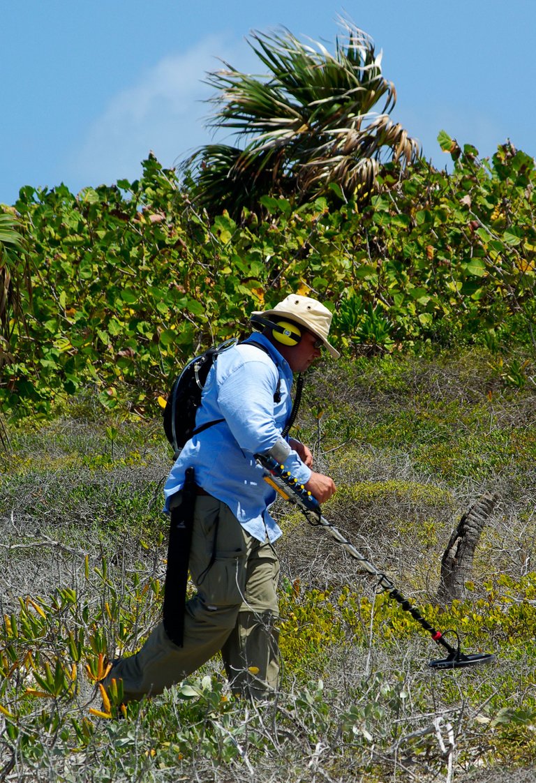
A metal detector can locate both ferrous and nonferrous materials and in its simplest form consists of an oscillator producing an alternating current that passes through a coil producing an alternating magnetic field. If a piece of electrically conductive metal is close to the coil, eddy currents will be induced in the metal, and this produces an alternating magnetic field of its own. If another coil is used to measure the magnetic field the change in the magnetic field due to the metallic object can be detected.
Survey
Pre-Disturbance Surveys – used to determine the broad extent or perimeter of the site.
- Close-plot Magnetometer survey - a diver takes the magnetometer head and either swims with it or takes it down to a predetermined position on the seabed and the local field strength is measured. This information can be plotted and an anomaly sitemap can be produced which will illustrate the best place to start your survey.
- Metal Detector Survey - a metal detector can locate both ferrous and nonferrous materials and will give an added effect to a magnetometer survey.
- Probe Survey – this is a simple iron rod which can be used to determine where the material is buried. If a grid system is used, the probing can be conducted at the intersections of the grid. In this way, a systematic survey can be conducted and hits and misses can be recorded revealing the outline of the remains.
- Water or air probe - This is much more efficient than a normal rebar probe. This is a long, thin, hollow PVC tube 10 mm in diameter. Air or water is pumped into it. The air or water helps to clear debris from the path of the tube and keeps the sediments from sticking to it.
Recording and Mapping Survey
Mapping gives us the ability to determine a position in 3D of natural and human-made features on or beneath the surface of the Earth.
Surveying Techniques
Site preparation
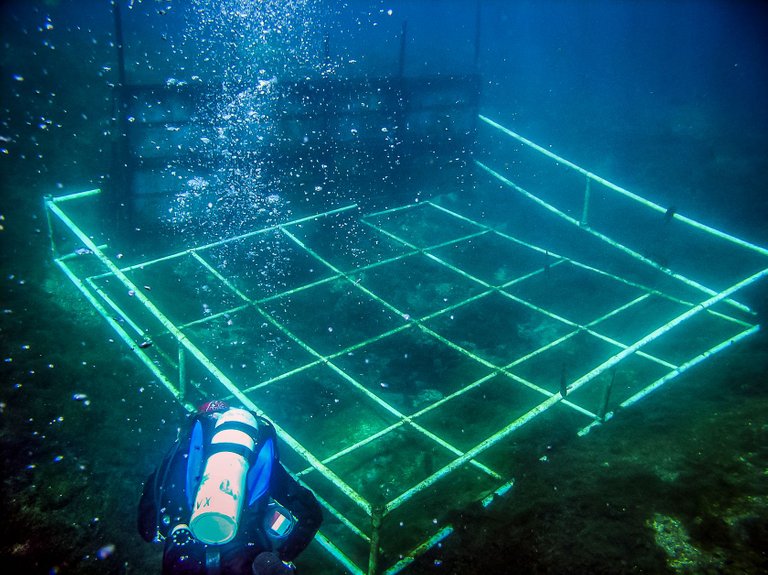
Grid System - there are a number of advantages and disadvantages to using a grid system underwater. On extensive sites with a large staff, grid frames are used to define excavation areas and to orient staff that may be unfamiliar with the site.
String/ rope - The most practical to use since the rope can be attached to rebar that can also serve as datums. The grid can be attached and detached as necessary and moved easily.
PVC - this grid is very rigid and will slop inwards as the site is excavated down. It also becomes difficult to excavate large features that cross several units.
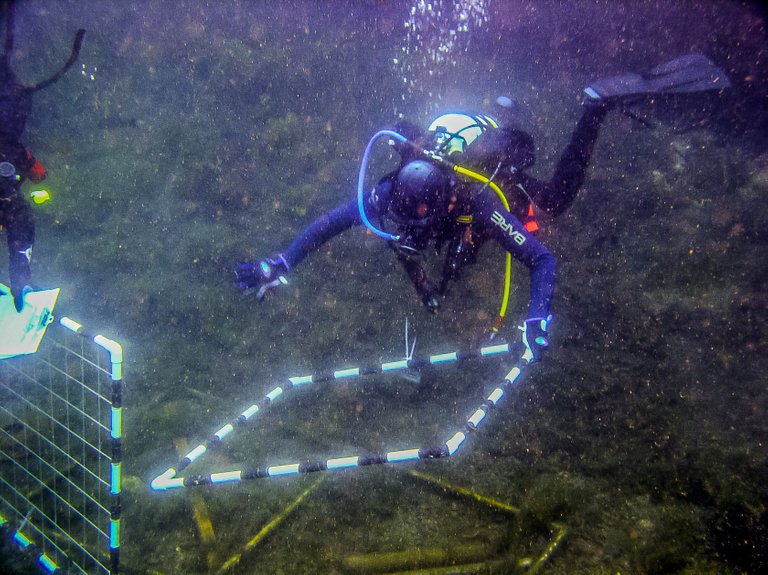
Datums - Datums are used as key reference points to measure artifacts or large features. These datums must all be mapped to each other to set up the baseline. In blackwater sites, it is a good idea to tie the datums together to form a travel line for the divers and to establish the perimeter of the site.
Trilateration - Direct Survey Method (DSM) - 2D survey technique - A single point can be uniquely determined relative to 3 fixed reference points if, firstly, the distance between the 3 reference points is known, and secondly, the distances from these 3 reference points to an unknown point can be measured. 3 fixed datums are set up on the site. In most cases, multiple datums will have to be used because of the size of the site.
Computer-based technology - a least square adjustment program is a mathematical method of calculating the best fit of a series of measurements. The program calculates the best fit from the given data, using rigorous statistical techniques, and provides a statistical estimation of the errors involved in the measurements. Through a series of mathematical iterations, the distances are systematically varied by small amounts in order to seek a unique best fit, which requires the least amount of adjustment to the measurements.
Distance-angle measurement - Working with a single tape and measuring the angle or bearing of the object to a fixed reference point. The zero end of the tape is fixed to a central datum. The operator then swims to the first point. At the point to be measured, the distance and bearing to the reference datum are recorded.
Electronic Distance Measuring Systems (EDM) - EDM Systems usually use sound signals or sonar, to measure distance and there are a number of possible configurations. A pulse of sound is transmitted from a transducer. The time it takes for the pulse to return is measured, enabling the distance to be determined and with a number of distance measurements, the position uniquely located. The main problem lies in the effects of spurious reflections from other objects (backscatter), and some form of complex corner reflector is required to redirect a strong signal back to the transducer.
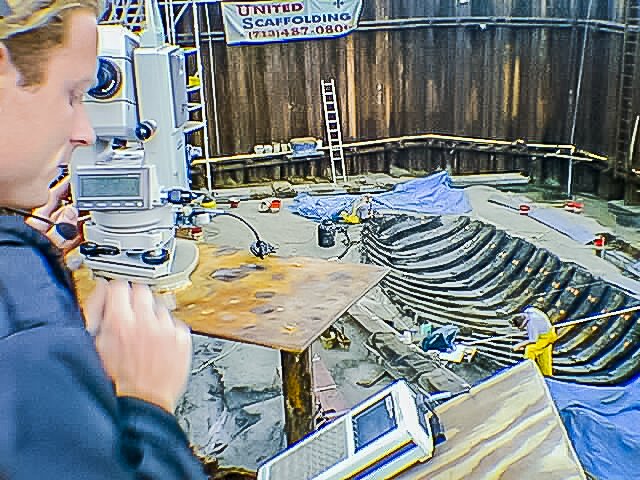
Total Data Station (TDS) - The TDS enabled archaeologists to map artifacts with sub-centimeter accuracy. The instrument issues an infrared beam towards a mounted prism, which then transfers an X, Y, and Z coordinate back to a data recorder. The dual-axis tilt sensor monitors any inclination of standing axis for both X and Y directions and automatically computes and applies corrected values for both horizontal and vertical readings. This can only be used on land sites or very shallow underwater sites where the main station is mounted above the water or on land.
Excavation Techniques
An excavation is a process of uncovering a site by removing spoil, observing and identifying the archaeological material and then recording and recovering it.
- Hand fanning - This is a simple technique that will cause very little damage if any to the cultural remain. It is however extremely slow.
- Airlifts - The principle of operation is that air, under pressure, is introduced into the bottom of a tube. As the air rises up the tube it expands, and this expansion causes suction at the lower end of the tube. The greater the volume of air and the greater the vertical rise from one end of the pipe to the other, the greater the suction. Because the airlift is buoyant when in operation, the lower end will have to be anchored to the seabed or weighted down. When working an airlift where the spoil could consist of archaeological material, the spoil should be checked to make sure nothing is lost.
- Hand feeding the airlift - this is the technique to use when there is archaeological material in the area. The excavator puts selected heavy material into the airlift, but hand fans the archaeological layer. The hand-fanning removes the light sediments from the seabed which are then sucked up the airlift leaving the water clear and enabling the excavator to reveal light, delicate objects.
- Overburden removal - In this situation, the airlift is placed just above the overburden so that it is sucked up the tube, rather like a vacuum cleaner.
- Water Dredge – High-pressure water (water pump) is injected into the tube at the head, directed so that the flow is axial with the long pipe. The flow of water along this pipe causes an induced suction at the working end. It is possible to attach a flexible tube to the suction end to increase the mobility of the dredge. This dredge can be used on both shallow and deep-water sites.
- Prop-wash deflectors - a device that diverts the water thrust from the vessel's propeller downward by means of a tube with a right-angle bend. The resultant down-thrust could be used to dig extensive holes in the sand overburden. The more powerful the thrust, the greater depth at which it can work effectively and the bigger the hole that can be dug. This device should only be used when there is a deep overburden and using an airlift or water dredge is not appropriate. It should never be used for delicate excavation.
- Lift bags – Lift Bags can lift from a few hundred pounds up to several tons. Air is introduced into the bottom of the bag, and it inflates until the whole bag is full and maximum lift is achieved. Where possible, it is better to have a number of small bags rather than one large bag. This is because as a bag rises, the air in it expands. Thus, if a big bag is only partially full on the lift, as it raises the air inside it expands and thus the force of the lift increases, resulting in an uncontrolled and extremely fast ascent. On arrival at the surface, the bag may exit from the water and lose a large portion of its buoyancy, resulting in an equally fast return to the seafloor.
Excavation Equipment
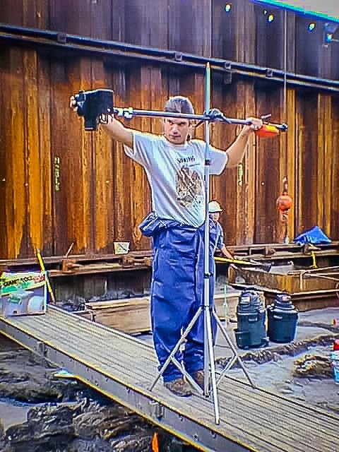
- Tools - Sledgehammers, chisels, crowbar, measuring tapes, geological hammers, etc.
- Artifact recovery - Lift bags - (rope or chain, block, and tackle, crane or winch), bubble wrap, wooden pallets, and containers for recovered artifacts, etc.
- Documentation equipment - measuring tapes, slates or clipboard spray painted white, cut mylar sheets, pencils, rulers, flagging tape, artifact tags, cameras, etc.
- Computer equipment - mapping software, Excel (simple database), graph paper, photo Log, field notes, etc.
Data Recovery
What kinds of information is important?
Provenience and spatial relationships
Vertical - stratigraphy and the law of deposition
Horizontal - distribution
Artifacts
Labeling - artifact tags - location, excavator, unit, date, and site number.
Drawings - Unit drawings, Artifact drawings, feature drawings, observations, etc.
Photography and Videography
Photography is essential for keeping records on archaeological investigations. Because archaeology is the systematic destruction of a site underwater, it is often referred to as the "unrepeatable experiment." Photographs may be all that remains of the site once the excavation is complete.
Photography provides a less selective and wider view of the site and ensures everything that might be of interest gets included in the documentation of the site.
Uses of Photography
- General Activity Shots - public education, public relations, fundraising and human interests.
- Research Methodology - Document how a site was excavated and recorded.
- Formal Record Keeping - Feature photographs that will record every feature of the site in relation to artifacts and other elements of that site.
- Site progression - Photographs will also help to keep track of the progression of work and to give before and after images of the site.
- Artifact Photography - for formal publications and presentations and to give before and after photographs of artifacts after they have gone through conservation.
- Photo Mosaics - An extremely good way to document a site.
Videography
Large areas can be recorded in a shorter period of time using video as opposed to still images. Video also provides instant feedback for planning consecutive dives, and is a good reference tool to go back and look at a site once you are out of the field.
Conservation
Because of the lower levels of oxygen, light, and temperature; archaeological materials are generally better preserved in underwater environments than in terrestrial environments. Consequently, submerged archaeological sites often yield larger collections, including bone, ceramics, glass, ferrous and non-ferrous metals, leather, vegetable fiber, cloth, rope, and wood.
Because of the harmful long-term effects of immersion in water, from the absorption of chlorides present in seawater, and from natural degradation processes that occur over time, almost all materials recovered from underwater archaeological sites require some type of conservation treatment to preserve them.
Field Conservation
Artifacts must be kept in sea/ fresh water until preservation can begin. In the field, the must that should be attempted is to apply fungicides, biocides or algaecides to the material to keep any foreign material from growing on the artifact.
Without exception, organic material must be kept in seawater or freshwater while in the field unless there is a lab setup to conserve or stabilize the material. Because of their complexity, these materials should be left alone until a lab with appropriate conservation equipment and chemicals can accept them.
Metal artifacts
- Pewter, lead and lead-tin alloys - These materials are usually stable when recovered. They should be washed free of saltwater and then stored in a dry environment. This type of material should not be stored in freshwater unless a corrosion inhibitor is used.
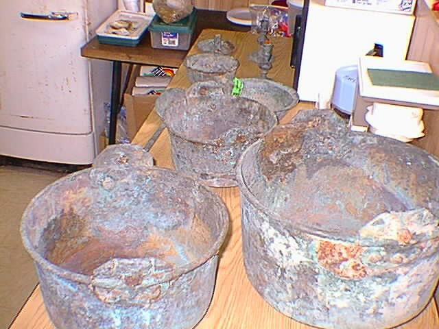
- Copper and copper alloys - This type of material can be stored dry in a relative humidity of less than 15%, for short periods of time. Otherwise, store in saltwater until transport to a lab can be arranged.
- Iron - Leave any concretions surrounding remains of the object alone. Once removed, O2 start to decompose the area and the object will need to go into conservation immediately. Keep in salt water until transport to a lab can be arranged.
Ceramics
- High-fired wares (stoneware and porcelain) - These materials can be mechanically cleaned in the field as they are generally very robust and non-porous. They should be stored wet, in freshwater.
- Low-fired wares (earthenware, tin glaze, etc.) - This type of material has to be kept wet because any drying out will cause the salt to crystallize and this will mechanically damage the surface. It is not advisable to directly place these materials into freshwater because the drastic change in osmotic pressure can damage the object. Initially, the objects should be placed in seawater and the salinity gradually reduced by adding freshwater.
- Glass and Stone - This material is best kept in seawater or in a wet environment until it can be properly desalinated in the lab.
Project Planning Recommendations for Conservation of Artifacts
Anticipate what might be encounter in the field either during a survey, testing, or full excavation. Be aware of the types of breakdown, corrosion, and degradation that the recovered material might undergo.
Have someone with conservation experience in the field to help with the excavation to ensure the recovered objects are properly treated.
Make arrangements for conservation before initiating any operation where artifacts may be recovered. This may mean contracting with an existing laboratory or establishing special facilities for a project.
As is evident, the survey, recovery, and protection of submerged cultural remains presents a series of complex issues. The protection of our cultural history is paramount so that it can be passed down to future generations. Using the proper tools and techniques to bring historical materials to the surface is only a small part of the process. Having the full understanding of the ramifications in doing so is what determines if a team is prepared or not.
Now this is a blog. I resteemed. Hopefully you get some followers after this.
Thank you