THE COCKTAIL IN OUR HYDROSPHERE
Water as an important drink for the survival of humans have become a life-threatening substance that has plagued humans with variable diseases in our society since time immemorial.
With time now! Have been haunted by the question in quote “To what extent will this be?” groundwater system has become a major and primary cause to the threatening of lives. Methods of different aims have been introduced and proven effective to eliminating this plague we are faced with...but of the contrary not looking forward to the root cause of this pandemic. And this...a research work to evaluate it, I carried out on the root cause of the pandemic.
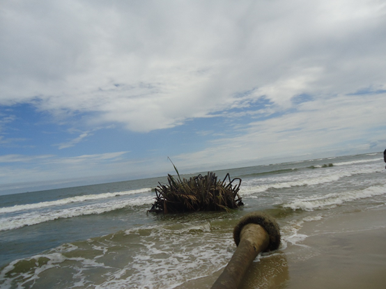
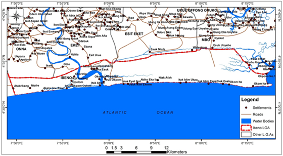
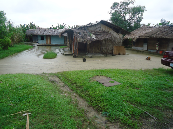
This research as it may was carried out in the coastal plains of Ibeno, Akwa Ibom state, Nigeria bordered in the south by the Atlantic ocean, north by Onna, Esit-Eket, and Eket and west by Eastern-Obolo Local Government Area.
In the course of this study, the geophysical method was used in evaluating the cocktail in our hydrosphere
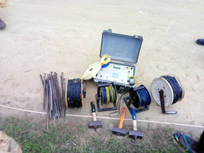
Different materials like steel electrodes, resistivity meter, measuring tapes, hammers, current and potential cable reels, power source and the geographical positioning system were used for this study as shown below.
With the geophysical method, the electrical resistivity survey technique involving Electrical Resistivity Tomography (ERT) was used.
This method was used due to its horizontal data coverage and depth penetration with the aim of delineating the cocktail in our hydrosphere which makes our groundwater system a threat to the human world.
The electrical resistivity tomography deploys the combination of Vertical Electrical Sounding (VES) and the Horizontal Resistivity Profiling (HRP). In this technique, the Wenner electrode array was adopted which consists of four collinear equally spaced electrodes.
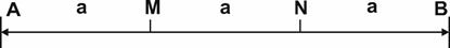
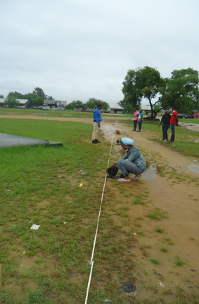
The outer two (A and B) are usually the current electrodes while the inner two (M and N) are potential electrodes in which the electrodes were regularly and equally spaced with a minimum separation (a) of 5m and maximum spread of 150m.
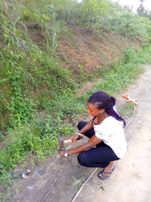
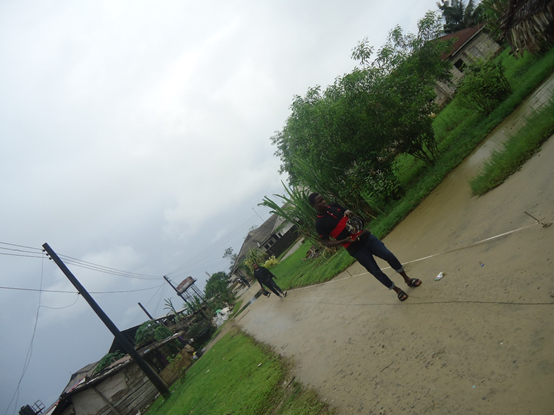
The survey line was measured for the survey down perpendicular to the coastal line; hammers were used to drive the electrodes into the ground at intervals of 5m along the profile.
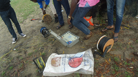
The power source was connected to the resistivity meter and the meter was put ON
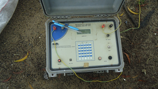
and prepared to record while the cables from the meter were also connected to the first four electrodes along the survey line for profiling, profiling done involved
moving the whole array with constant spacing of 5m that is from 5m spacing and then expanded to 10m spacing, 15m, 20m, 25m, and 30m along the line of survey till the 150m spread was exhausted.
Readings on the resistivity meter were limited to shallow depth as there was no further increase of the electrodes. This was basically because of the nature of the beach. Resistance readings gotten from the resistivity meter were written down at every measuring point
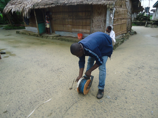
Problems encountered were the difficulty in moving cables from one point to another, and that made it so hectic although it was fun too.
After the field survey, the measured resistances were then converted to apparent resistivity values with the help of the geometrical factor of Wenner electrode array (2πaR) where R is the (resistance measured in the field otherwise known as the ground resistance) and “a” ( is the spacing between electrodes).
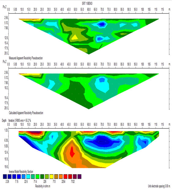
The data acquired were used to create 2D Electrical Resistivity tomography for the ERT using the RES2DINV software program. The pseudo-section reflects the true resistivity distribution along the profile and therefore was used as a base for qualitative interpretation.
From the result acquired below, the 2D electrical resistivity tomography profiles measured with lateral extent of 200m, 200m, 135m, and 150m for the configuration and vertical extent ranging from 1.25 to 19.8m, 1.25 to 19.8m, 1.25 to 15.9m, 1.25 to 12.4m respectively showed that there was an intrusion of cocktail “saltwater” in this area with resistivity values below 10 Ωm.
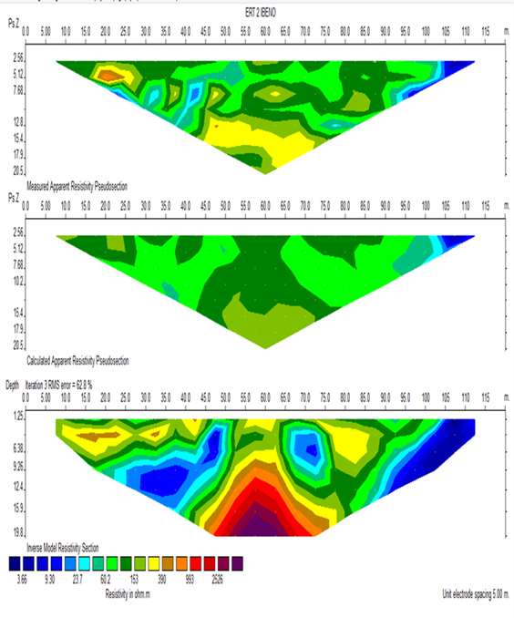
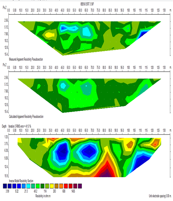
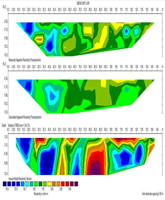
In conclusion, the geophysical investigation have been used to study the subsurface geology and to delineate the extent of the incursion of the cocktail in our hydrosphere within the study area.
The inferred lithologies from the 2D ERT imaging shows a high level of incursion of cocktail in the area, perhaps due to increase in groundwater extraction; hydraulic connection between freshwater and seawater thereby allowing the cocktail to push further inland beneath the freshwater.
To this effect, it is vital that adequate remediation measures should be adopted to mitigate the effect of the cocktail intrusion into coastal aquifer system within the study area like policies to regulating pumping rate of groundwater within coastal areas should be adopted and also introduction of fresh water injection and saltwater extraction techniques to prevent or retard the salinization process within coastal aquifer systems.