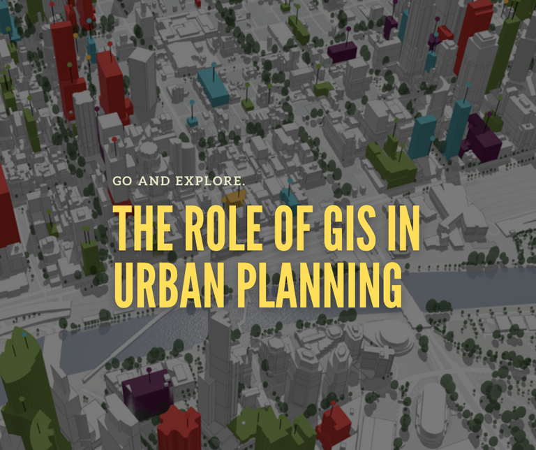
The role of Geographic Information System (GIS) in Urban Planning
We can't deny that more than half of the world's population lives in cities, but we still don't know much about them. It is especially true in fast-rising cities in emerging global economies, where growth and redevelopment become frequent and overwhelm administrative capacity. Urban planners only have a little reliable data, internationally consistent data on how we organized cities, how they grow and develop, and how we can improve them for our well-being in urban space and the planet, from the city scale to the neighborhood scale.
Mapping urban land usage over time enables us to understand what, where, and when changes occur. We used remote sensing has transformed how we measure and comprehend our planet. Technically, we can use it to watch global deforestation and forecasting weather in near real-time. We can use remote sensing to mapping urban space to some extent, but it does not capture the intricacies of urban areas. Mapping urban spaces help us understand cities better. We can see the network of roads and housing and the distribution of commercial and industrial spaces. To some extent, we can predict and identify the availability of jobs that is on the area.
To date, we can improve our urban planning with the aid of a geographic information system (GIS), a computer system that captures, stores, verifies, and displays data about positions on the Earth's surface. With GIS, we can better understand geographical patterns and relationships by connecting seemingly unconnected data. In urban planning, GIS enables planners to visualize, analyze, and model spatial data. GIS can boost urban planning.
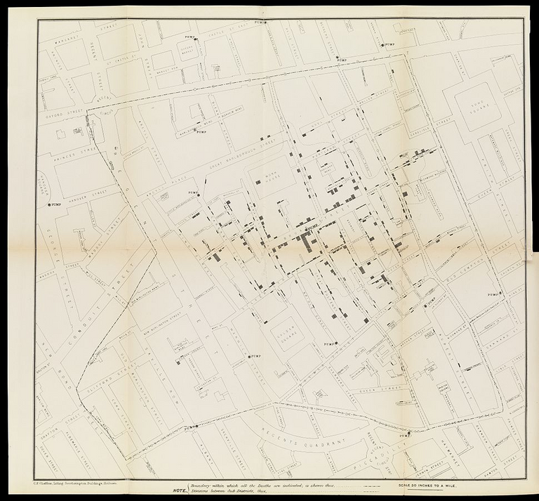
A map (p106-107) taken from a report by Dr. John Snow: p. [97]-120 of the "Report on the cholera outbreak in the Parish of St. James, Westminster, during the autumn of 1854", presented to the vestry by the Cholera Inquiry Committee, July 1855 | Phot Credit: Wellcome Collection from Science Museum Group
The Evolution of GIS
In 1854, people believed cholera spread through the air, but Dr. Jon argued that it was not. He decided to map the epidemic location, the highways, property boundaries, and water pumps. When he did, a pattern began to emerge, which lead him to conclude that cholera transmitted through water, and more precisely, through one infected water pump. It is the first instance that we have used spatial data in urban planning. We can trace back GIS origin to it. Snow's work revealed that GIS solved problems in urban planning and epidemiology. Snow's map illustrates where it was and made a life-saving discovery.
Before the 1960s, there is limited development in GIS. People who do urban mapping through paper and computers have no involvement in it. In the 1950s, people started to used maps for vehicle routing, development planning, and locating points of interest. During these years, people used Sieve mapping to identify areas of overlap in a map by using transparent layers on light tables. The spatial analysis is hard or near impossible to conduct. Data from the Sieve map are coarse and often inaccurate.
Between 1960 and 1975, there are three technological advances in new computer technology that resulted in the development of contemporary GIS. During this time, we can generate output map images using line printers. We can store large datasets due to the advancements in data storage. Also, our mainframe computers can process more data. These developments enable us to now save coordinates as data inputs and execute calculations on those coordinates.
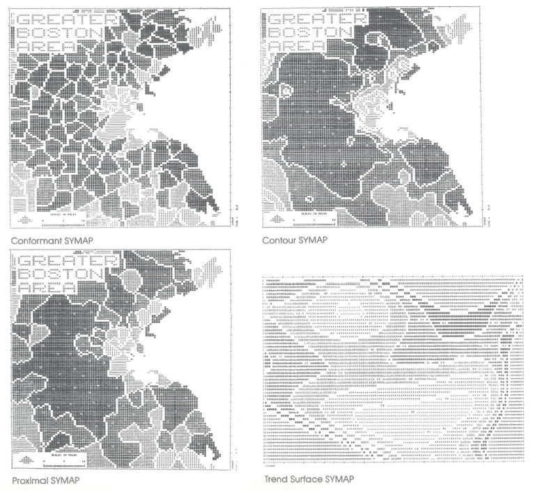
SYMAP - comparison of conformant, contour, proximal, and trend surface outputs | Photo Credit: Open Source Research - Laboratory for Computer Graphics and Spatial Analysis
In the mid-1970s, Jack Dangermond developed the first vector GIS, which he named ODYSSEY GIS. The advancement in computer memory and graphics led to the commercialization of GIS software. Between 1990 and 2010, GIS became mainstream. The launch of new earth observation satellites and integrating remote sensing technology with GIS resulted in more applications. Open source GIS was born between 2010 to 2018. GIS data became more and more ubiquitous with satellite imagery.
To date, modern GIS incorporates a wide range of data like high-resolution maps and 3D sceneries to analyze the geographic position and organize layers of information into visualizations. With modern GIS, we have better insights into data, such as patterns, relationships, and situations, allowing users to make more informed judgments.
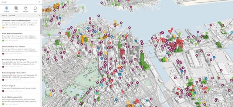
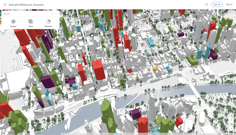
Every year, the Boston Planning & Development Authority (BPDA) organizes around 80 substantial development projects in and around Boston, Massachusetts. The public agency can use ArcGIS Urban to consolidate the development process into a centralized, shareable view of projects. | Photo Credit: ESRI
GIS boost Urban Planning
Urban planners are the people who direct the development of cities and towns, also called City planners. We can see most urban planners work for the government, but some consult with nonprofit and community organizations on how to effectively build and develop their communities. In the late nineteenth century, the United States pioneered urban planning, which is due to many cities were filthy and overcrowded at the time. Diseases like cholera, yellow fever, typhoid, and influenza quickly spread, which prompted city planners to relocate people and enacted zoning rules.
Hence the primary purpose of urban planning is to organize cities and mitigate urban problems like disease and traffic. An urban planner can use GIS to make accurate maps and perform spatial analysis that gives us better insight into what we need in our cities. Again, GIS is a tool that we can do data collection, management, and analysis. We can visualize data into tables, graphs, and maps to make data more visually presentable and easily understood. GIS provides patterns, correlations, and situations to users, allowing urban planners to make more educated decisions.
An urban planner can use GIS to estimate the demographics and density of urban space. It helps urban planners to decide where to create new cities and expand existing ones. It can alleviate overcrowding, urban blight, and other challenges. We can gain more insight from satellite images, reports, statistics, and paper maps about a planning area when integrating these data into a GIS. Urban planners can estimate demographic and land-use changes with the GIS data. Besides, GIS data enable planners to simulate traffic flow and speed.
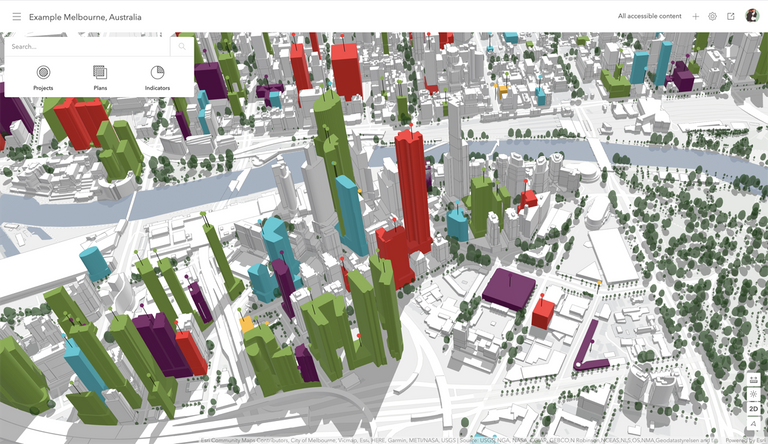
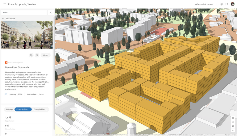
The overview UI for ArcGIS Urban. | Photo Credit : ArcGIS
With GIS technology, we can find better alternatives to pressing urban issues in development. It resides on GIS capability to bring together enormous information required to balance competing goals and solve complex problems such as optimizing new land uses to meet expanding populations. We can use GIS remote sensing technologies to assess a land area's environmental feasibility. We can decide whether to use the land for garbage disposal and treatment or wetlands restoration. Besides, we can use GIS for land and infrastructure management, such as assessing the impacts of dams, bridges, and other structures on the community and environment.
With GIS, we can make maps up-to-date, which boosts thematic mapping and reduce data storage costs by having a single repository for current and historical data and maps. GIS improves our access to urban space information by having the data in one place rather than searching through documents, hard drives, or search down data across departments. The urban planner can use the GIS data to have a one-stop-shop of information that readily accessible by the government and public. Again, planners can simulate and investigate a broader range of "what-if" scenarios leading to better long-term strategy.
Conclusion
We can't deny that GIS applications in city and region planning and management seem limitless. The diversity of GIS applications used by urban planners expand as time goes on, and it is crucial to keeping up with the global expansion and evolution of cities cannot be emphasized. Again, the goal of urban planning is to manage cities and reduce urban problems. With GIS data and technology, urban planners estimate changes in urban space and find better solutions to critical urban development concerns. The GIS's capacity to bring together massive amounts of data required to balance competing aims and solve complex challenges such as optimizing new land uses to satisfy rising populations.
The Geographic Information System (GIS) is truly a technological marvel and has revolutionized the way we look at urban landscapes and modern built environments. Analyzing significant statistical and scientific data in these areas would greatly boost our understanding of how cities operate and how these metropolitan zones could be improved further. An excellent tool for our urban planners indeed!
GIS is indeed a technological marvel. I tried using one with my remote sensing class at graduate school. It really is a beast in terms of analyzing spatial data (especially linking it to observatory satellite). GIS are really great tools for urban planners.
Oh wow, that's amazing! May I know which field of engineering you've implemented GIS in your graduate school?
It's on agriculture and biosystem. It is for monitoring depth and topography on protected watersheds.
Cool! Sounds like interesting courses of study. All the best!
I'm not an urban planner but it would be interesting to learn more and tinker with GIS technology.
I am too not an urban planner, but I have tried using one for a paper in my remote sensing class. It is quite a useful tool that can be integrated to real-time satellite data.
@lizelle you may be interested in this?
Thank you so much @livinguktaiwan, will certainly head on over there!
It does look like GIS will help quite a bit in urban planning but I have the feeling that remote work be more likely to happen. So I don't know if planning for the extra traffic will actually be useful.
I agree that it is the reality that we need to face in the ongoing pandemic and after it. Remote works will become a norm, and planning for traffic may likely tone down.
Oh interesting!
I now know that there is more than meets the eye when we are talking about the city. People like me only see the structures, the drainage, the plumbing, the cabling (electrical/data/voice) but I now know there is more going on than just erecting a structure, creating drainage, mapping plumbing, and installing cables.
I agree that there are more to take into consideration in planning cities. As you have said, it is more than the physical objects that we perceived.
This technology seems revolutionary, truly it could be wonderful tool to manage and know the topography of sites.
Seems like an interesting subject.
Keep bringing such topics and increasing our knowledge. Have a great weekend!
Yes, GIS revolutionize how we observe and plan our cities. It will help us better understand what, where and when changes occurred. I will continue to share technology that boost architecture, design and urban planning.
I'm a retired GIS Technician, worked in a municipality where we maintained the base cadastral dataset and were the custodians of the city's GIS. I am still in awe of the capabilities of GIS which is still not used to its full capacity!
A well documented blog on this powerful technology, enjoy all the new advancements!
Hi @lizelle, thank you for sharing your experience with GIS! I agree that GIS capabilities are remarkable but we are yet to utilize it at full capacity.
Its advance technology for mapping for agriculture
Well done @juecoree! We're happy to inform you that this publication was especially collected and awarded RUNNER-UP in Architecture Brew #27. Congratulations!
Subscribe to Architecture+Design, an OCD incubated community.
Now a days and future GIS very important for agriculture and development for societies and much more for life