Using Drone Deploy Software To Create A Flight Plan For Photogrammetric Analysis
Recently, with the help of drones farmers find it easier to monitor the growth rate of their crops, and soil conditions thereby making agricultural activities to be simpler and faster.
Drone Deploy is a common photogrammetric software that allows farmers to design a flight plan for their drones, which can then be used to obtain important data for photogrammetric analysis on their farms.
Using Udung Uko local government area as a case study, this report will carefully show the procedures for creating a flight plan with Drone Deploy software using a configured camera setting of Phantom4RTK camera - which is ideal for agricultural mapping and monitoring due to its ability to sense the infrared region of the electromagnetic spectrum.
METHODOLOGY:
Creating a Drone Deploy Account:
To create a flight plan for the drone using Drone Deploy interface, you need to own an account if you are a new user. I created an account for Drone Deploy using https://www.dronedeploy.com/
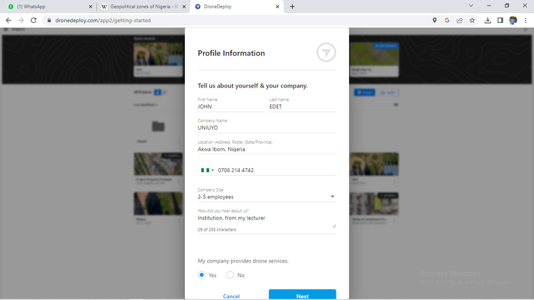
Creating a Drone Deploy Account
After creating a Drone Deploy account
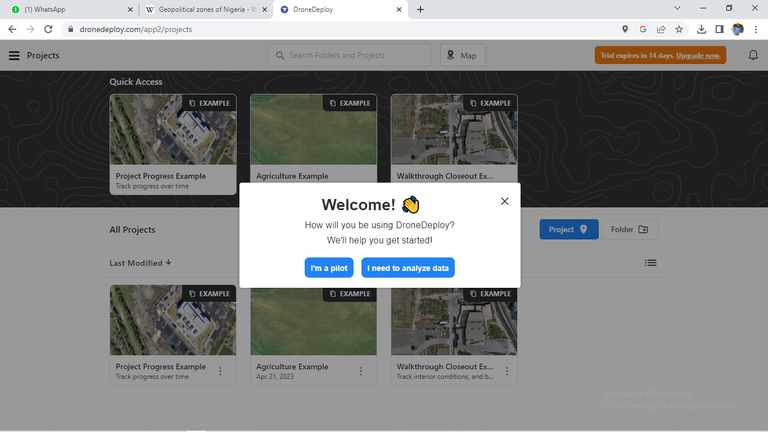
Setting up the Drone Deploy App:
After signing up to Drone Deploy on your device, click ‘Create a new project’ and select the area you want to map. Alternatively, you upload a .KML file that contains the shapefile of the study area.
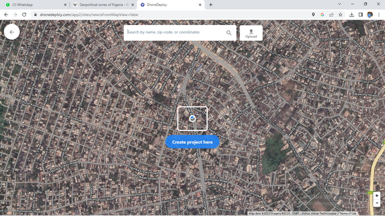
Creating a project
Creating a project for Udung Uko flight plan
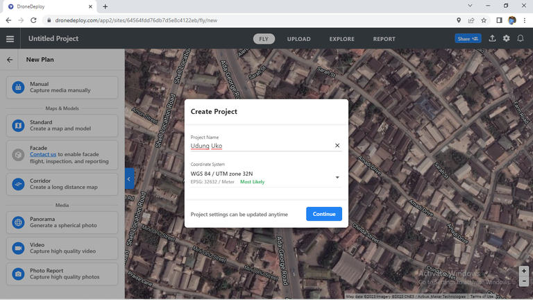
Drone Reconfiguration:
Once the shapefile had been uploaded it will appear as seen below. Thereafter reconfigure the software settings to best suit how you want the drone to fly. Some of the settings include the drone's altitude, speed, camera settings, etc. It is critical to ensure that the altitude is adjusted appropriately in order to capture all the farmlands covered in Udung Uko LGA.
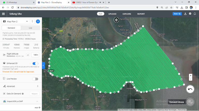
Altitude configuration
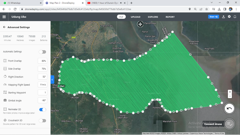
Side overlap and front overlap configuration
To locate the configuration for the side overlap and front overlap, click on the advanced option that is located in Altitude configuration figure.
Still on the drone configuration, a planning camera was chosen, most preferably, I chose Phantom 4k camera as seen in the figure below.
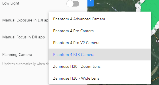
Drone Reconfiguration Process for planning camera
Flight Plan Execution:
Once all the settings are reconfigured, you can execute the flight plan. The drone will take off and follow the pre-defined path, capturing images along the way. The Drone Deploy app will automatically stitch the images together to create a detailed map of the area.
How I got the Udung Uko LGA shapefile from the State boundary using QGIS
With the Akwa Ibom shapefile, I was able to carve out Udung Uko LGA shapefile (this is because Udung Uko LGA is situated in Akwa Ibom State) using the procedure below:
i.I opened the attribute table for the Akwa Ibom boundary, and I clicked on ‘Udung Uko.’ Udung Uko LGA boundary was highlighted as seen below:
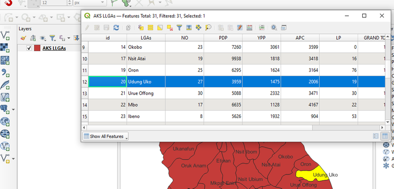
Udung Uko LGA boundary
ii.Thereafter, I exported the shapefile as ‘save selected features as…’
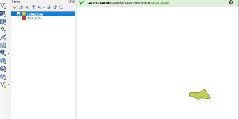
Extracted shapefile of Udung Uko
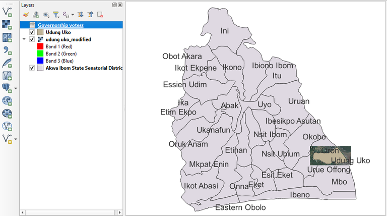
Overlaying the flight plan on QGIS
Additional Knowledge - How to calculate the scale of the flight plan
Scale = focal length/flight height.
The focal length is based on the camera being used for capturing. For example, the focal length of Phantom 4k camera is 24mm. Then based on your settings, you would note your flight height. Thereafter you compute the scale of the flight plan.
Thanks for your contribution to the STEMsocial community. Feel free to join us on discord to get to know the rest of us!
Please consider delegating to the @stemsocial account (85% of the curation rewards are returned).
You may also include @stemsocial as a beneficiary of the rewards of this post to get a stronger support.
You’ve been doing some interesting work. Thanks for sharing.
!discovery 31
Thank you very much.
I'm so inspired
This post was shared and voted inside the discord by the curators team of discovery-it
Join our Community and follow our Curation Trail
Discovery-it is also a Witness, vote for us here
Delegate to us for passive income. Check our 80% fee-back Program