MAKING SCHOOL BUILDING LAYOUTS IN CIVIL ENGINEERING USING MANUAL MEASURE
For some people consider school is the most valuable place, because that's where people look for a variety of knowledge, including me. Schools are also the most commonly inhabited places, therefore residential places or buildings must be nice and look neat. How to?
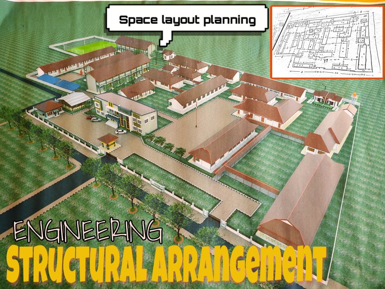
One way is to plan a beautiful building layout, so that people who use the place feel comfortable with the conditions there. With this, the school environment will also look beautiful and will be easy to remodel or want to add a facility in the school environment.
If so, then this work (building layout) must be done by people who have skills in the field. One of them is Civil Engineering.
Now in this post, me and my friends are searching for a school in my area, the school yard is quite extensive. It takes a long time to find out the distance between buildings and other buildings, because in this work it is measuring all the buildings there so that we can draw plans according to the conditions of the field there.
Unlike the case with planning a building that is still not done at all, just planning the building model as what we want. But in this work, we must really pay attention to the existing building models and measure them again, so that we know the size or when making drawings the results are appropriate and do not miss any of it.
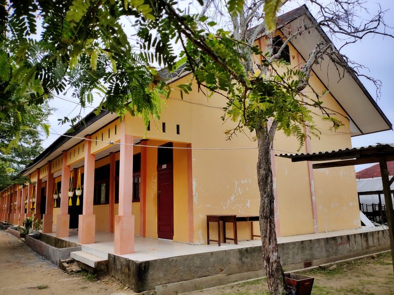
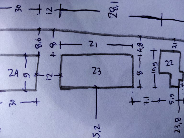
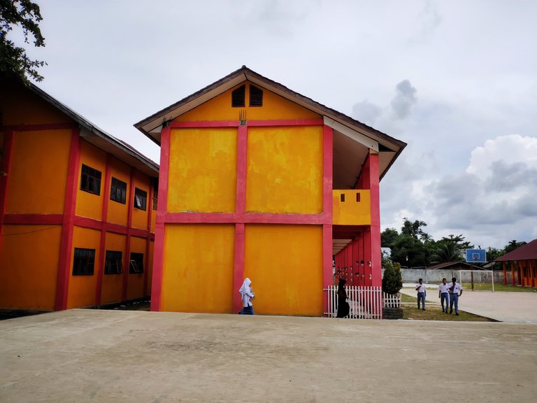
Below this is the layout of the existing building, but because the school did not save the file, my friends and I were forced to measure again. But this re-measurement is also very important for us, because the measurement results we get can be more easily understood than those of other people.
This work is not an order from the school, this is a plan from the state that is looking to organize all schools to be more comfortable and safe. Me and my friends get this job, and must be responsible with what we make, if there is a mistake we also fix it.
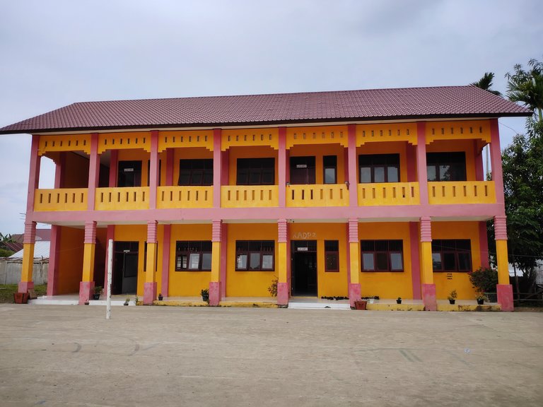
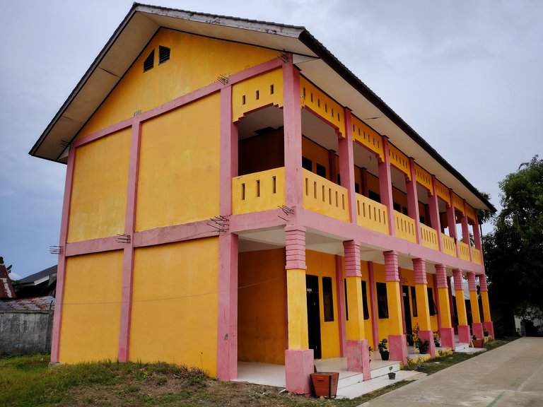
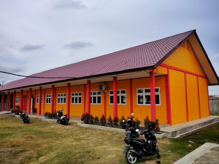
Below this is proof of the size of the building to other buildings, and it is not easy to do just like that. Here I spend all day to get all sizes of the building, yet we also have to make a beautiful 3D image in the eye.
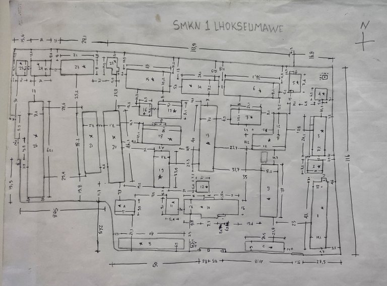
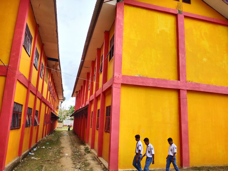
Before starting the measurement, I first made a manual sketch on the exact same drawing paper as the location of the building there. After the manual drawing was finished, I proceeded to measure and take photos on all sides, for depictions when creating 3D images later.
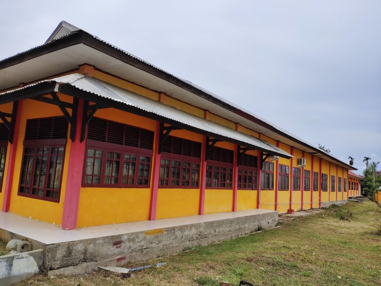

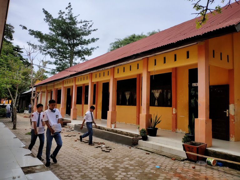
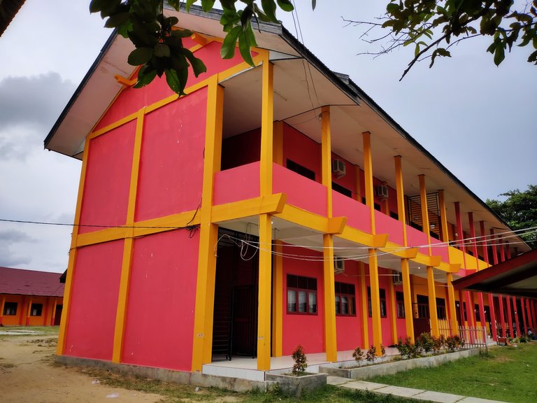
Here I not only measure and take photos, I also need to know which buildings are still suitable for habitation and not. If the building is still livable, I can explain there that the building is livable and renovate again (minor rehabilitation). Vice versa if the building there is no longer livable then the statement is to make a new building (heavy rehabilitation). One of them in the photo below.

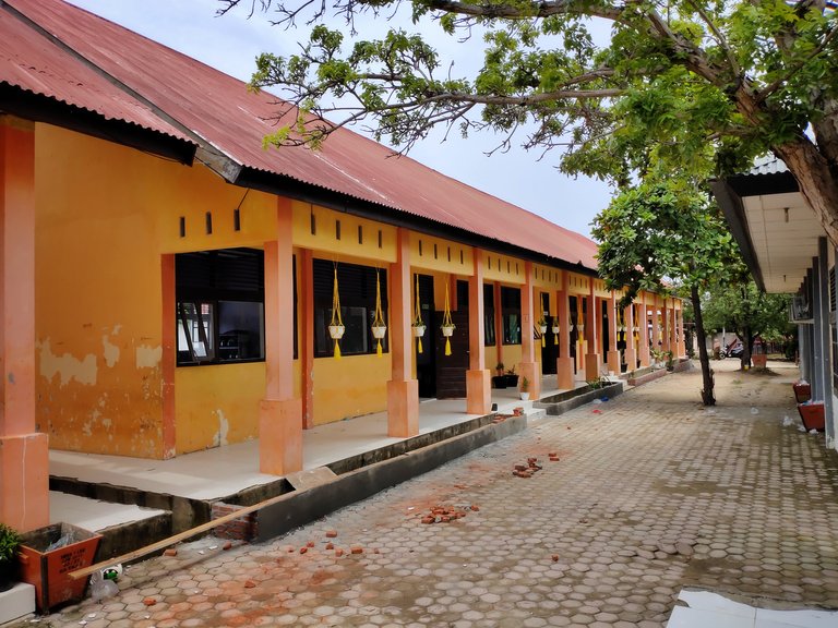
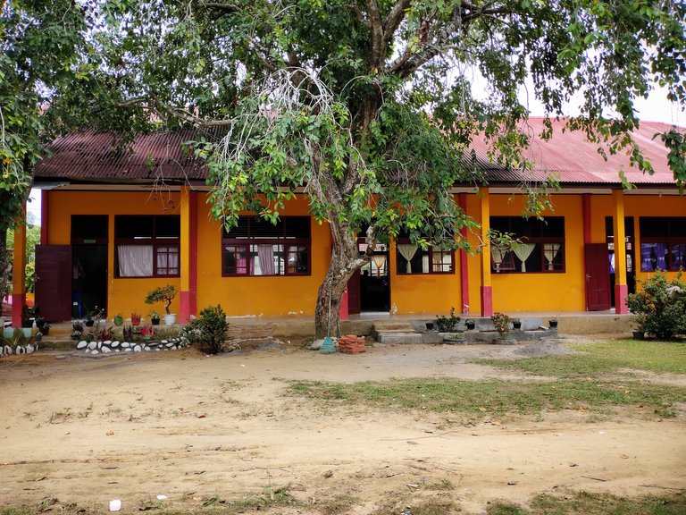
Below this is how I measure and fund it by taking photos on a sketch image. This is a way that later when making 3D images not so dizzy and easy to understand. Because so many buildings make us dizzy to see or choose it.
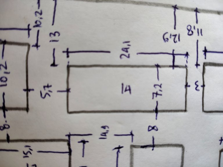

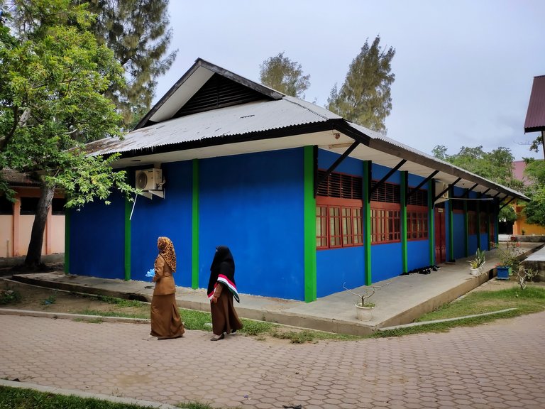
In buildings that are still just under construction, we only need to note their size and make a little description there, so that people who see our planning products can more easily understand them. Likewise, state officials who want to continue renovating schools have become easier when looking at the layout of the buildings we have made.
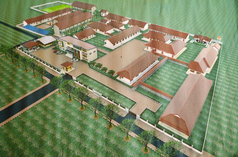
If we already know all the sizes from buildings to other buildings, the next step is to design or create a 3D version of the drawing, and complete with details of the buildings to be followed up on. For example in the picture below, but there is not yet complete with the description, maybe the results of the drawings that we made are not like that and must be complete with information and placement of new buildings that will be done later.
To join in the world of Civil Engineering requires a process of learning basic rules, it is not easy as we imagine. Must also follow the instructions or regulations set by a country, and also high risk.
Maybe the above activity is the simplest way to understand it, but it also still has a big risk in planning (consultant).
Thanks to all of you who support my blog, hopefully in the future I can make a post related to the world of Civil Engineering and provide useful knowledge for me and you all.
See also my related post:
.jpeg)
This post has been voted on by the SteemSTEM curation team and voting trail. It is elligible for support from @curie and @minnowbooster.
If you appreciate the work we are doing, then consider supporting our witness @stem.witness. Additional witness support to the curie witness would be appreciated as well.
For additional information please join us on the SteemSTEM discord and to get to know the rest of the community!
Please consider using the steemstem.io app and/or including @steemstem in the list of beneficiaries of this post. This could yield a stronger support from SteemSTEM.
Thank you so much, I'll check there :)