Technology meets hiking
When I go on nature trails, I want to leave technology and distractions behind and just enjoy the outdoors, as much as possible. But technology can be a great help sometimes. Recently, I started using a feature that exists for long, but never got to dwelve into it in this particular setting: our friend GPS, or more specifically in this case... GPX files!
We all used GPS before, right? But this is a format I hadn't come across before, and as I researched a little bit more... I realised it's everywhere!
So, what are GPX files?
GPX files have stored GPS data, and can be read by different programs or apps: they can contain entire routes, waypoints, all that's needed to map a full hiking trail! They can be done and shared by anyone, and you can easily find a ton of apps that can read them, entirely free; and you don't even need an internet connection!
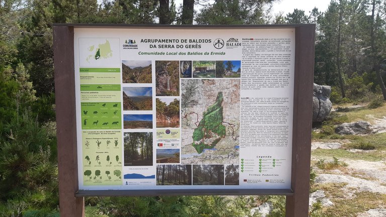
If you're in a well maintained park, with good trail description, true: you probably don't need this. You'll probably find signs like this, at the beginning, explaining everything about the trails, the sights, the wildlife.
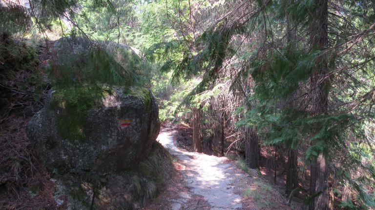
As as you venture into the trail, you just follow the path, and be alert to the signs along the way:
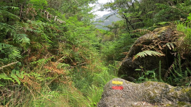
Two parallel lines, red and yellow? You're on the right track!
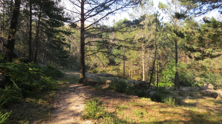
But... what if the signs are nowhere to be seen? Just picture the setting above if the sign wasn't there; does it look like a clear path to you? Not really!
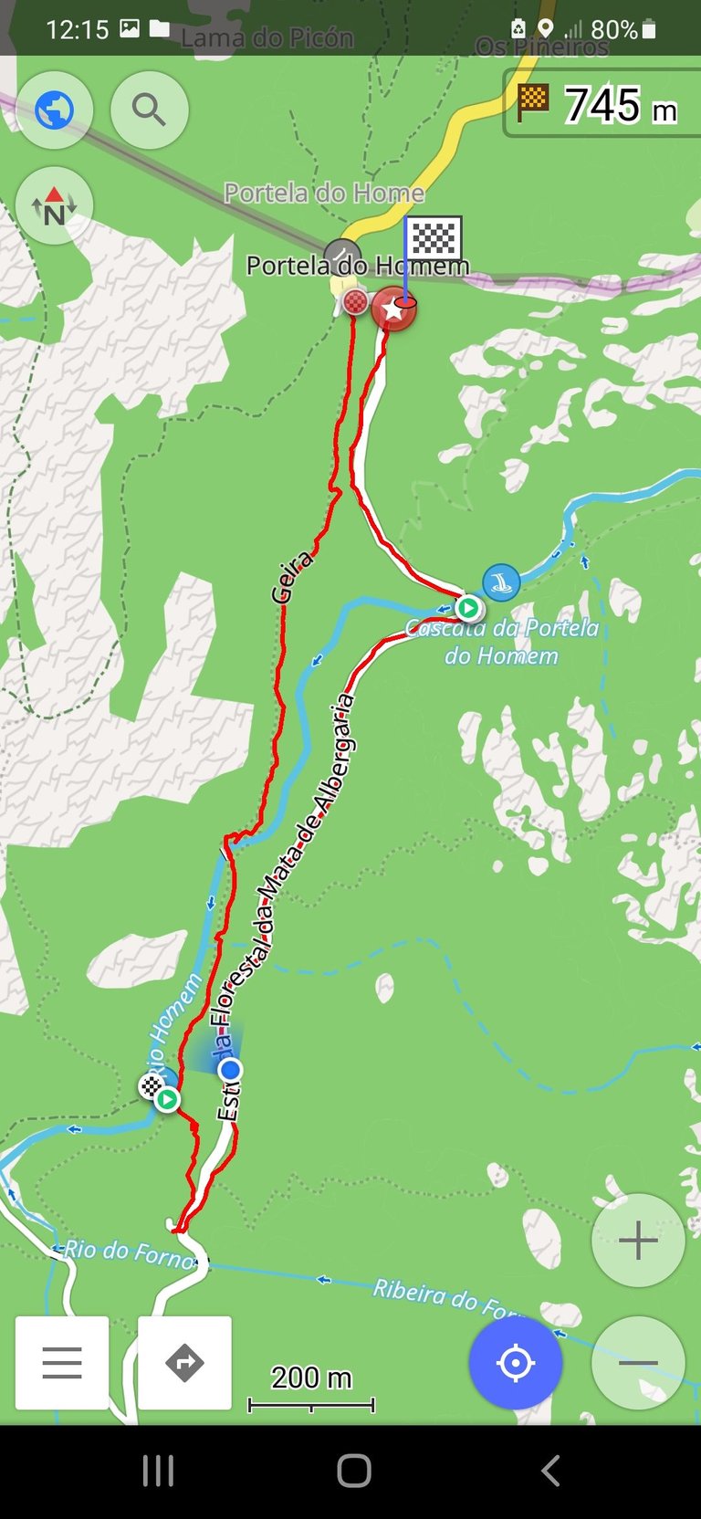
And the first photo of this post is a screenshot from a GPX file of one of the trails I've enjoyed the most on my last vacations... that I wouldn't have done if I hadn't found it on a travel blog, since it wasn't one of the official hiking trails of the park.
Another example:
This one on the left seems wider.... but there seems to be another one on the right. Marks? Nowhere to be found. Solution? A peak at the GPX file.
That explains it, they're both correct!
Another good reason to have a GPX file of the trail you're doing, especially if it's a longer or more difficult trail: security.
If yuo ever hiked in mountain trails, you know conditions can change... and fast. Imagine heavy rain, or fog, in the middle of your trail; if the trail is not that apparent, it's easy to go off course. Having the file in your phone can be the difference between no problem at all and a ton of complications.
So... how do we get our hands on those?
Simple. Just go to an app store and search for GPX viewer; you'll find a ton of different options. In my case, I opted for OsmAnd, since it had some of the best reviews, and it is free; it's based on Open Street Maps.
After you download and install the app, you can download for free the map of your current location (or even the entire country); this will allow you to see the GPX files without needing an internet connection, you just need the GPS signal.
With the map on your phone, you're good to go! You just have to download of the GPX files of the trails you want to do, and that's it; it's easy to get the hang of it.
Where to download them? You have several options here. In my case, it was even possible to get them right before starting the trails.
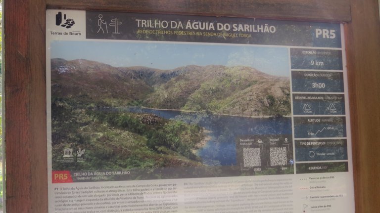
This was one of the signs at the beginning of one of the trails; it had handy QR codes:
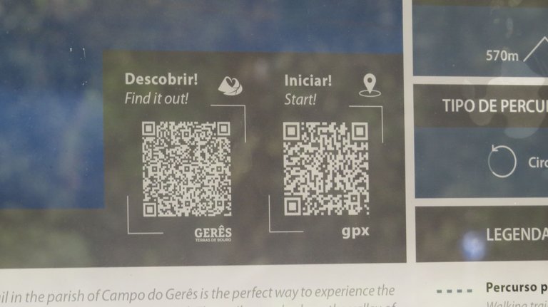
One directed you to the park's website, and the other one was the GPX file of the trail. It was actually thanks to these signs that I decided to investigate this further, and realised there were official GPX files for all the official trails in the park's website.
Online you'll find countless sources for the GPX files, and it's likely that for a specific area or natural park that you want to visit, you will find more than enough options. If you travel through Portugal, I'll leave here one of my favourite travel blogs, Vagamundos, that has GPX files of all the trails the bloggers do.
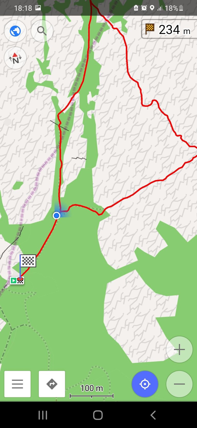
This is how GPX files looks on the phone, through OsmAnd:
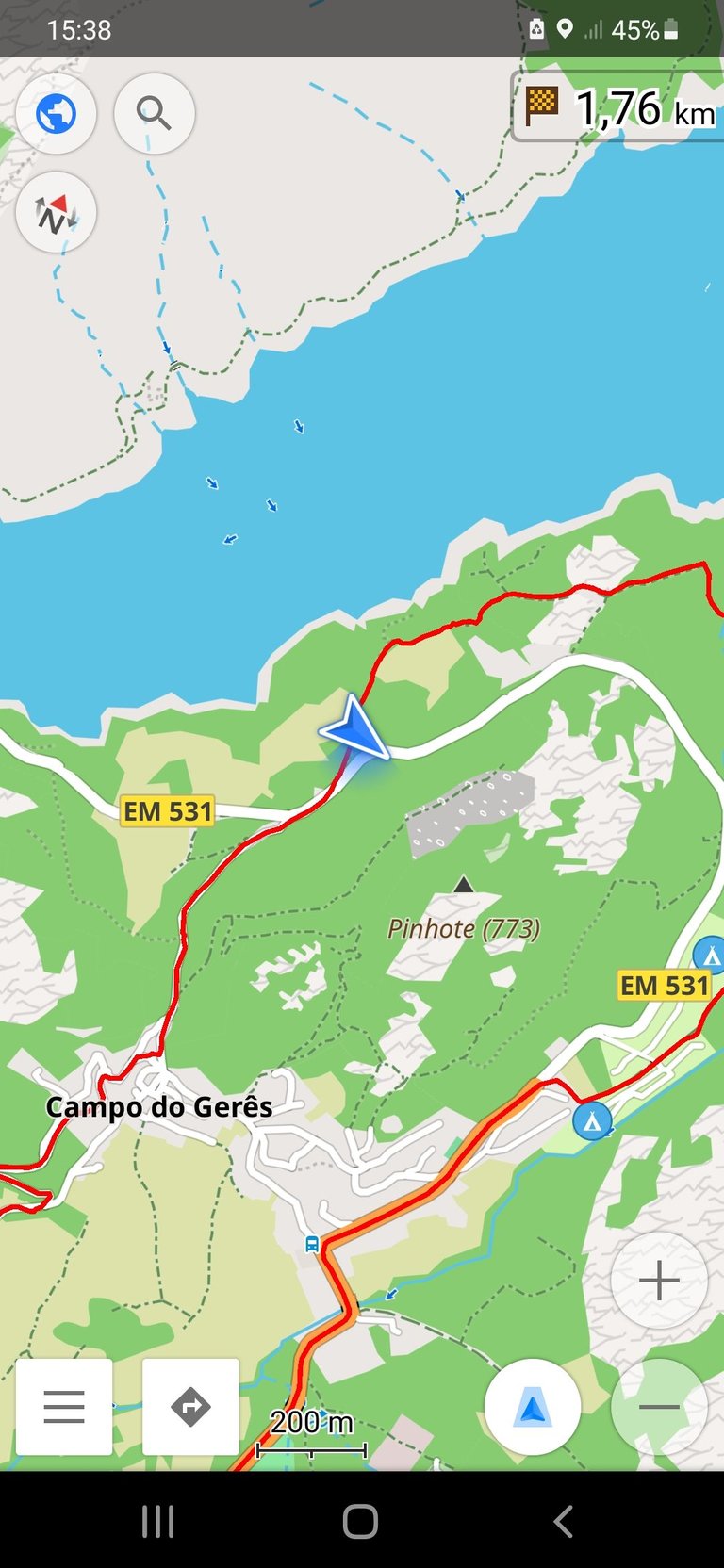
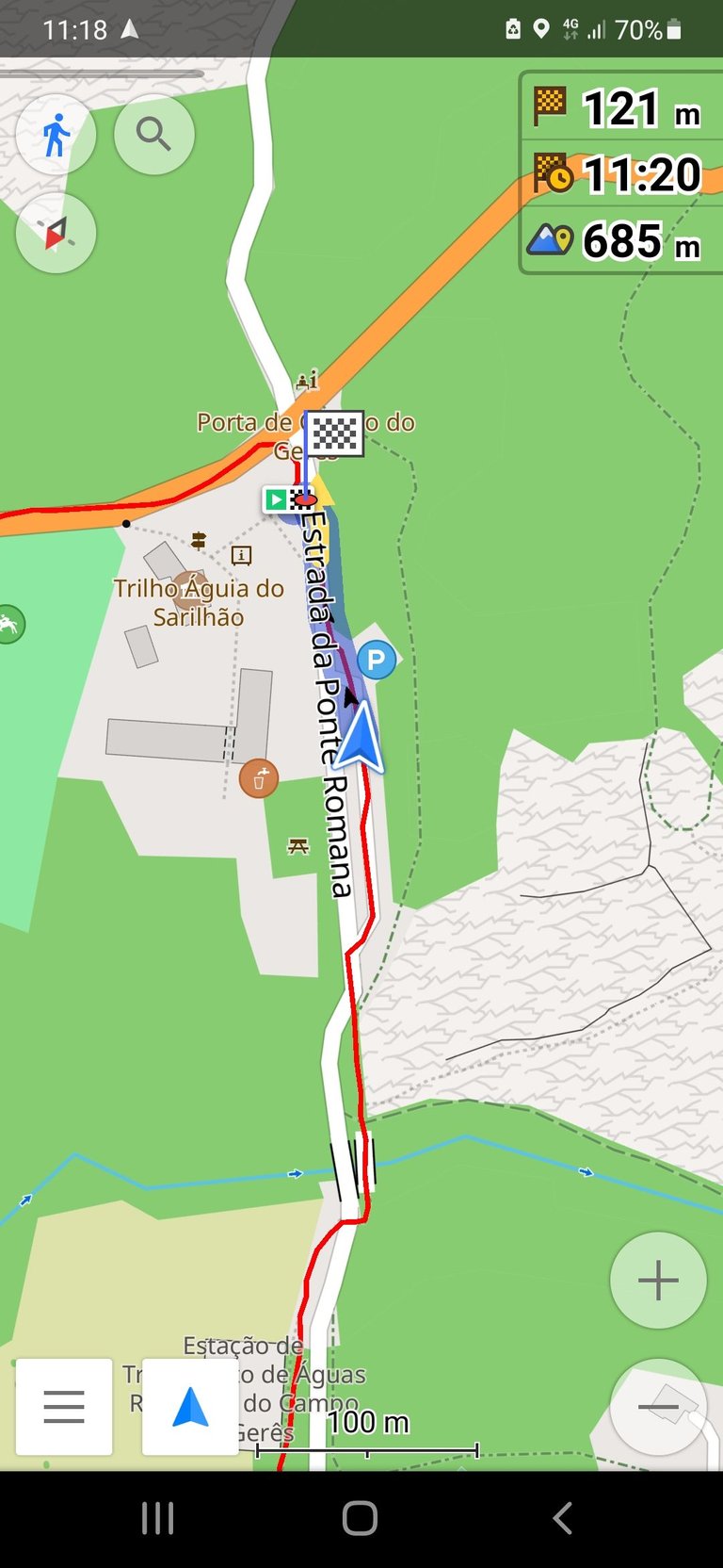
Some will be more complete, with several points along the route, while other show just the basic route; nevertheless, they are all handy.
Hope this info helps you exploring the great outdoors! 😉


Still haven't joined Splinterlands? In what planet do you live in? Click the banner below and join the fun! (It has my referral link; you can go directly to the website if you don't want to use it; either way... join in! 😎 )

Ooh my God
That will be very good and I just hope it is available in my country
Thank you so much for sharing
Pretty sure it already is; and if it's not, you can create your own! ;)
Click on the badge to view your board.
Thank you to our sponsors. Please consider supporting them.
Check out our last posts:
Click on the badge to view your board.
Thank you to our sponsors. Please consider supporting them.
Check out our last posts:
Hi @pardinus,
Great to see you using the #travelfeed tag! We launched the #travelfeed curated tag more than 5 years ago and have been supporting the best travel blogs on Hive ever since. But did you know that TravelFeed has evolved? Based on the feedback of thousands of Hive travel bloggers we created TravelFeed.io.
TravelFeed.io brings together all the benefits of Hive decentralized blogging with features that you as a travel blogger will love: Photo galleries, Instagram embeds, custom maps and more. We also offer many of the features you love on Peakd such as drafts and post scheduling. And if you want, you can even use our easy site builder to set up your own travel blog on your own domain which can be a great way to generate a passive income from your blog!
Unfortunately, focussing on developing the best platform for travelers means that we no longer curate the #travelfeed tag. But, you can log in with your Hive account on TravelFeed.io to publish your next travel post, and it will be posted to Hive automatically! Every day, we select the best posts and reward them with an upvote and added visibility.
We would love to see you on TravelFeed.io soon :)
Googling gpx files for local hikes... I'm gonna talk to a friend that will know about this also. Interesting rabbit hole.
It sure is; amazing how widespread it seems to be now, and they can be really handy.