Downloading Satellite Images for Remote Sensing (LandSAT-7 image)
Satellite images are usually acquired to carry out remote sensing analysis in various fields like agriculture – soil mapping, crop monitoring, forest cover mapping, land cover change detection, hydrological modeling, geological analysis, and lots more. LandSAT is an example of a satellite and it has been developing year after year, ranging from LandSAT-1 to LandSAT-8. LandSAT can be obtained from the USGS (U.S. Geological Survey) earth explorer using the link.
USGS earth explorer interface
Below are steps to acquire LandSAT images using the above link.
Step 1:
Create an account once you’ve clicked the link or login if you already have one.
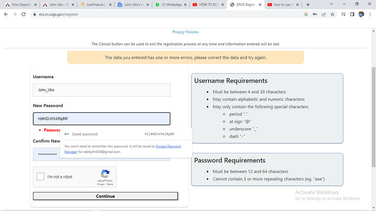
Creating USGS earth explorer account
Step 2:
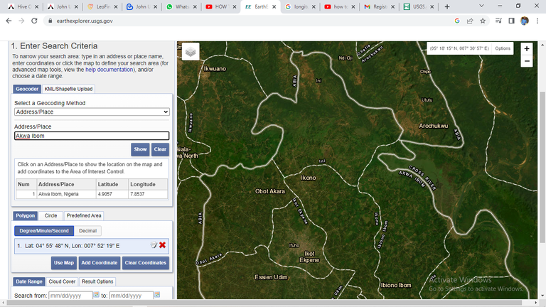
Once logged in to the interface, set your area of interest in the “Search Criteria” tab. One can double-click the browser to create regions of interest. The region of interest (ROI) is the geographic boundary that limits the search to acquire data.
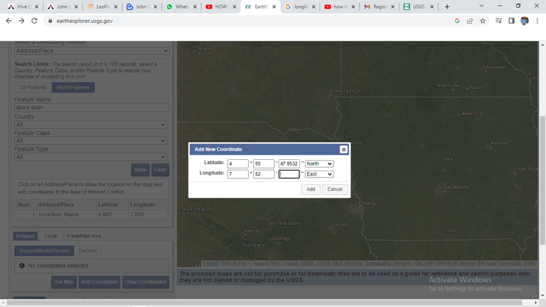
Inputting the coordinate of the area of interest
Alternatively, you can use one of these options to create a region of interest:
Using an address to search
i.Importing a shapefile (in a zip file) or KML
ii.Or just double-click the map to make ROI
One can also set a timeline for aerial and satellite imagery downloads in USGS Earth Explorer.
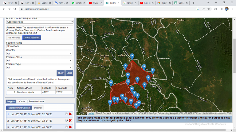
Boundary of interest
Step 3:
Step 2: Select your data to download in the “Data Sets” tab
The Datasets tab answers the question: What satellite or aerial imagery are you looking for? The USGS Earth Explorer remote sensing datasets are many, we have the aerial imagery, AVHRR, commercial imagery, digital elevation models, Landsat, LiDAR, MODIS, Radar, and more. In this case, the Landsat7 collection 2 Level 2 group was the interest. This dataset contains atmospherically corrected surface reflectance and land surface temperature derived from the data produced by the Landsat 7 ETM+ sensor. These images contain 4 visible and near-infrared (VNIR) bands and 2 short-wave infrared (SWIR) bands processed to orthorectified surface reflectance, and one thermal infrared (TIR) band processed to orthorectified surface temperature. They also contain intermediate bands used in the calculation of the ST products, as well as QA bands.
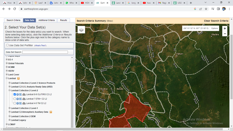
Selecting data set
Step 4:
Filter the “Additional Criteria” tab to easily filter out scenes with too much cloud cover. Now, you won’t be able to filter to get the perfect cloudless image. But one can set the cloud level to less than 10%.
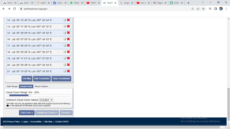
Selecting the cloud cover range
Step 5:
After setting the search parameters, click the "Results" button at the bottom of the panel. The search results will appear on the map as green footprints. You can click on any footprint to view more information about the scene.
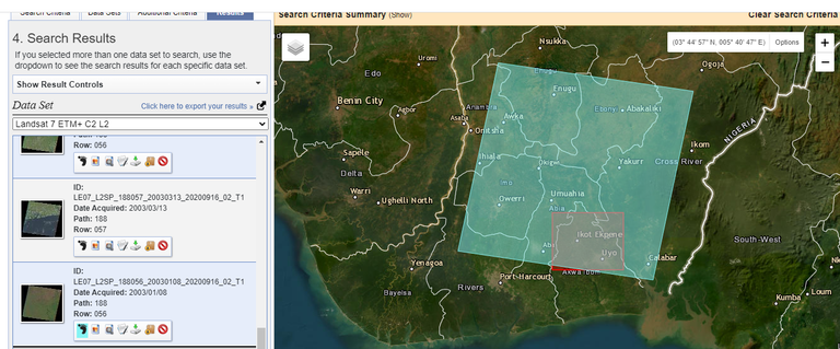
Result of the LandSAT-7 image
Step 6:
To download a specific Landsat-7 image, select the desired scene by clicking on the corresponding footprint. In the scene information panel that appears, click on the "Download Options" tab.
Step 7:
Under the "Data Access" section, select the download option that suits your needs. You can choose to download the entire scene or specific bands. Once you have selected the download option, click the "Download" button to initiate the download process.
Thanks for your contribution to the STEMsocial community. Feel free to join us on discord to get to know the rest of us!
Please consider delegating to the @stemsocial account (85% of the curation rewards are returned).
You may also include @stemsocial as a beneficiary of the rewards of this post to get a stronger support.