The Sliding Continents
Chapter VIII of Immanuel Velikovsky’s Earth in Upheaval is called Poles Displaced. In this chapter Velikovsky explores a number of possible causes of ice ages. Central to these hypotheses is the concept of a pole shift, which could explain why the Arctic ice cap during the Pleistocene Ice Age was not symmetrically arranged around the current North Pole: significant parts of Alaska and Eastern Siberia remained unglaciated, while thick sheets of ice buried Ireland, Britain and New York.
At the conclusion of the second section—Shifting Poles—Velikovsky conceded that none of the pole-shift theories put forward by geologists in the 19th century could adequately account for all the observations: the asymmetry of the ice sheets, their extent, and the speed with which glacials and interglacials succeeded one another.
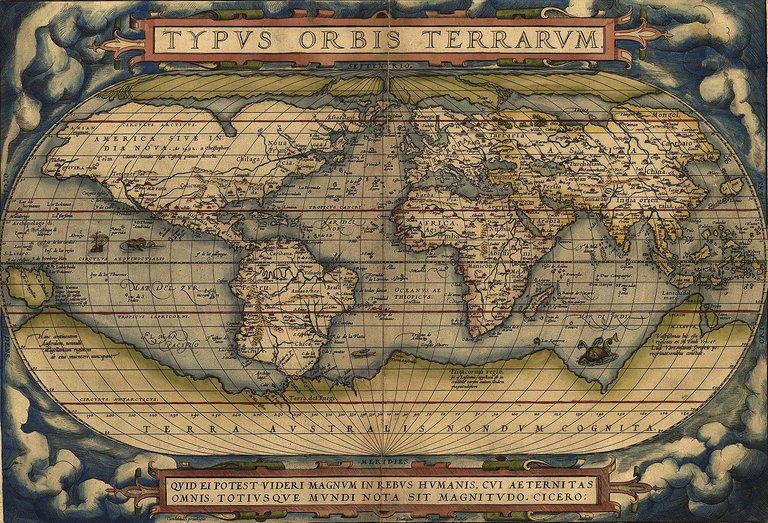
In the third section of this chapter, The Sliding Continents, Velikovsky considers another geological mechanism that could have produced the necessary pole shifts, Continental Drift, which captivated the interest of geologists in the twentieth century. The idea that the continents may have somehow drifted to their present positions was first suggested by the Flemish cartographer Abraham Ortelius in 1596. Ortelius had been struck by the geometric similarity between the eastern coast of the Americas and the western coasts of Europe and Africa:
In Greek there was once the word EUMELI, ἔυμηλος, translating the word Gadiri from the vernacular. This is what Plato says in his Critias, or Atlantis. If it is not a fable, Gadir or Gades was the remaining part of Atlantis, or the island of America, which therefore was not submerged (as is related in the Timaeus) but, rather, torn off from Europe and Africa by an earthquake and an inundation: note how Gadir is clearly elongated towards the West. But if anyone accuses me of explaining one fable with another fable, I won’t object. The vestiges of this rupture, however, can be clearly seen on a map of the world if one examines closely the shorelines of the three aforementioned lands where they face one another—that is, the promontories of Europe & Africa opposite the concavities of America. To such an extent that one could say, as Strabo does in Book II of his Geography, that what Plato, following Solon’s account, tells us about the island of Atlantis is not a lie. (Ortelius 310, Gadiricus)
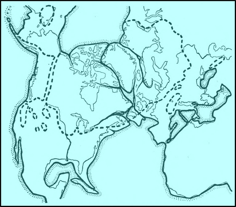
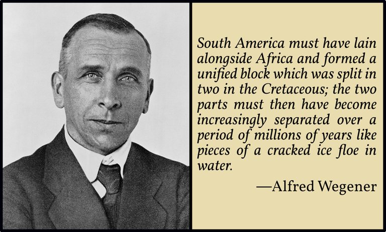
This idea was repeated by other scholars over the following centuries, but it was not until the first decades of the 20th century that it was formulated as a serious geological theory. Alfred Wegener, the first to properly flesh out the theory, which he called the Displacement Theory, was not a geologist—he was a meteorologist—so, not surprisingly, his ideas met with considerable resistance from the geological community. Half a century would pass before Plate Tectonics was finally accepted as a reality by the scientific community.
In 1955, when Earth in Upheaval was published, the theory of continental drift was still a hotly contested subject:
In August 1950 the British Association for the Advancement of Science devoted the sessions of its annual convention to debate on the question: Is the theory of the continental drift (slide) right or wrong? There were many defenders of the theory and as many opponents. The theory was then put to a vote. The result was an even division between “yea” and “nay.” The chairman was entitled to cast the deciding vote but abstained. Only through the fortuitous circumstance that the presiding officer was a conscientious—or undecided—person was the sanctification of continental drift averted. (Velikovsky 107-108)
Velikovsky quotes from J G A Skerl’s English translation of Alfred Wegener’s Die Entstehung der Kontinente und Ozeane [The Origin of Continents and Oceans]:
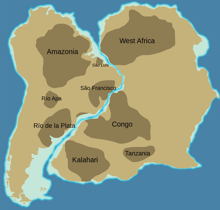
He who examines the opposite coasts of the South Atlantic Ocean must be somewhat struck by the similarity of the shapes of the coastlines of Brazil and Africa. (Wegener 1924:1)
John William Evans, President of the Geological Society, wrote the introduction for this English translation from which Velikovsky also quotes. The passage from which he took his brief quotation reads in full:
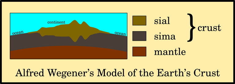
The rocks of the continental masses consist for the most part of the acid plutonic rocks, granite and its foliated form gneiss. The sedimentary, metamorphic, and basic igneous rocks, though they often play a conspicuous rôle at the surface are essentially subordinate in amount. The continental rocks as a whole are comparatively low in density and are composed predominantly of silica, alumina, and the alkalis, and are sometimes referred to collectively as sial (that is to say, silica plus alumina). [Note.—Suess employed the term “sal,” but most people will agree with Professor Wegener in adopting a suggestion of Professor Pfeffer that the form “sial,” which has not, like “sal,” an irritating resemblance to the Latin for salt, should be substituted.]
There is good reason for believing that the rocks forming the substratum of the ocean bed are more basic in composition and contain a large proportion of magnesia, iron oxide, and lime, and that similar rocks or magmas of the same composition underlie the sial of the continents and probably form a zone of the earth’s substance some fifteen hundred kilometres in depth. They constitute the sima (silica plus magnesia), in contradistinction to the sial. (Wegener 1924:viii)
Note that Velikovsky incorrectly derives the technical terms sial and sima from the names of the elements silicon, aluminum and magnesium, whereas they actually refer to the oxides of these elements: silica, alumina and magnesia.
The Ice Age
Velikovsky summarizes Wegener’s very brief treatment of the Quaternary glaciation of Northern Europe and North America. Wegener only devotes thirty-three lines to this subject:
The occurrence in an early glacial period of ice cover in lands now in tropical and subtropical regions is explained by the supposition that these lands were once in the Antarctic. However, their extent is so great that if all of them were joined around the South Pole, many parts that have signs of the Ice Age would still be too remote from the pole. The theory assumes, therefore, that these lands occupied in succession the position of the Antarctic continent today, each in its turn passing through a glacial period; the signs of glaciation in Africa, India, Australia, and South America are accounted for by the successive sliding of these continents through the southern polar region. A similar explanation is offered for the origin of the Ice Age in the Northern Hemisphere, at a much more recent date, when the land masses of North America and Europe wandered close to the North Pole. The North Pole is charted on various points on the globe – in the Pacific, in the Canadian arctic archipelago, in Greenland, in Spitsbergen – all in succession during the Pleistocene, or recent Ice Age. (Velikovsky 109 : Wegener 1924:109-111)
Wegener actually surmised that the North Atlantic had not yet been created when the Pleistocene Ice Age began, but that the continental blocks of North America and Europe must have been separated considerably by the time of the last glaciation (Wegener 1924:110).
Displacement Theory
Wegener’s Displacement Theory is catastrophic in the extreme, but this was not sufficient to win over Velikovsky. Unless geologists could come up with a force capable of moving entire continents, not even the father of modern catastrophism was willing to endorse it:
If a theory can explain the origin of mountains, the cause of the ice ages, the coal beds in higher latitudes, and certain common characteristics of the fauna and flora of continents separated by oceans, then the correspondence in the contours of the Brazilian and West African coasts truly served as a clue to the solution of major problems in geology and climatology. However, there are facts that strongly challenge this hypothesis. (Velikovsky 110)
In the thirteenth and concluding chapter of The Origin of Continents and Oceans, Wegener addressed the thorny problem of identifying a displacing force that would be capable of moving the continents. Believing that continental drift always took place towards the equator and in a westerly direction, he restricted his search for forces that met these requirements:
Although at the first glance the displacement of the continents presents a very variegated picture of different kinds of movements, yet nevertheless there is one great underlying principle: the continental blocks move equatorwards and to the west. It is advisable to consider both the components of this movement separately. (Wegener 1924:190)
Wegener himself had little to contribute to the debate that was original, but he cited a number of his predecessors who had already trodden this path:
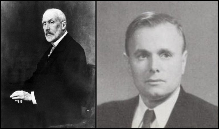
Damian Kreichgauer, a German geologist and Catholic priest. In The Geological Question of the Equator (1902), he had described how the centrifugal force due to the rotation of the Earth alters the direction of the gravitational force (Kreichgauer 63). The resultant force drives floating icebergs on a rotating Earth towards the equator. This is the so-called Polfluchtkraft (Pole-Flight Force). If one body is floating upon another body, it will be slightly further from the axis of rotation, and so will experience a slightly greater centrifugal force. This is the force that causes it to float towards the equator. If the continents (sial) are truly floating upon the oceanic crust (sima), they too will experience this force. Kreichgauer actually believed that the entire crust drifted en masse towards the equator, as it was supposedly “floating” upon the mantle.
Frank Bursley Taylor, an American geologist, who first proposed the idea of continental drift in 1908, a few years before Wegener. In a paper published two years later, Taylor noted how the ice sheets of the last Ice Age had a tendency to creep towards the equatorial zone (Taylor 218-219). This tendency, he believed, could also be discerned in the distribution of recent mountain chains. Taylor attributed this equatorial tendency to deforming forces, titanic lateral pressures that pushed the Earth’s surface upwards. But he was unable to account for these forces. In a later paper, he suggested that when the Moon was captured by the Earth—an event he believed had taken place during the Cretaceous Period about 100 million years ago—the resulting tidal forces were the ultimate cause of the general crustal creep away from the poles (Taylor 197). Taylor was the first to coin the term “plates” for the movable sections of the Earth’s crust (Taylor 191).

- Loránd Eötvös, a Hungarian physicist, whose special field was gravity. In a conference held in Berlin in 1912 Eötvös described how there existed a natural force that would tend to push the continental landmasses towards the equator. The Eötvös Force is a differential gravitational force due to the fact that the Earth is rotating and is not a perfect sphere but is, rather, flattened at the poles on account of its rotation. My understanding is that this is the same force as Kreichgauer’s Polfluchtkraft, but Eötvös explained it in terms of the rotation of the Earth and the principle of isostasy, whereas Kreichgauer explained it in terms of the Earth’s rotation and the flattening of the poles. Most online sources I have consulted do not clearly distinguish between the two:
Herr von Eötvös has dealt a little with the question of which forces are capable of bringing about systematic movements in the earth’s crust. He recalls that the direction of a plumb line is curved in the meridian plane, the concave side facing the pole, so that the centre of gravity of a floating body is higher than the centre of gravity of the displaced mass of liquid. From this it follows that a floating body is subject to the action of two forces acting in different directions, the resultant of which is directed from the pole to the equator. There would thus be a tendency among the continents to move toward the equator, which motion would produce a secular change in latitude, such as is conjectured for the Pulkovo Observatory. On the other hand, he has not been able to discover any force which could produce a systematic movement in an east-west direction. (Eötvös 111)
The American historian Charles Hapgood, who became a champion of the pole-shift hypothesis a few years after the publication of Earth in Upheaval, explained the physics behind the Eötvös Force in Earth’s Shifting Crust (1958):
Eötvös investigated the centrifugal effects that would arise if a given mass had its center of gravity above the equipotential surface. This could occur even with masses in isostatic equilibrium. To visualize this case, we may take the example of a block of ice floating in water.
Ice is lighter than water. When a block of ice falls into a body of water it displaces its own weight of water, and then floats with a tenth of its mass above the water level. It is now in equilibrium, or in isostatic adjustment, even though its upper part projects a considerable distance up out of the water. This upper tenth, in the meantime, has displaced air, not water. It is a solid mass of far greater density than the air it has displaced. Its center of gravity, midway between its summit and the water surface, is farther from the axis of rotation of the earth than was that of the mass of water it has displaced. Since points move faster with the earth’s rotation the farther they are from this axis, this mass has now been given added velocity. Added velocity means an increase in the centrifugal effect, and one not compensated by gravity, since the amount of mass is the same as before, and therefore the effect of gravity at that point has not been altered. A tangential component of this added centrifugal momentum will tend to move this ice mass toward the equator.
Eötvös applied this same principle to parts of the earth’s crust. We have seen that, according to the theory of isostasy, mountains and continents are elevated above the ocean bottoms because they are composed of lighter materials, and they are considered to be “floating” in an approximate gravitational balance with the heavier crustal formations under the oceans. Eötvös considered the centrifugal effects that might arise from the elevations of the centers of gravity of continental formations above those of the oceanic sectors of the crust, and calculated them mathematically. He found that the effects were comparatively slight. Attempts have been made to account for the drift of continents through these effects, but his calculations show they are too small to have considerable effects. Since Eötvös’ time, it has been generally assumed that any centrifugal effects that were to be considered in relationship to the earth’s crust must be effects resulting from variations in the vertical position of centers of gravity of masses in gravitational balance, that is, elevations of these centers above the equipotential surface, or depressions of them below it, owing to differences in relative density of the masses involved. (Hapgood 371-372)
This effect is now known to geologists by the German expression Polflucht (Pole-Flight), which Wegener adapted from Kreichgauer:
Polflucht A concept that was invoked by Wegener to explain his ideas about continental drift. He suggested that a differential gravitational force (the Eötvös force), caused by the flattening of the Earth at the poles, would cause continental masses to drift towards the equator. This force is now known to be far too weak to cause continental movements. (Oxford Reference)
Note that the Eötvös Force is not to be confused with the Eötvös Effect, which is a slightly different but related phenomenon. One source I consulted, however, claims in parenthesis that the Polfluchtkraft is another aspect of the Eötvös effect (Pratt 56).
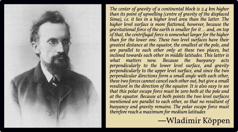
- Wladimir Köppen, a Russian meteorologist, who independently identified the Eötvös Force. Köppen had been Wegener’s mentor and teacher at the University of Heidelberg. In 1913 Wegener married his daughter Else. Wegener criticized Kreichgauer’s analysis of the Polfluchtkraft and referred his readers instead to Köppen’s treatment in the forthcoming issue (1921) of Petermanns Mitteilungen:
Causes [of the Polflucht]. Kreichgauer identified the centrifugal force as the cause of the polar flight. His derivation is wrong, however, since he assumes the shape of a sphere instead of the ellipsoid of revolution, and the force derived from him is eliminated precisely because the earth is flattened. However, even in the case of the ellipsoid of revolution, there still remains a pole-flight force for the continents ... (Wegener 1920:121).
Velikovsky summarizes Wegener’s concept of the Polfluchtkraft thus:
The minute difference between the gravitational pulls to which the crust is subjected in higher latitudes and closer to the equator was offered by Wegener as the motive force in the drift of continents. (Velikovsky 110)
Velikovsky, however, rejects this hypothesis, citing the British geophysicist Harold Jeffreys in support. Jeffreys considered four possible forces (the first being the Polfluchtkraft and the second the putative source of the westward drift):
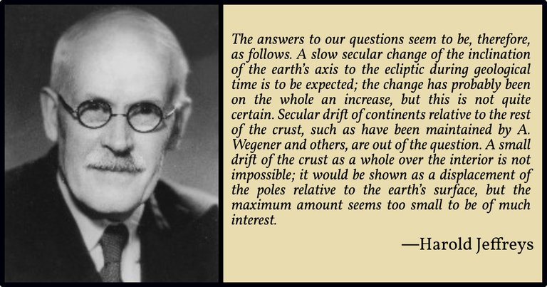
The other two questions do not concern the movement of the Earth as a whole, but only the displacements of parts of it relative to one another. They depend on a discussion of what forces exist and what displacements they are capable of producing. The chief of these deforming forces are the equatorial attraction, tidal friction, the attraction between continents, and perhaps an internal stress incidental to the precession of the equinoxes. The magnitude of the first is, we have seen, of order 4000 dynes/cm2. Tidal currents at their strongest give a bottom drag of the order of 40 dynes/cm2; but this is abnormal and is reversed in direction in every tide where it does occur. The mean secular tidal friction producing the slowing down of the earth’s rotation corresponds to a westward stress of the order of only 10-4 dynes/cm2 over the earth’s surface. The attraction between continents may, we have seen, give stresses of the order of 10-2 dynes/cm2 The stress in precession that makes the whole of the earth precess at the same rate, instead of different shells precessing at different rates, is at most of order 60 dynes/cm2, and this must be mainly alternating in direction. The chief of these factors is definitely the equatorial attraction. Now a horizontal stress of 4000 dynes/cm2 over a circular continent of radius 2000 km would give a total force of 40007π(2 x 10⁸)2 dynes. This is resisted by the strength of the lithosphere, say 40 km thick. An average stress of 105 dynes/cm2 around a cylinder of radius 2000 km through the lithosphere would suffice to prevent all movement. The strength at the surface is of order 109 dynes/cm2, and the support of the great mountains seems to point to greater strengths lower down. There is therefore not the slightest reason to believe that bodily displacements of continents through the lithosphere are possible (Jeffreys 304)

Wegener’s belief that continental drift always took place from the poles to the equator and from the east to the west is sure to take modern readers by surprise. The modern theory of plate tectonics knows of no such phenomenon. Animations of continental drift clearly show the continental plates moving in all possible directions. Velikovsky also questions this element of Wegener’s hypothesis:
Even assuming that this motive force was sufficient, why did the lands of Europe, Siberia, and North America first move away from the original common land mass toward the equator and then retreat from the equator? (Velikovsky 110)
Wegener’s Westwanderung, or the tendency of the continents to drift towards the west, was believed to be due to the tidal force. But as we have just seen, Jeffreys calculated that this force was far too small to shift entire continents.
An Alternative Force
Velikovsky next turns to another hypothetical force to explain continental drift:
In search of another moving force, A. L. du Toit, a South African scientist, offered a variation of Wegener’s theory, namely, a “concept of an earth in which the periodic, though variable, softening of the sub-crust through radioactive heating enables the skin to creep differentially over the core with consequent wrinkling.” (Velikovsky 110)
Alexander Logie du Toit was a South African geologist, and an early supporter of Wegener’s hypothesis. Like Wegener, he postpones a discussion of the physics of continental drift to the final chapter of his book on the subject, Our Wandering Continents (1937). There he considers several different possibilities. He rejects the Polfluchtkraft for the same reason that Velikovsky gives:
That centrifugal forces acting upon the higher-standing continents is tending to move those masses towards the equator has long been appreciated. This is the so-called “Polflucht” force favoured by Kreichgauer, Taylor and Staub as the explanation of equatorial folding. Arnold Heim (36) has made the pointed observation that the repeated reversals of movement in the orogenic zones scarcely seems to support the idea of the polflucht force as the original cause of compression. That “polar flight” was not the dominant factor is clearly shown by the deduced movement (Chapter XIII) of Gondwana towards the South Pole in the period preceding the Carboniferous and of Laurasia towards the North Pole after that epoch. (du Toit 320)
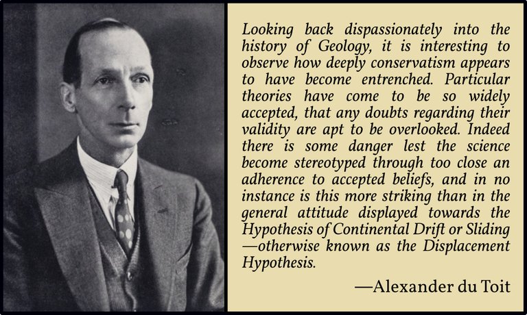
Du Toit believed that the continental plates could only creep across the upper mantle if the latter was periodically heated, radioactivity being the source of this heating:
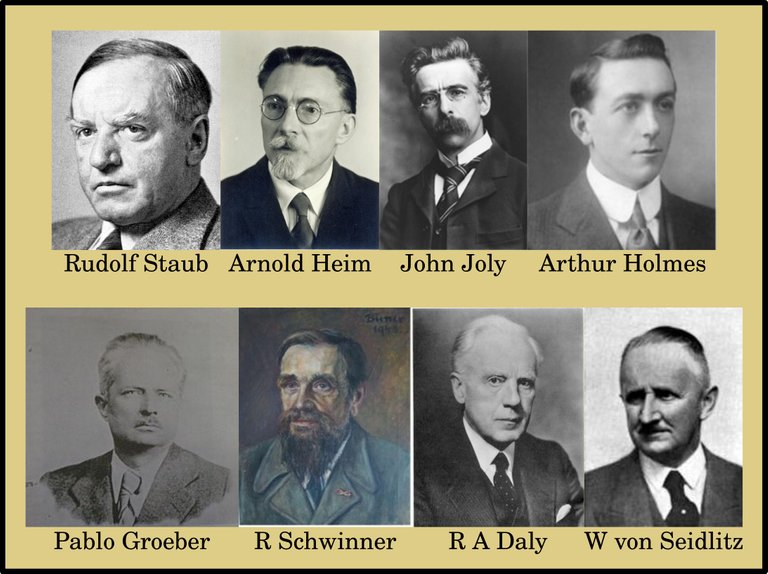
Various schemes embodying the above ideas have been developed by Joly, Holmes, Groeber, Staub, Schwinner, Daly, von Seidlitz and others, which have one and all contributed materially to the important theory of Magmatic Currents as the cause of diastrophism. The writer, nevertheless, feels that, in the form hitherto stated, convection by itself is not wholly competent to account for continental drift in the full meaning of the term, and that some modification of the theory is accordingly demanded.
In our interpretation every revolution has involved a certain amount of “drift” and such movement must hence be regarded as a normal consequence of the orogenic cycle. The Energy therefor must be derived from some internal source that is itself cyclic, and of such the only outstanding one is that provided by the Earth’s radioactive content. Drifting must indeed be viewed as a function of Radioactivity. (du Toit 322)
Du Toit cites several other scholars in this passage:
Rudolf Staub: A Swiss geologist who built a theory of mountain building on some of Wegener’s ideas.
Arnold Heim: Another Swiss geologist.
John Joly: An Irish physicist, whose book The Surface-History of the Earth (1925) deals very briefly with the theory of Continental Drift.
Arthur Holmes: A British geologist, who hypothesized the phenomenon of mantle convection to explain continental drift. His ideas led to the theory of Seafloor Spreading and the eventual acceptance of Plate Tectonics.
Pablo Groeber: A German geologist, who specialized in the geology of the Tian Shan mountain ranges of Central Asia and the Argentinian Andes.
Robert Schwinner: An Austrian geologist, who studied under Arnold Heim. Like Holmes, he put forward a theory of thermally induced convection currents in the Earth’s mantle. In the fourth edition of his book on continental drift, Alfred Wegener suggested that these currents were the source of the Displacing Forces.
Reginald Aldworth Daly: A Canadian geologist. His theory of continental drift was based partly on the idea that after the Moon was ejected from the Earth, continental movement was required to reestablish the planet’s isostatic equilibrium. He elaborated on this idea in Strength and Structure of the Earth (1940), anticipating certain aspects of plate tectonics.
Wilfried von Seidlitz: A German geologist and palaeontologist.
Evidence of Drifting
Velikovsky acknowledges that there is an abundance of evidence to show that the continents have not always been where they are today:
Coal is found not only in arctic lands but also in Antarctica. Did, then, this continent travel there from the tropics? And what was the motive force? (Velikovsky 110-111)
But if this were evidence of Continental Drift, then surely it could be observed today?
If the theory is correct, the motion of the continents should be observable at present; yet, though Wegener claimed, on the basis of certain reports, that Greenland and an island near its western coast still move, repeated observations and triangulations do not support this claim. Wegener perished on an expedition to Greenland in 1930. (Velikovsky 111)
Today the slow drift of the continental plates can indeed be observed in real time, but in 1955 this evidence was still lacking.
Sial and Sima
As we have seen, another important feature of the theory of plate tectonics is the distinction between continental crust (sial) and oceanic crust (sima). But Velikovsky argues that even this crucial aspect of the theory is unsupported by the evidence:
The assumption that ocean floors and continents are eternally different in structure is in contradiction to a great number of observations, though the land surface has been better explored than the bottom of the sea. The idea of a basic difference between the rocks of the ocean bottom and those of the continents is disproved wherever the fossiliferous contents of the land and of the ocean bed are examined. Marine expeditions have failed to find at various places on the ocean bottom the thick layers of sediment that should have been present if the sea had been covering the areas for untold centuries. On the other hand, sediments thousands and even tens of thousands of feet thick have been found on continents. Not only were large stretches of land in North America and Europe and Asia covered by the sea at various times in the past – and some well-investigated localities, like the gypsum beds of Paris, show repeated returns of the waters – but even the largest and highest mountain chains – the Alps, the Andes, the Himalayas – at some time were under the sea. Since the ocean once covered a vast expanse of land, it may at present occupy the place of former land. (Velikovsky 111)
In Conclusion
Velikovsky’s concluding remarks are a little puzzling:
The land masses of today do not change their latitudes; the motive force claimed is insufficient by far. Coal beds in Antarctica and recent glaciation in temperate latitudes of the Southern Hemisphere all conspire to invalidate the theory of wandering continents. (Velikovsky 111)
Surely Antarctic coal and glacial signatures in temperate latitudes validate some form of continental drift? It will transpire, however, that Velikovsky had a vested interest in rejecting Continental Drift. He wishes to cite these anomalies in support of an alternative model: the Pole-Shift Hypothesis.
It is ironic that Immanuel Velikovsky, the father of modern catastrophism, rejected the theory of continental drift a decade before it was endorsed by mainstream geology. No doubt, his opponents will make much of the fact that he accepted things that modern geologists baulk at while rejecting something as potentially catastrophist as the shifting of entire continents. On the other hand, it is surely a mark of the man’s intellectual honesty that he was unwilling to accept a theory that, in 1955, still lacked a firm scientific foundation.
And that’s a good place to stop.
References
- Alexander Logie du Toit, Our Wandering Continents: An Hypothesis Of Continental Drifting, Oliver and Boyd, Edinburgh (1937)
- Loránd Eötvös, Verhandlungen der 17. Allgemeinen Conferenz der Internationalen Erdmessung, Volume 1, Georg Reimer, Berlin (1913)
- Charles H Hapgood, Earth’s Shifting Crust: A Key to Some Basic Problems of Earth Science, Pantheon Books, New York (1958)
- Harold Jeffreys, The Earth: Its Origin, History and Physical Constitution, Second Edition, Cambridge University Press, Cambridge (1929)
- Wladimir Köppen, Ursachen und Wirkungen der Kontinentalverschiebungen und Polwanderungen, Dr A Petermanns Mitteilungen aus Justus Perthes’ Geographischer Anstalt, Volume 67, Pages 145–149 & 191–194, Justus Perthes, Gotha, Germany (1921)
- Damian Kreichgauer, Die Äquatorfrage in der Geologie, Missionsdruckerei in Steyl, Steyl (1902)
- Abraham Ortelius, Thesaurus Geographicus, Third Edition, Plantin, Antwerp (1596)
- David Pratt, Palaeomagnetism, Plate Motion and Polar Wander, New Concepts in Global Tectonics Journal, Volume 1, Number 1, Pages 66-152, Online (2013)
- Frank B Taylor, Bearing of the Tertiary Mountain Belt on the Origin of the Earth’s Plan, _**Bulletin of the Geological Society of America, Volume 21, Number 1, Pages 179–226, GSA, Boulder, Colorado (1910)
- Immanuel Velikovsky, Earth in Upheaval, Pocket Books, Simon & Schuster, New York (1955, 1977)
- Alfred Wegener, Die Entstehung der Kontinente und Ozeane, Second Edition, Friedrich Vieweg & Sohn, Braunschweig (1920)
- Alfred Wegener, The Origin of Continents and Oceans, Translated from the Third German Edition by John George Anthony Skerl, E P Dutton and Company, New York (1924)
Image Credits
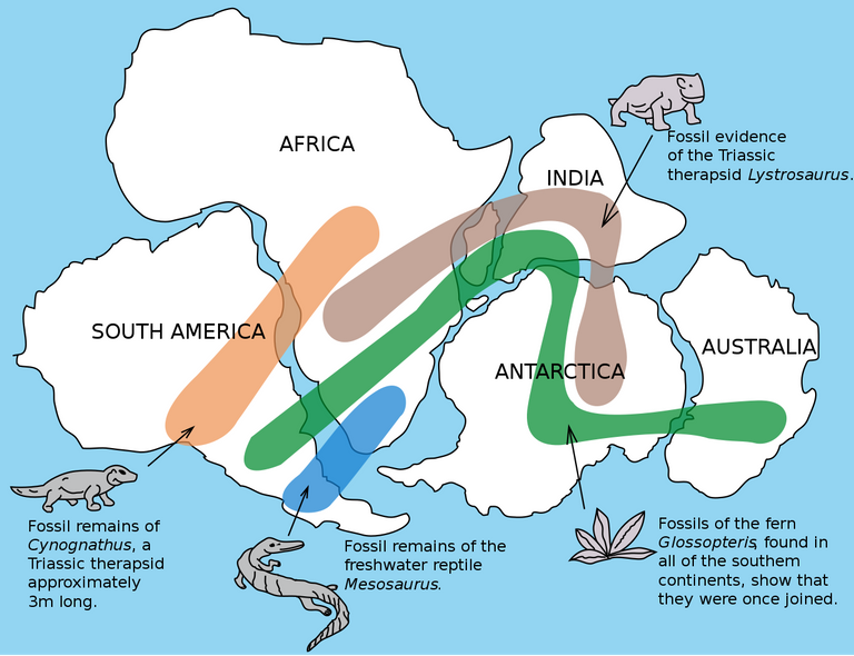
- Fossils and Continental Drift: United States Geological Survey, Public Domain
- Abraham Ortelius’s World Map (1570): Abraham Ortelius, Theatrum Orbis Terrarum, Gilles Coppens de Diest, Antwerp (1570), The Library of Congress, Washington, DC, Public Domain
- The Shared Geology of South America and Africa: Woudloper (designer), Creative Commons License
- Alfred Wegener: Anonymous Photograph, Bildindex der Kunst und Architektur, Public Domain : Alfred Wegener, The Origins of Continents and Oceans, Fourth Edition (1929), Translated by John Biram (1966), Page 17
- Damian Kreichgauer: Anonymous Photograph, St Gabriel, Mödling (1924), Public Domain
- Frank Bursley Taylor: Anonymous Photograph, Twenty-Fifth Anniversary Report (Report VII) of the Secretary of the Class of 1886 of Harvard College (1911), Pages 304–305, Public Domain
- Loránd Eötvös: Anonymous Photograph, Public Domain
- Charles Hapgood: The 1951 Massasoit, Springfield College Yearbook, Springfield, Massachusetts (1951), Public Domain
- Wladimir Köppen: Bundesamt für Seeschifffahrt und Hydrographie (photographers), Bulletin of the American Meteorological Society, Volume 77, Number 5, Page 938, Boston, Massachusetts (1996), Public Domain
- Harold Jeffreys: International Seismological Centre (photographers), Fair Use
- Alfred Wegener in Greenland (1912-13): Archive of Alfred Wegener Institute, Public Domain
- Alexander du Toit: Geological Survey, Pretoria, Public Domain
- Rudolf Staub: Anonymous Photograph, Public Domain
- Arnold Heim: Anonymous Photograph, ETH-Bibliothek Zürich, Bildarchiv, Public Domain
- John Joly: Alfred Werner (photographer), Public Domain
- Arthur Holmes: Anonymous Photograph, Public Domain
- Pablo Groeber: Anonymous Photograph, Public Domain
- Robert Schwinner: Portrait of Robert Schwinner in 1943, Biener (artist), © Bernhard Hubmann, Fair Use
- Reginald Aldworth Daly: Anonymous Photograph, American Journal of Science, Fair Use
- Wilfried von Seidlitz: Anonymous Photograph, Public Domain
