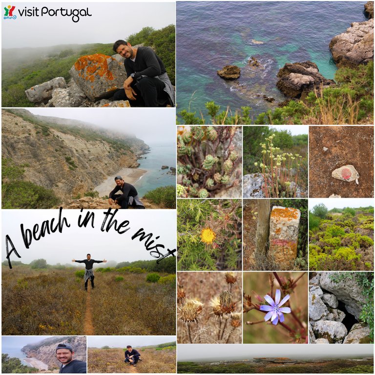
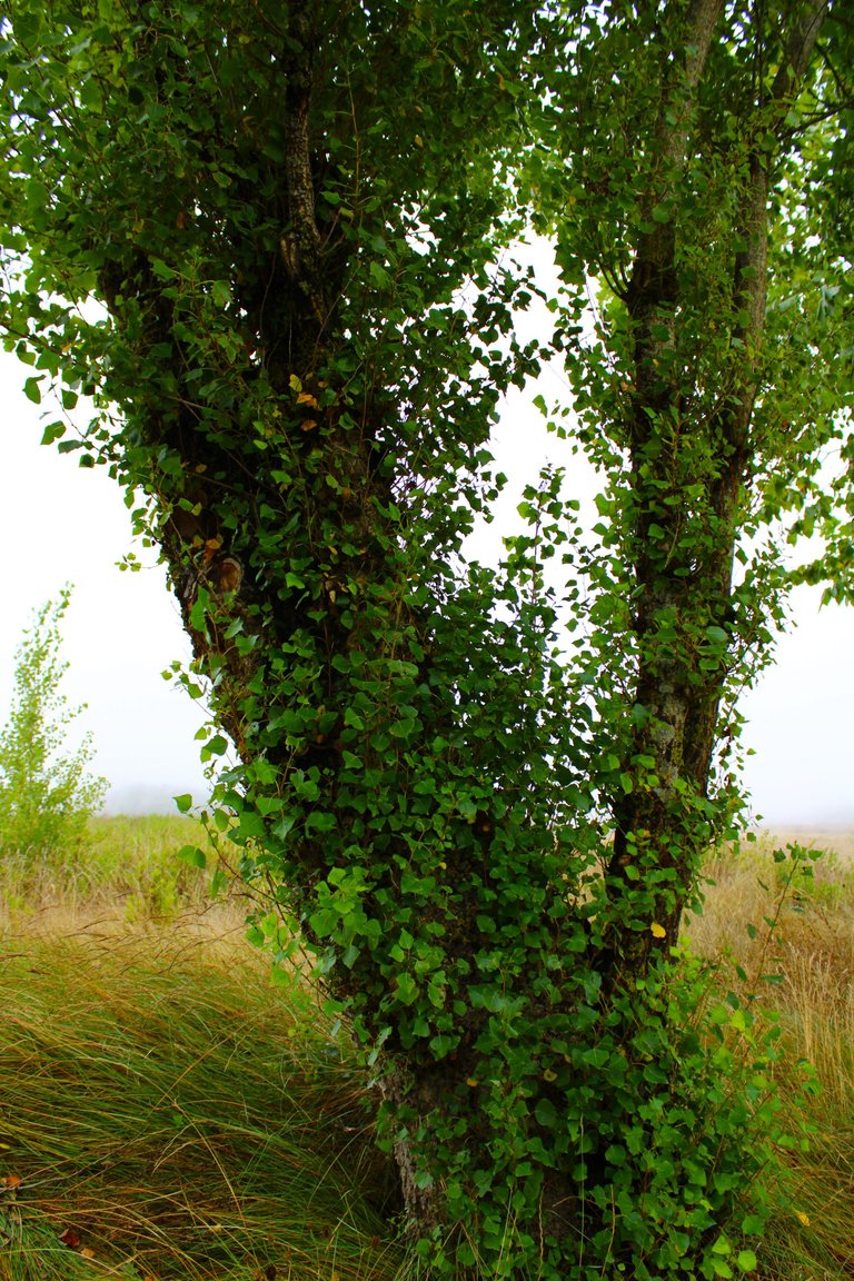
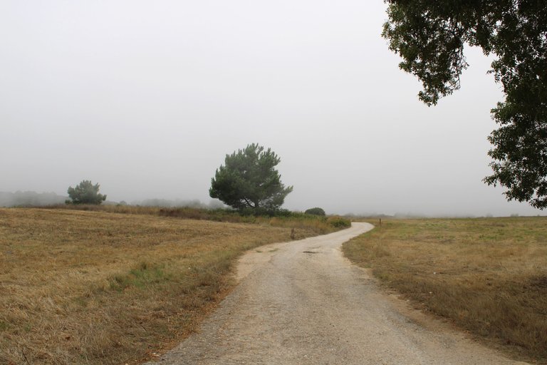
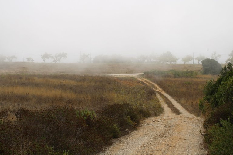
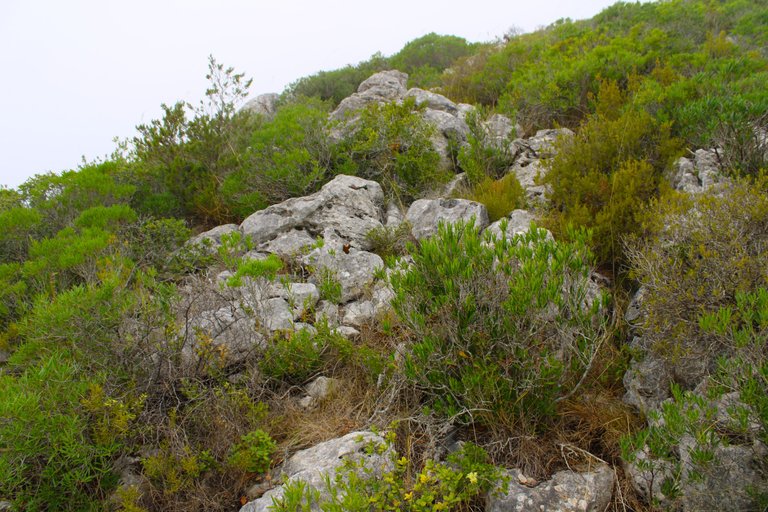
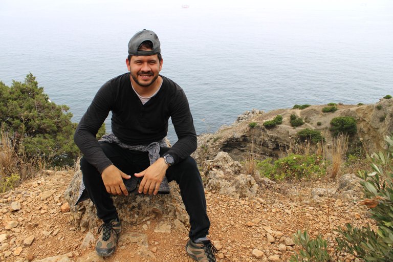
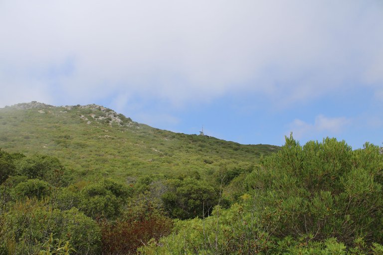
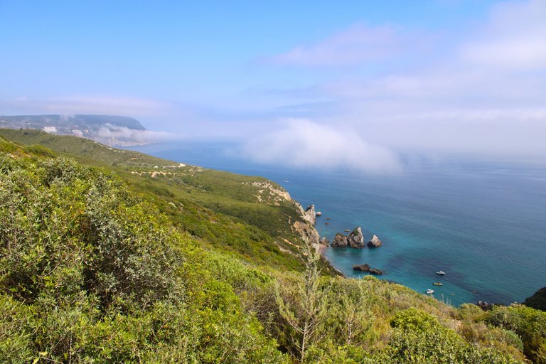
Greetings adventurous friends! Today I am in the area of Sesimbra, 40km from Lisbon, to do one of the strangest trails I have ever done. I had read on several pages that there is a strange phenomenon in this area, since at any time of the year we can see a lot of fog rising up the mountain from the Atlantic. This phenomenon makes the landscape look like something out of a "fantasy" movie. My goal is to walk in the middle of nowhere along a short trail that will take us to a little-known beach that will reveal itself from the middle of the fog. This beach is called "Mijona".🧭🚵🏻♀️
Saludos amigos aventureros! hoy me encuentra en la zona de Sesimbra a 40km de Lisboa para realizar uno de los senderos mas extranos que ya hice, habia leido en varias paginas que hay un fenomeno extrano en esta zona ya que a cualquier epoca del ano podemos ver mucha neblina a subir por la montana desde el atlantico, este fenomeno hace que el paisaje parezca sacado de una pelicula de "fantasia". Mi objetivo es caminar en medio de la nada por un corto sendero que nos llevara a una playa poco conocida que se revelara de en medio de la neblina, esta playa se llama "Mijona".👨🏻🦯📸🌎
Preparing the trail🧭🚩 /Preparando el sendero🌎🗺️
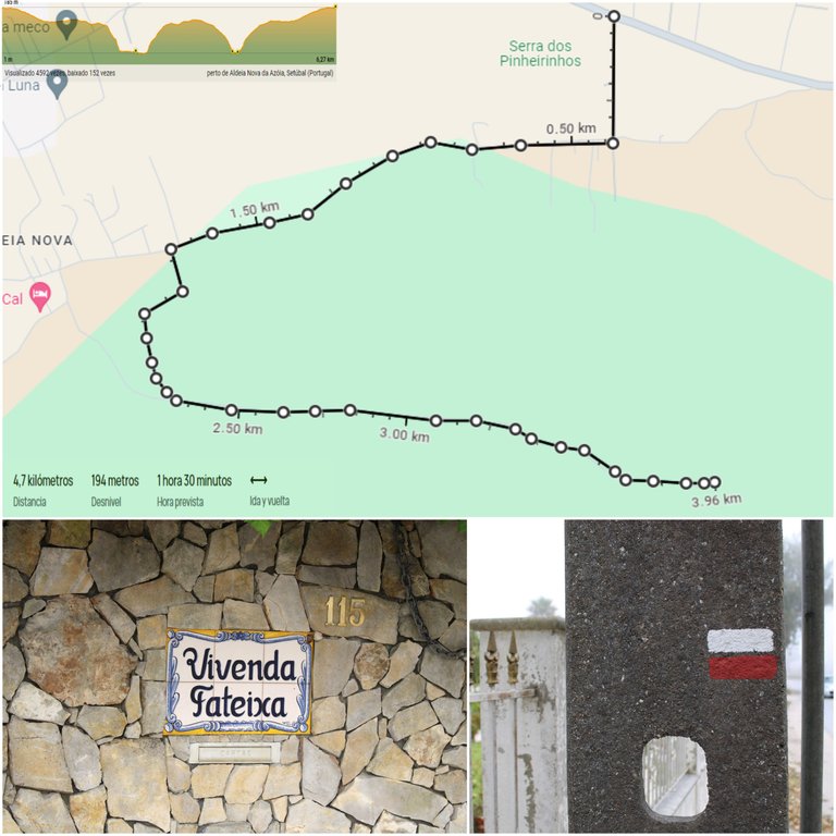
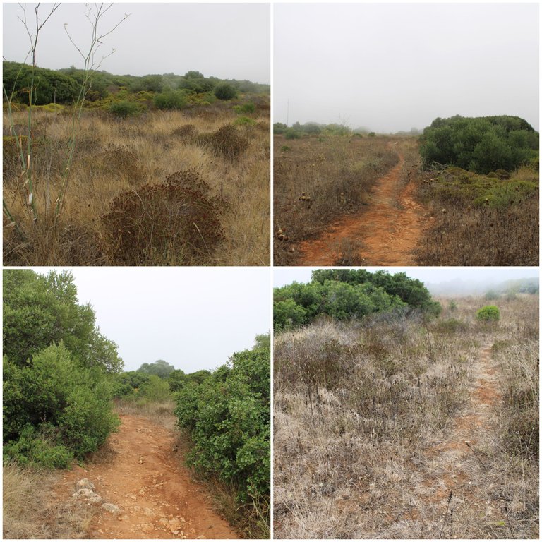
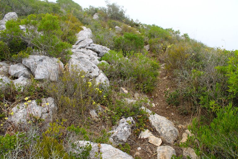
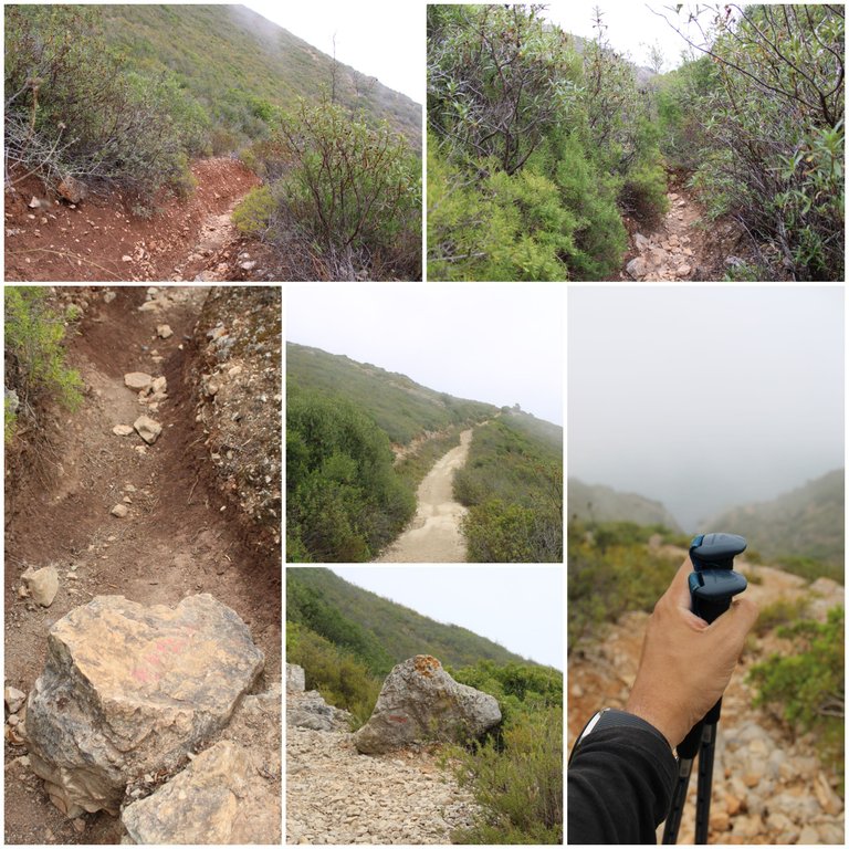
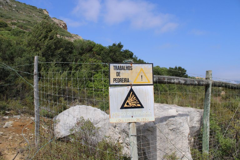
I'll leave you the coordinates where the trail begins (38.438373, -9.163978), let's see the trail has its level of difficulty, first it's quite easy to get lost and there are so many paths that go around the cliff that if you take the wrong one you'll end up on another beach, that's why if you don't know the area you should always use Gmaps to get your bearings, one of the easiest ways is to always look for paths in the direction of the ocean, in summer bring lots of water, dress in comfortable clothes, hiking boots, walking sticks. There are a few moments where you have to go down a granite rock path that is too slippery and without walking sticks you will most likely fall.📸👨🏻🦯
Te dejo las coordenadas donde comienza el sendero (38.438373, -9.163978), a ver el sendero tiene su nivel de dificultad, primero es bastante facil de perderte y hay tantos caminos a rodear el acantilado que si tomas el incorrecto vas a terminar en otra playa, por eso si no conoces la zona debes usar el Gmaps siempre para irte orientando, una de las formas mas faciles es siempre buscar los caminos en direccion al oceano, en verano trae muchisima agua, vistete con ropa comoda, botas de excursion, bastones. Hay unos momentos donde debes bajar por un camino de roca de granito demasiado resbaladiza y sin bastones muy probable te caigas.🚵🏻♀️🧭

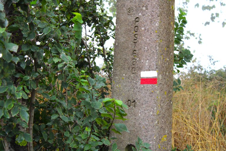
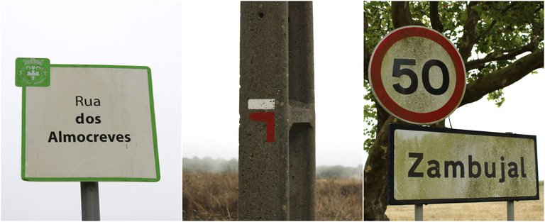
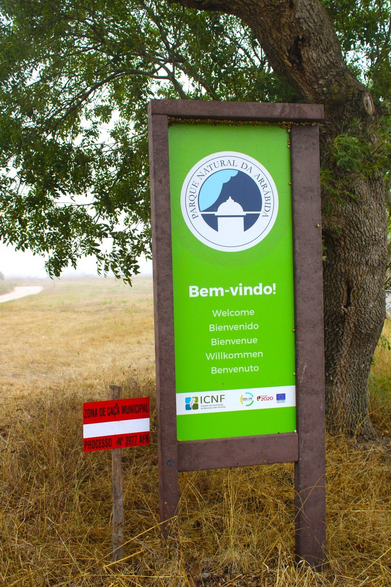
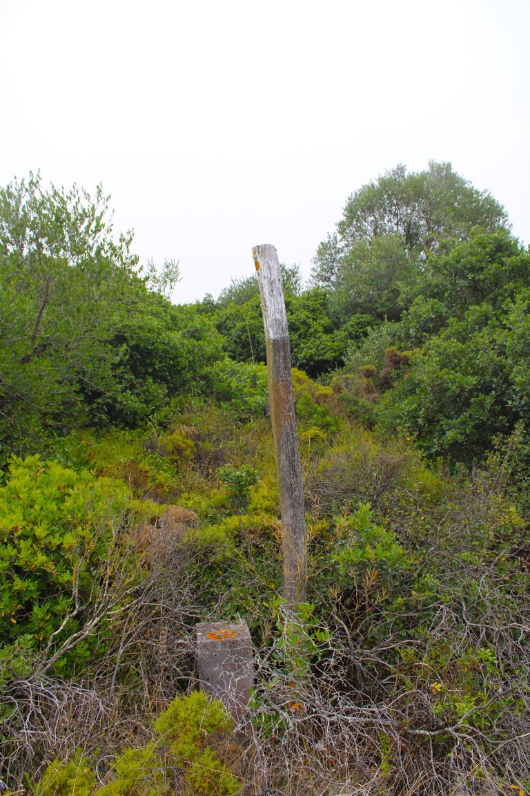
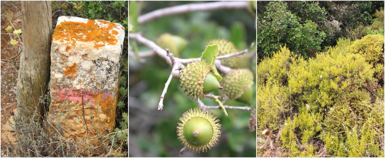
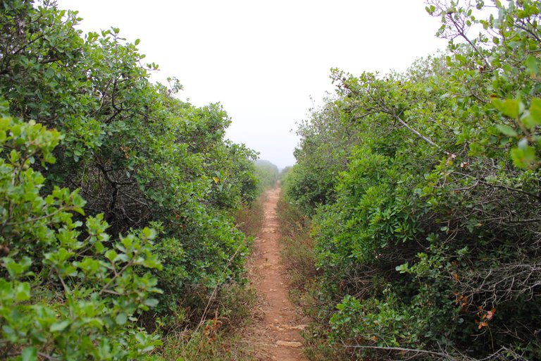
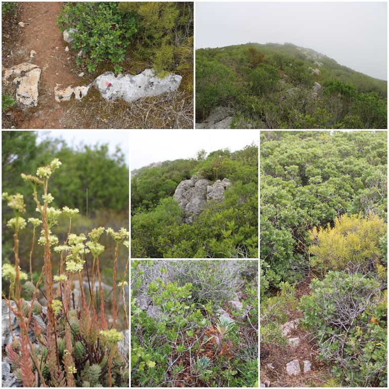
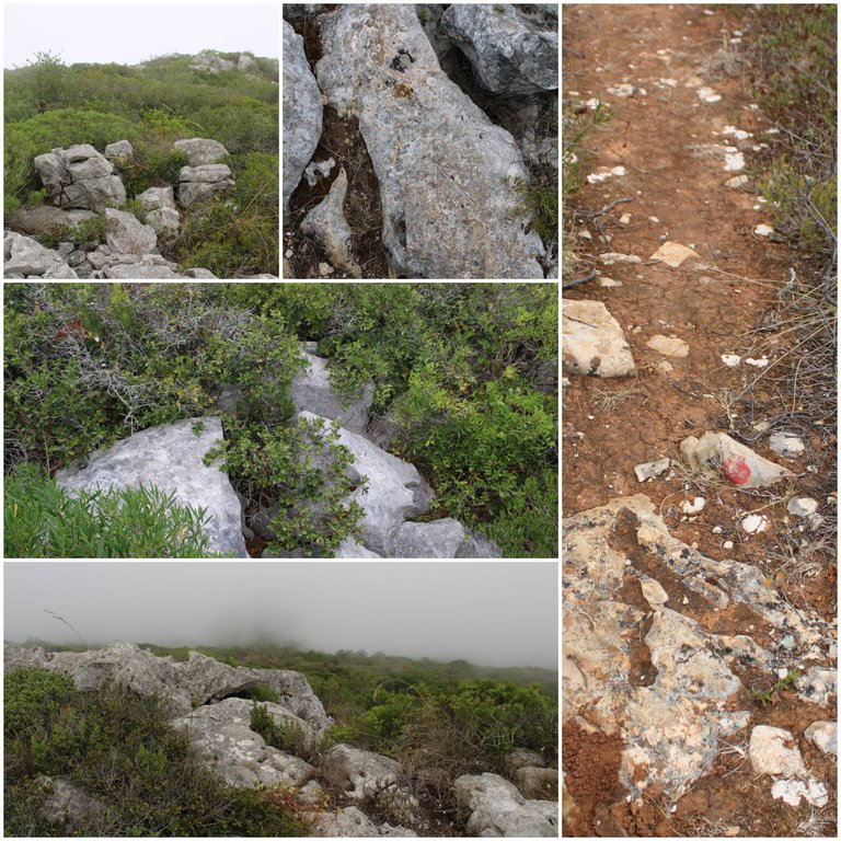
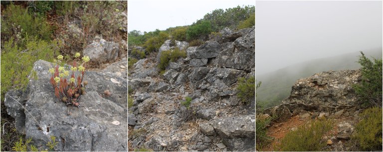
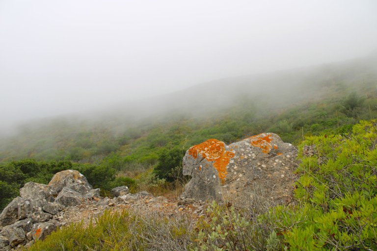
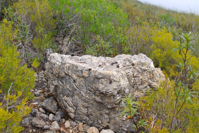
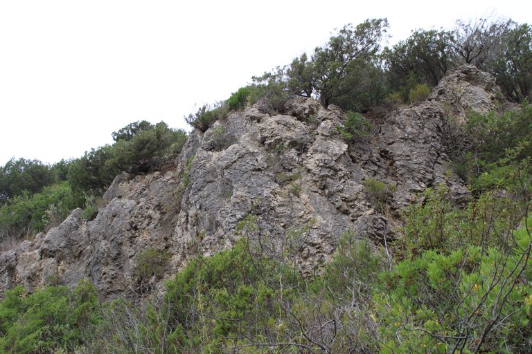
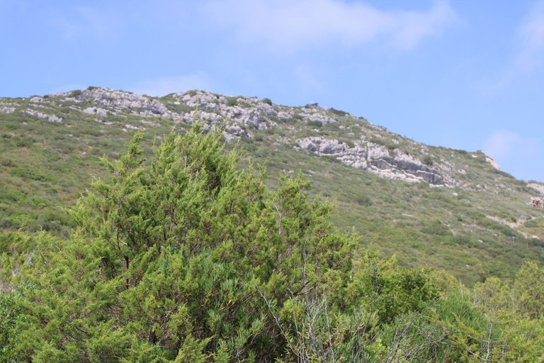
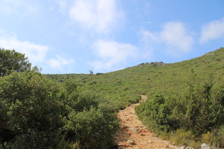
The path has this signage until you reach the sign that says: "arrabida", then you have to continue and cross to the left onto a dirt road, there the signs no longer exist and you have to follow the stones with red spots, the trail is classified as (easy-medium) for me more medium than easy because of the climbs, it is not suitable for people with disabilities, and it is circular because the paths take you to the starting point.📸🌎
El camino tiene esta senalizacion hasta llegar al letrero que dice: "arrabida", luego hay que continuar y cruzar a la izquierda por un camino de tierra, alli la senalizacion deja de existir y tienes que seguir las piedras con manchas rojas, el sendero esta clasificado como (facil-medio) para mi mas medio que facil por las escaladas, no es apto para gente con discapacidad, y es circular porque los caminos te llevan al punto inicial.🧭🗺️
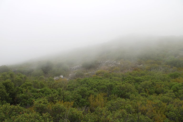
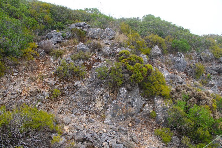
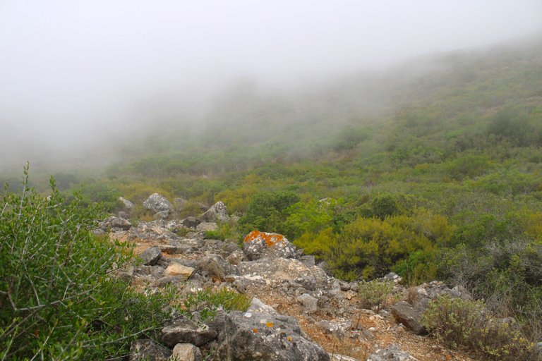
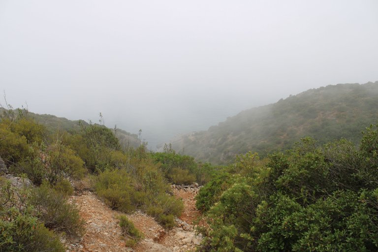
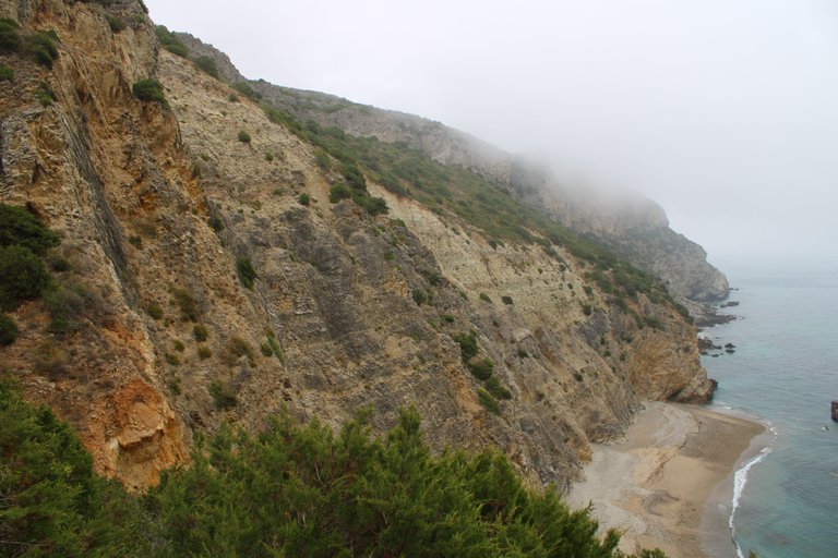
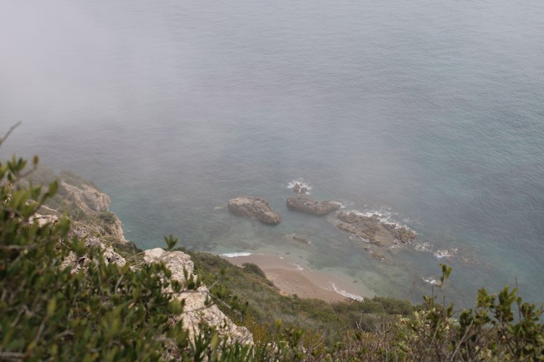
The beauty of the mist🧭🚩 /La belleza de la neblina🌎🗺️
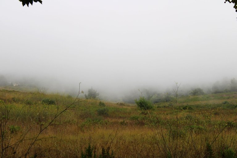
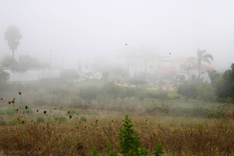
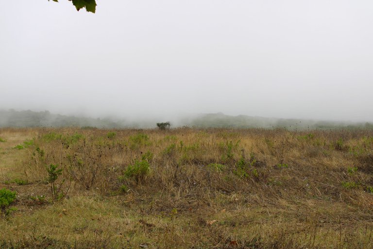
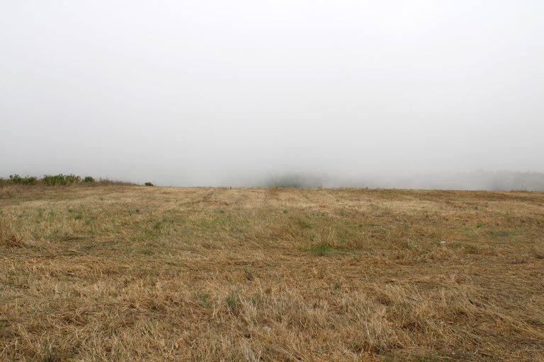
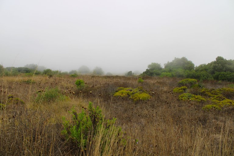
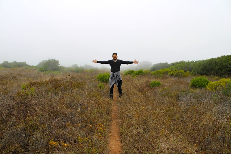
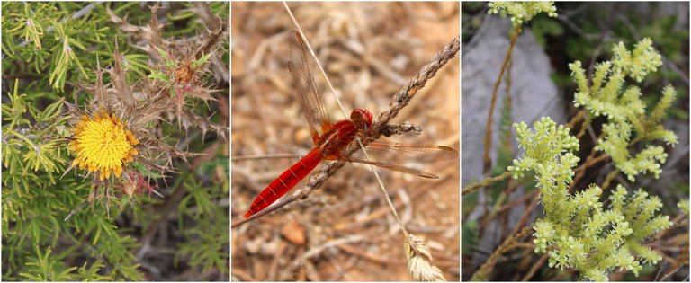
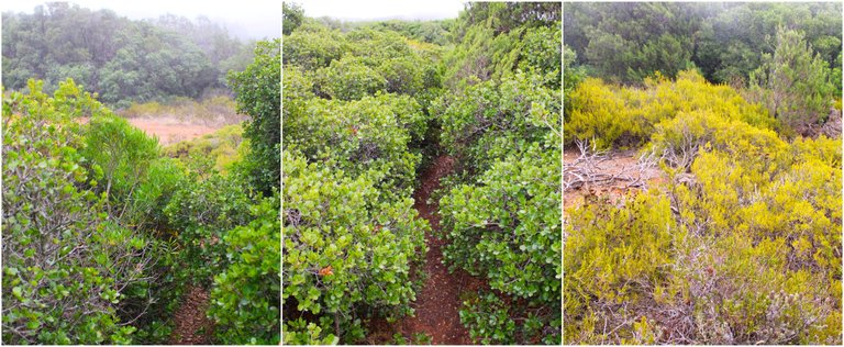
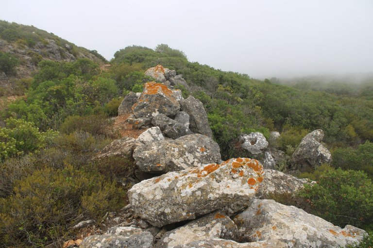
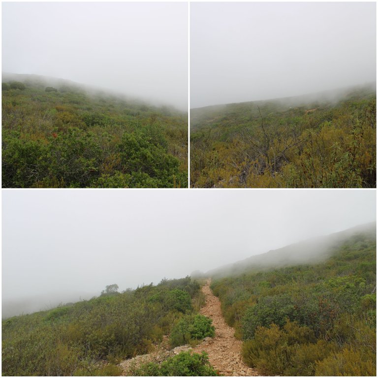
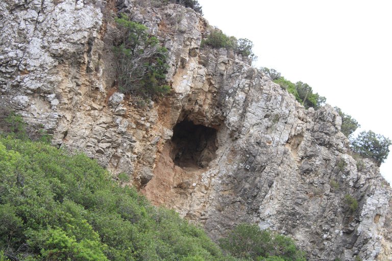
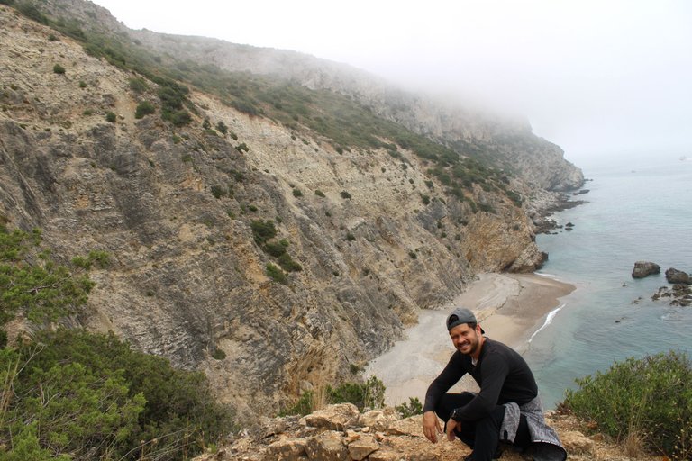
Of course the fog makes the trail beautiful, mysterious, magical, but at the same time it makes it difficult to follow. It is almost impossible to see the landscape more than 50 meters away, so you can easily get lost, especially if you don't know the area. Who would have thought that two days ago the temperature was 40 degrees and today we have this dense fog that lasts a whole day at 20 degrees? This makes "Mijona" beach an interesting place to walk around. Of course there are other interesting things to see, for example we will pass by a cave that is millions of years old, where man lived in prehistoric times.🧭📸
Por supuesto que la neblina hace que el sendero sea bonito, misterioso, magico, pero a la vez dificulta su realizacion, es casi imposible ver el paisaje a mas de 50 metros por lo que te puedes perder facilmente y mas si no conoces la zona, quien diria que hace dos dias atras habia 40 grados de temperatura y hoy tenemos esta neblina densa que dura un dia completo con 20 grados, esto hace de la playa "Mijona" un lugar interesante para recorrerlo. Claro que hay otras cosas interesantes para ver por ejemplo pasaremos por una cueva con millones de anos donde habito el hombre en la prehistoria.🚵🏻♀️🌎
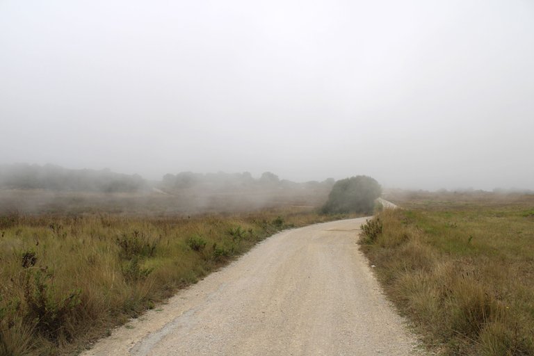
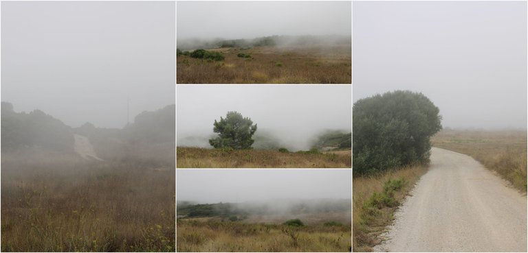
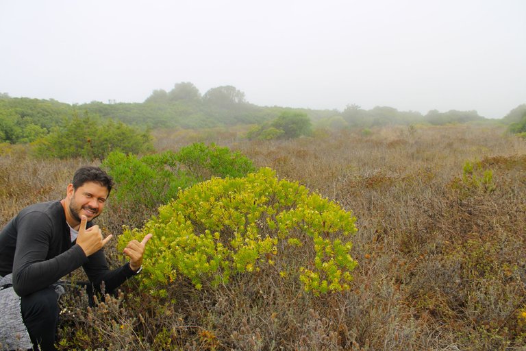
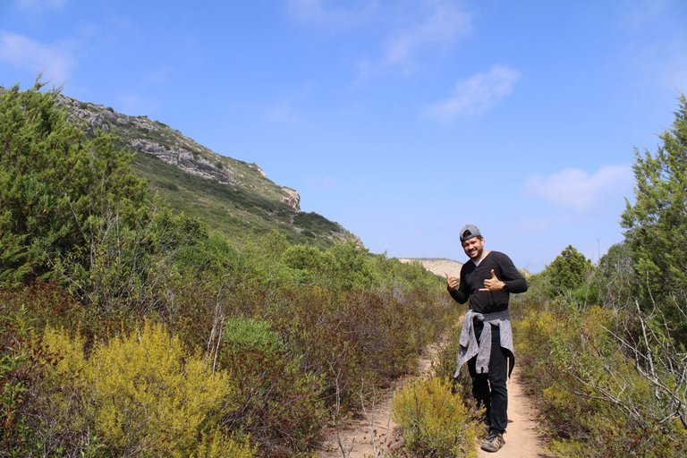
So far I haven't had much difficulty finding the paths, however I had to turn back about three times because I felt I wasn't going in the right place. As this is a nature reserve, the city council can't really promote tourism and hiking in these areas, so they don't prohibit it, but they don't encourage many people to walk there either. All day long I only saw two people walking along the paths, which is why I find the trail attractive if you don't like places full of tourists. With so much fog it's hard to see animals; I heard birds but I couldn't see them.🗺️👨🏻🦯
Hasta ahora no e sentido mucha dificultad para ir encontrando los caminos, sin embargo como tres veces tuve que devolverme porque senti que no iba por el lugar correcto, como esto es una reserva natural tambien la camara municipal no puede impulsar mucho el turismo y las caminatas por estas zonas, asi que no lo prohiben pero tampoco incentivan a muchas personas andar por alli, en todo el dia solo vi dos personas caminando entre los caminos, por eso me parece atractivo el sendero si no te gustan los lugares llenos de turistas. Con tanta neblina es dificil ver animales, escuchaban pajaros pero no los veia.⛲🌎
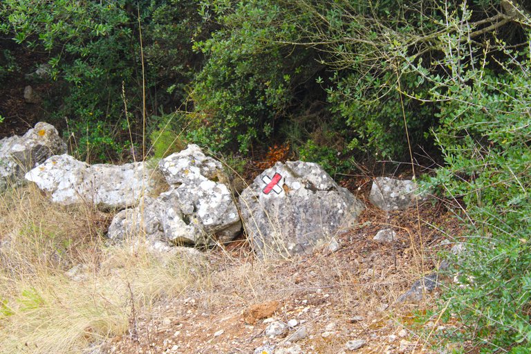
Follow the path of the X📸
The next thing you do is after leaving the road with the sign you are going to cross where this X is, that is, you have to leave the official road to take these alternatives and here things are really more complicated, I will not be able to guide you but I do advise you to always use the roads that on Maps direct you to the beach.🧭📸
Lo siguiente que haces es luego de dejar el camino con la senal vas a cruzar donde esta esta X, osea tienes que salir del camino oficial para tomar estos alternativos y de verdad aqui la cosa es mas complicada, no conseguire orientarte pero si te aconsejo que siempre uses los caminos que en Maps te dirijan a la playa. 🚩⛲
Protection area🧭🚩 /Area de proteccion🌎🗺️
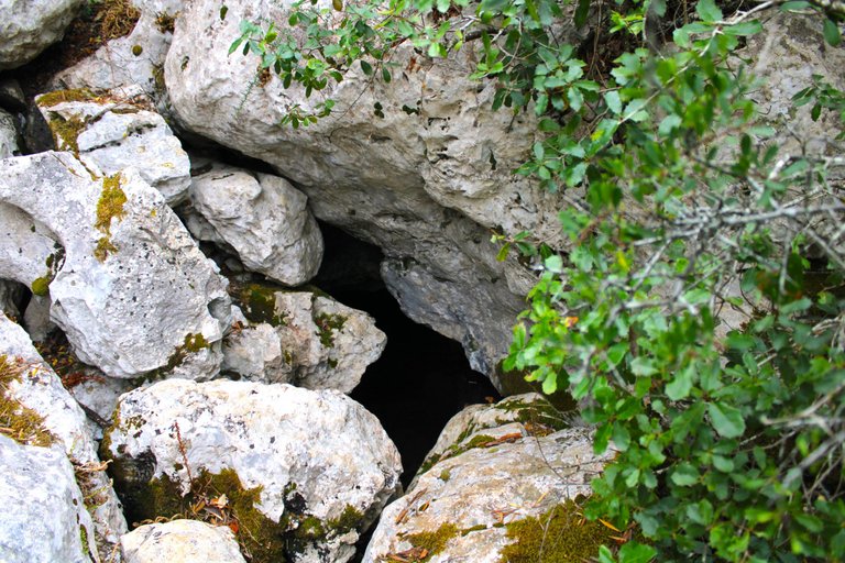
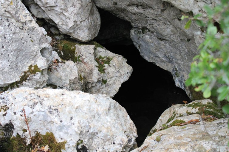
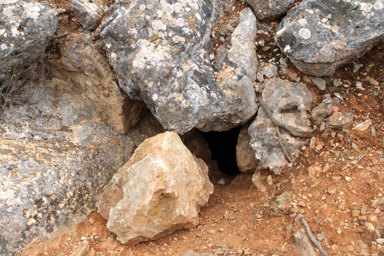
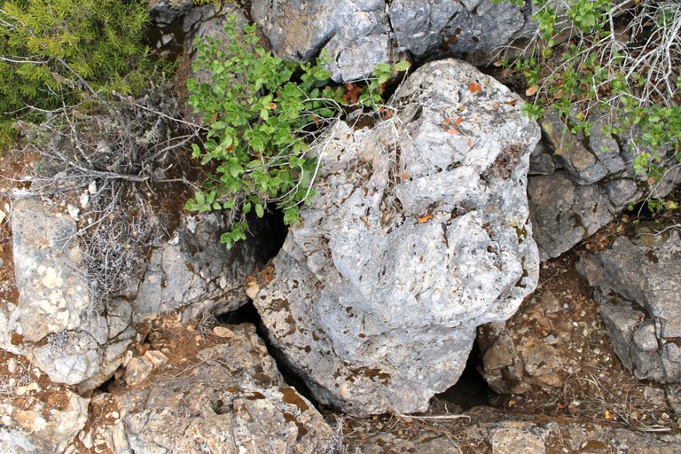
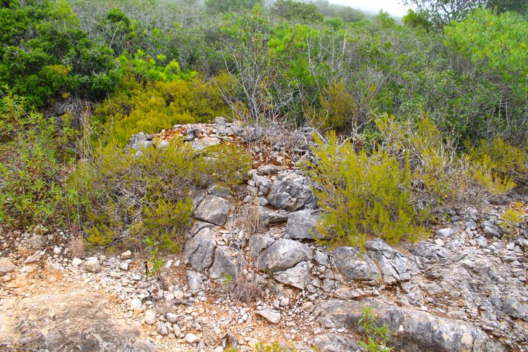
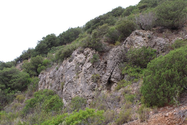
The Sesimbra area has been exploited for thousands of years due to its resources by various civilizations. There are records that the first man who arrived in Portugal in 3000 BC settled in these caves that you see here to protect himself from the environmental conditions and at the same time make these caves his home. The Setubal museum has several pieces that were found in this cave, for example arrowheads, bones and other funerary artifacts. I didn't think it was safe to go down here without someone to accompany me, so I only took photos from outside.🚵🏻♀️📸
El area de sesimbra por miles de anos fue aprovechado debido a sus recursos por varias civilizaciones, hay registros que el primer hombre que llego a Portugal en el 3mil antes de cristo se establecio en estas cuevas que ves aqui para protegerse de las condiciones ambientales y al mismo tiempo convertir estas cuevas en su hogar, el museo de Setubal tiene varias piezas que se encontraron en esta cueva, por ejemplo puntas de flecha, huesos y otros artefactos funebres. No me parecio seguro bajar aqui sin una persona que me acompanase, por eso solo tire fotos desde afuera.🧭🌎
https://www.sesimbra.com/grutas/grutas-e-lapas/serra-do-risco/gruta-da-figueira-brava.html
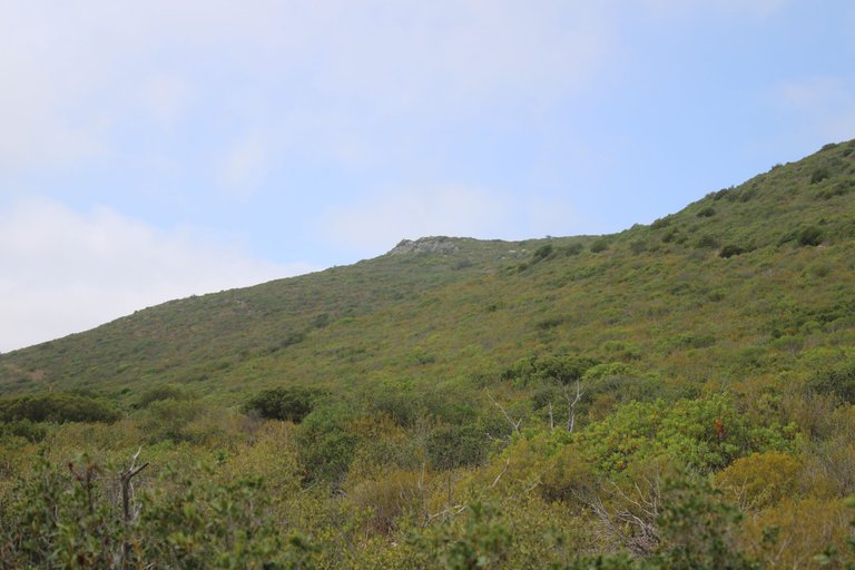
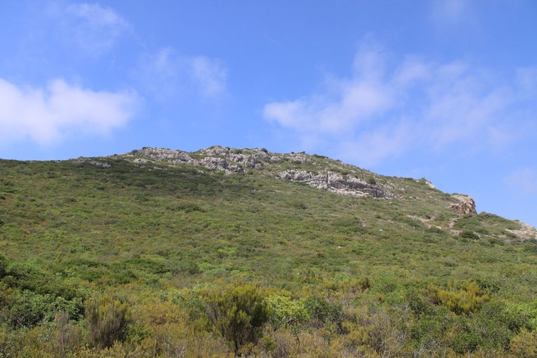
We continue the tour🧭🚩 /Continuamos el recorrido🌎🗺️
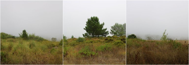
Watch out for the signs🧭🚩 /Pendiente con las senales🌎🗺️
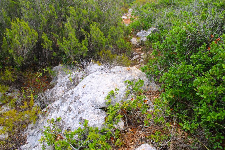
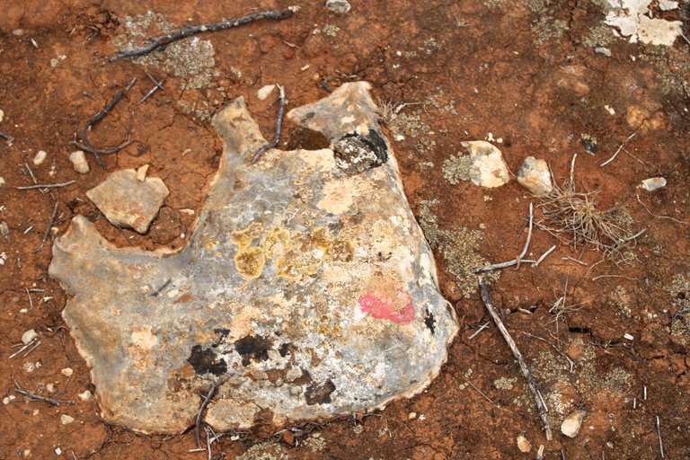
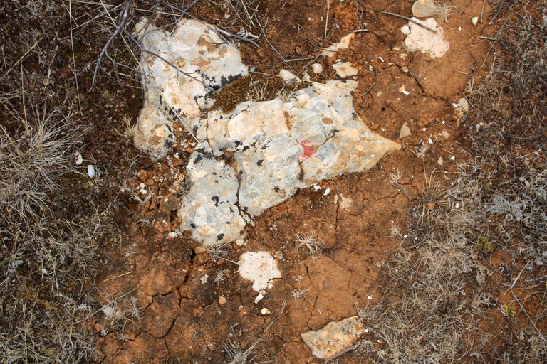
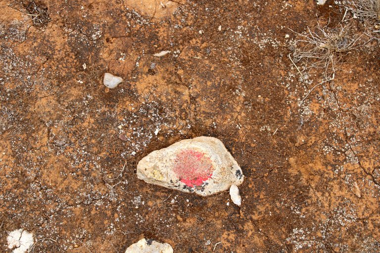
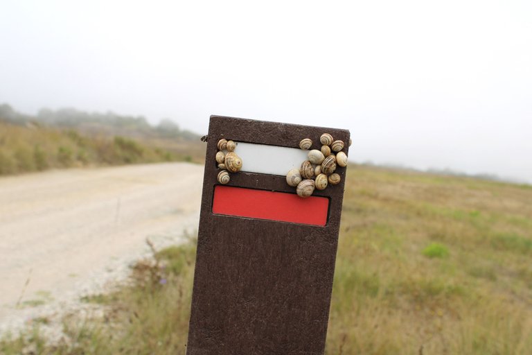
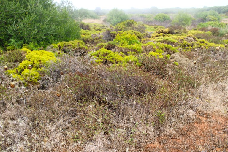
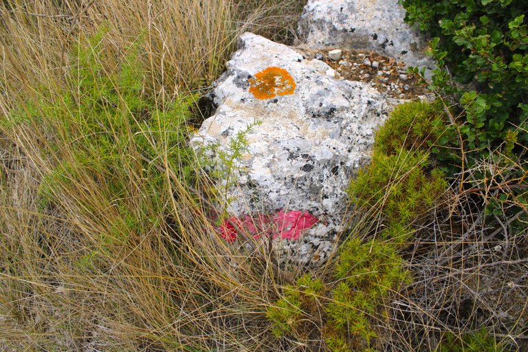
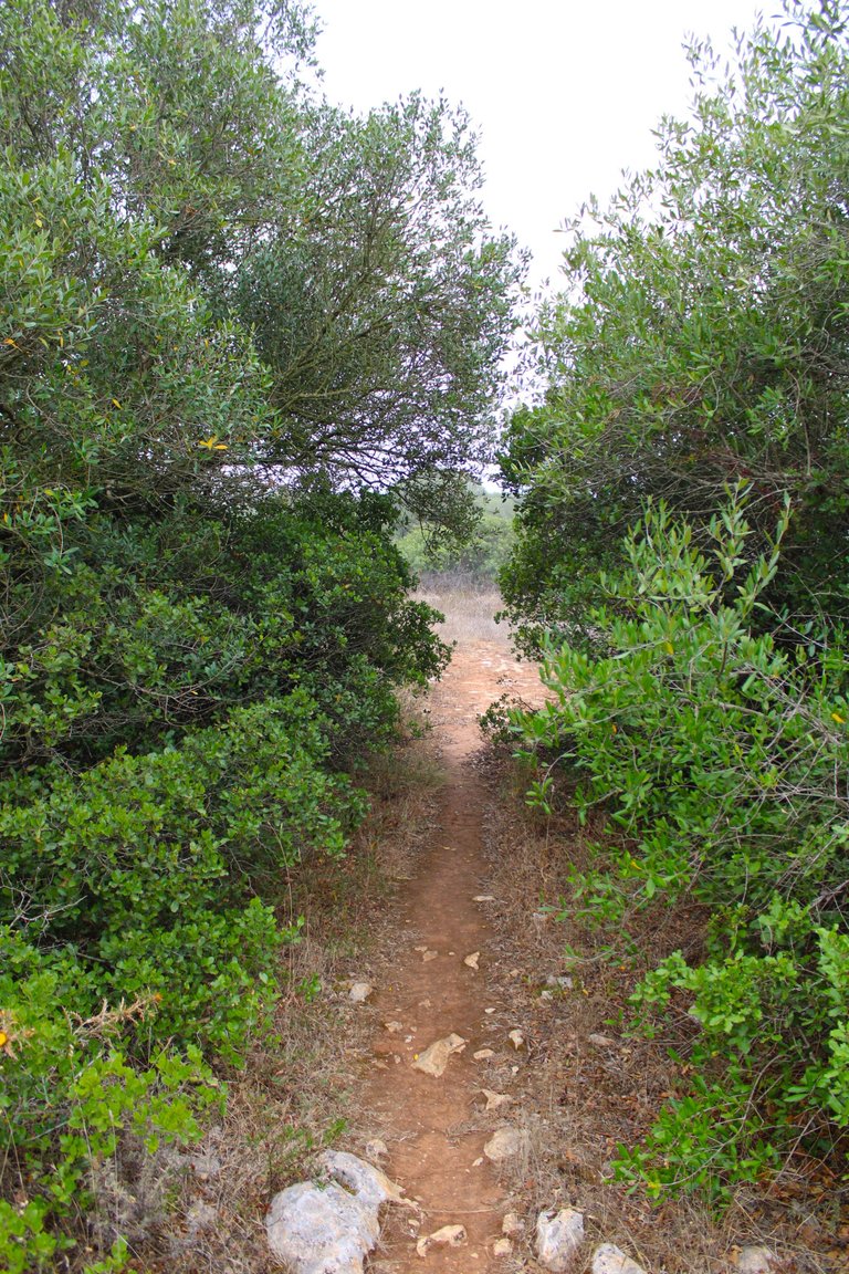
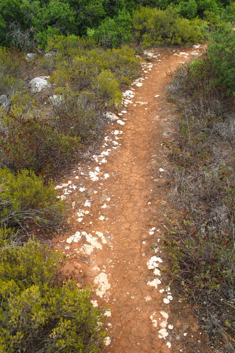
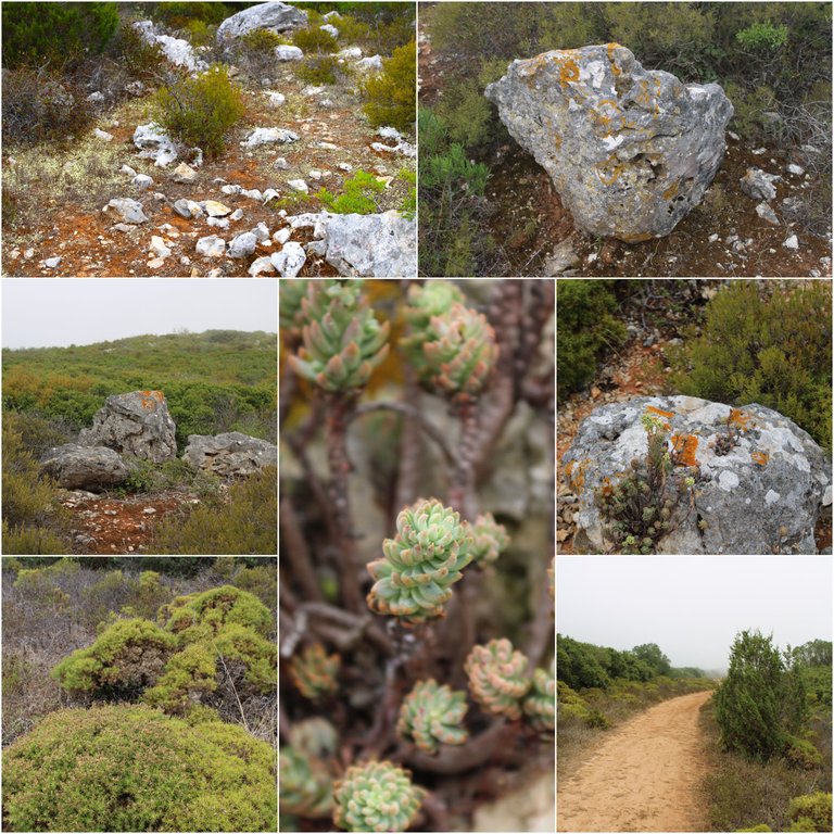
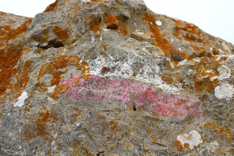
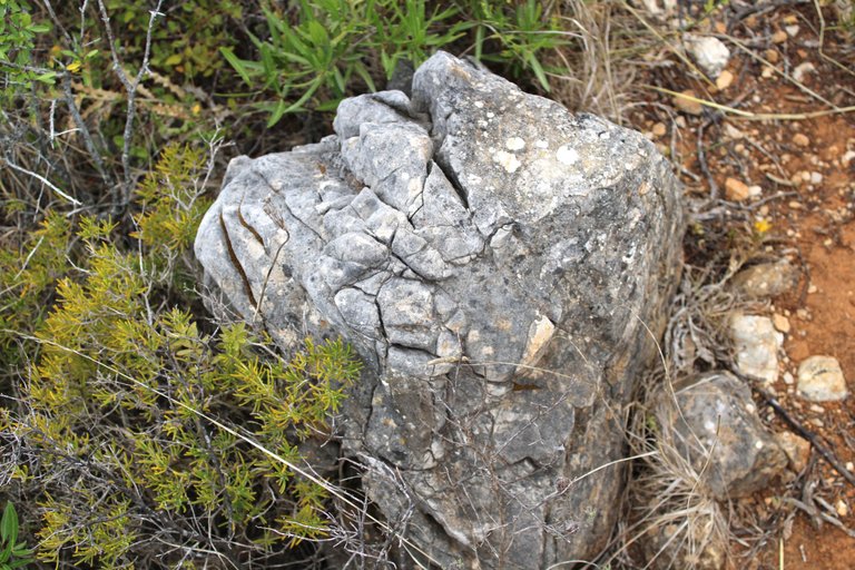
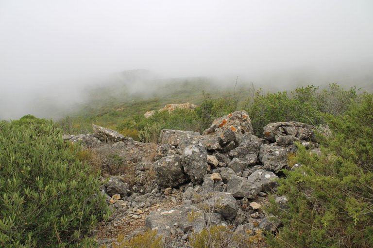
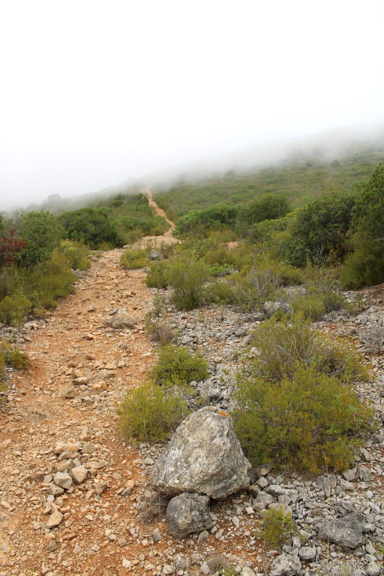
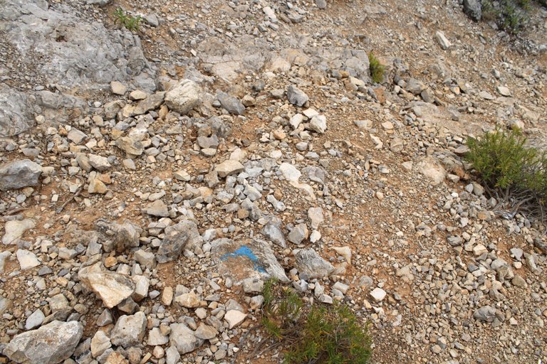
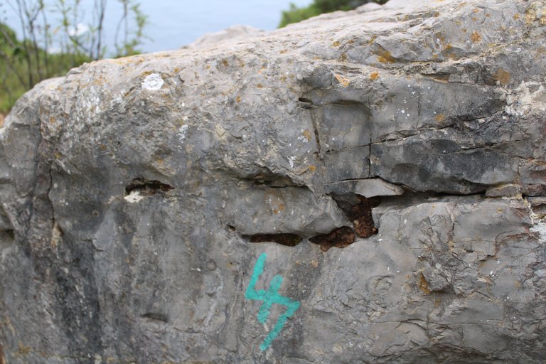
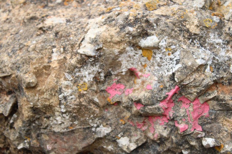
We have to be good observers, looking at the rocks as we go along because some stones have red, green or blue paintings that show us the way, some colors can lead us astray but you know, always follow the ones that take you to the beach "Mijona", as a reference they are also quite useful in case you get lost and want to return to the road.🧭📸
Tenemos que ser buenos obervadores, ir viendo en las rocas mientras avanzamos porque algunas piedras tienen unas pinturas rojas, verdes o azules que nos van marcando el camino, algunos colores pueden desviarnos pero ya sabes siempre sigue las que te llevan a la playa "Mijona", como referencia tambien son bastante utiles en el caso que te pierdas y quieras volver la carretera.👨🏻🦯⛲
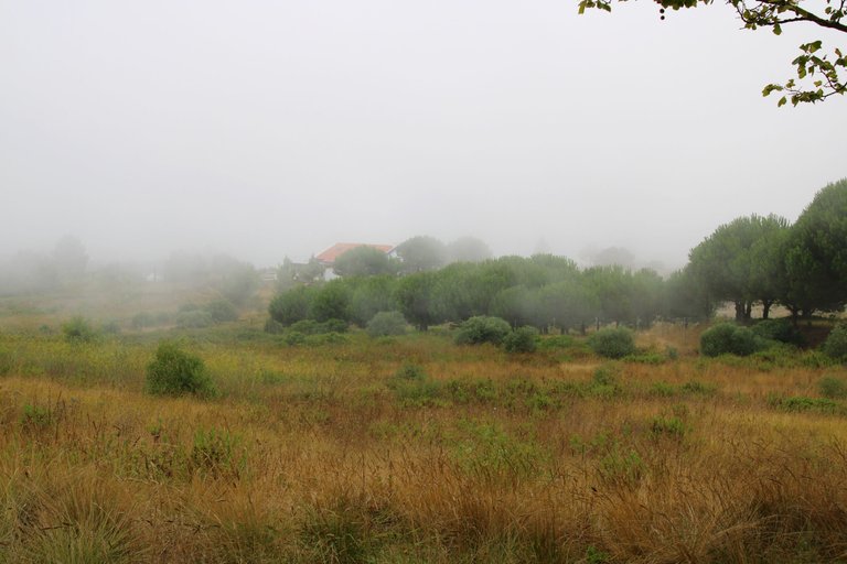
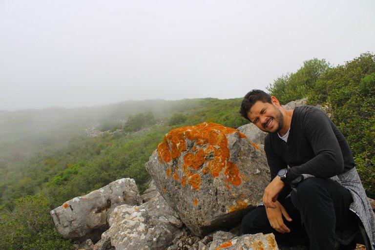
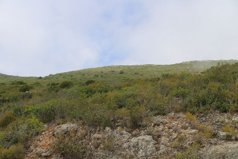
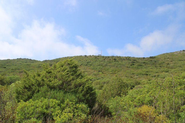
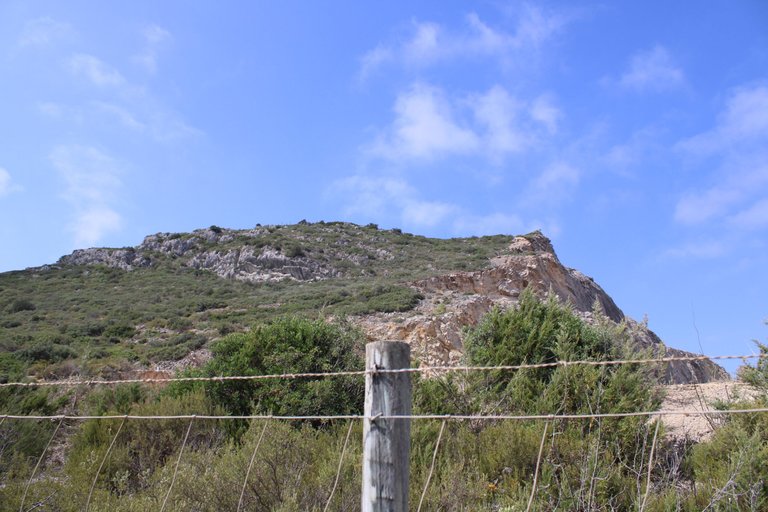
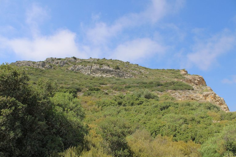
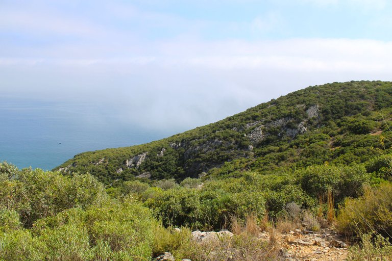
228 meters high🧭🚩 /228 metros de altura🌎🗺️
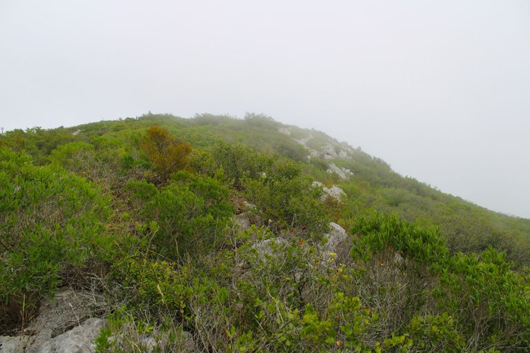
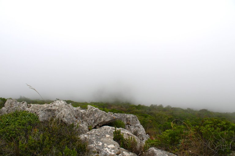
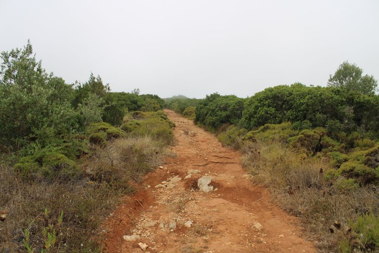
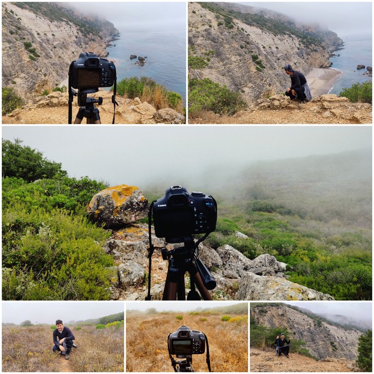
We are halfway along the trail and have reached a height of over two hundred metres, however the fog cuts off the landscape. Here we are supposed to see the whole mountain including the Atlantic. My intention is still to reach the beach. Here we must go back and head north along a very wide dirt road.📸🧭
Estamos a medio camino del sendero y alcanzamos una altura de mas de doscientos metros sin embargo la neblina nos corta el paisaje, aqui es supuesto ver toda la montana incluyendo el altlantico, mi intencion aun es llegar a la play, aqui debemos retroceder y dirigirnos hacia el norte por un camino de tierra muy ancho.🌎👨🏻🦯
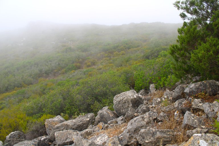
Descent down the mountain🧭🚩 /Descenso por la montana🌎🗺️
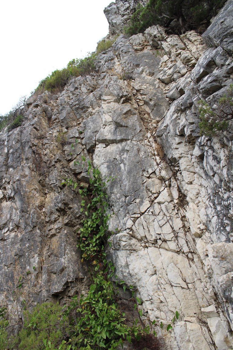
This is the final stretch of the trail and is undoubtedly the most demanding and difficult part of our journey. As you can see, we begin a descent on the slippery sandy ground. This is where our walking sticks help us a lot. Be careful where you step because the path has some small caves that are dangerous.📸🚵🏻♀️
Este es el tramo final del sendero y sin duda es la zona mas exigente y dificil de nuestro recorrido, como puedes ver comenzamos un descenso en el suelo arenoso resbaladizo, aqui es donde nos ayudan mucho los bastones, fijate donde pisa porque el camino tiene algunas pequenas cuevas que son peligrosas.🗺️📸
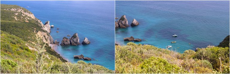
I arrived at the beach🧭🚩 /Llegue a la playa🌎🗺️
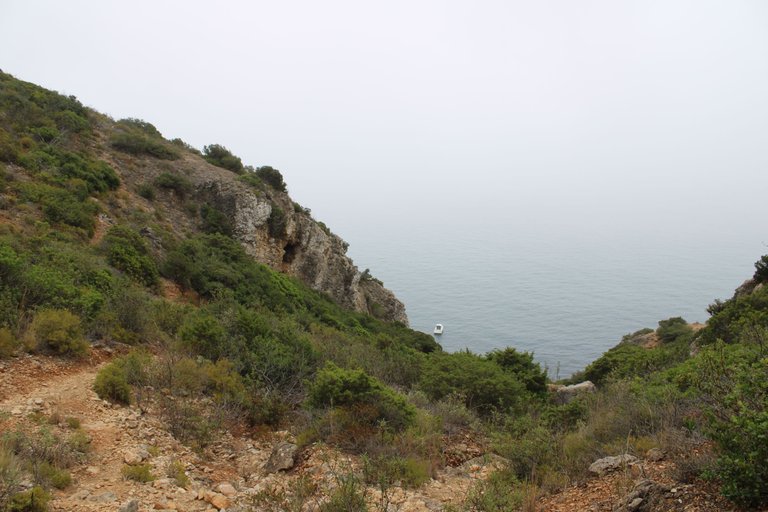
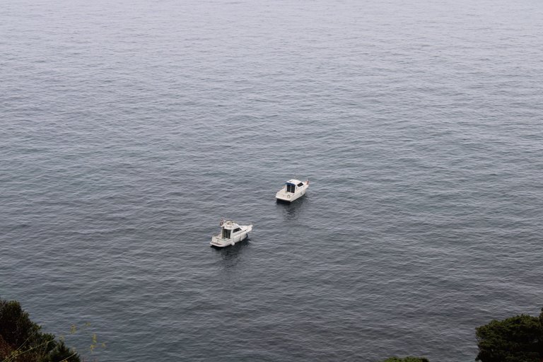
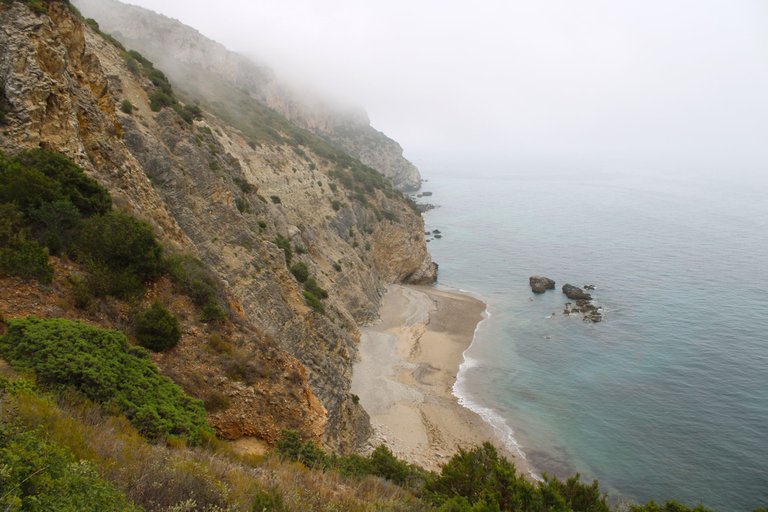
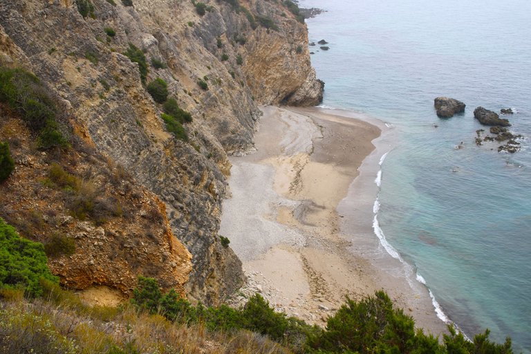
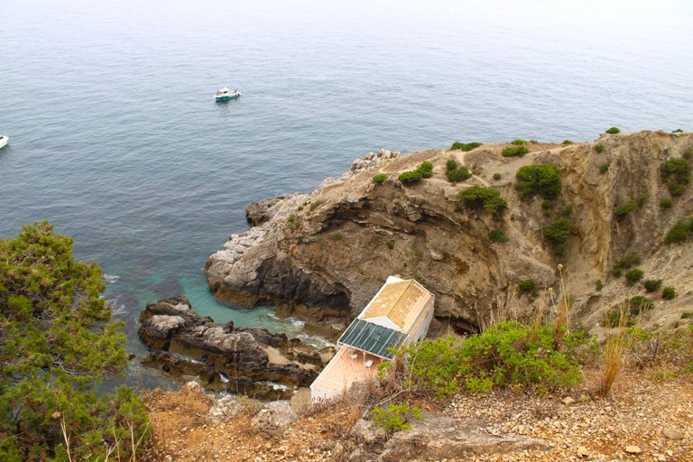
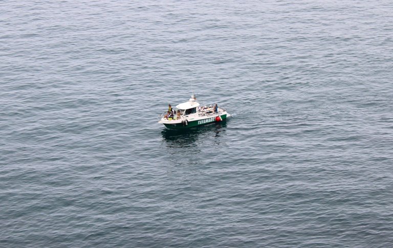
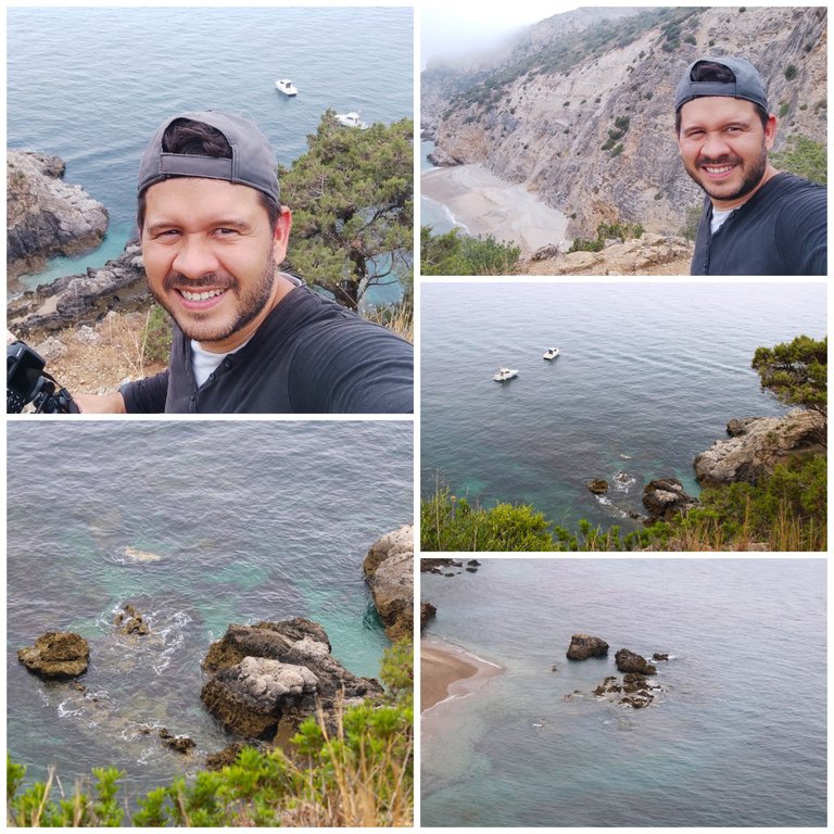
About the beach, I'll tell you that it's one of the least visited in Portugal and of course the whole route I took to get there wasn't easy at all, it's super wild, as there's no surveillance and the tide here is usually quite "hostile" it's not at all advisable to swim, but you can be on the shore without any problems. How do I get here easier? In fact, there are Sesimbra tours that, as you saw in my photo, take you here by boat and you can snorkel, kayak, among other things. Down on the beach there's a restaurant that must be for those who pay for the tour.🚵🏻♀️🗺️
Sobre la playa te dire que son de las menos visitadas en Portugal y claro todo el recorrido que hice para llegar a ella no es nada facil, es super salvaje, como no tiene vigilancia y la marea aqui suele ser bastante "hostil" no es del todo aconsejable para banarte, pero puedes estar en la orilla tranquilamente. Como llego aqui mas facil? en realidad hay tours Sesimbra que como viste en mi foto en barco te llevan aqui y puedes hacer snorkel, kayak entre otros. Abajo en la playa hay un restaurante que debe ser para aquellos que pagan le tour.🌎🧭
Welcome to the sun🧭🚩 /Bienvenido al sol🌎🗺️

DNA is an organization to foster and DENSIFY NATURE-APPRECIATION which aims to establish REPORTS OF BIODIVERSITY DATA that is contributed by all of us Hiveans and subsequently cataloged.
Therefore DNA searches for HIGH-QUALITY posts that aim to DESCRIBE and determine the BIODIVERSITY AROUND YOU with added EXPLANATIONS and INFORMATION. For these informative posts they offer a CURATION SERVICE using the @dna.org account. It is also a CURATION TRAIL. Just add the #dna TAG if you think that any of your posts is what they are looking for.
THANKS FOR READING ME (PHOTOS AND VIDEOS OF MY PROPERTY) / GRACIAS POR LEERME FOTOS Y VIDEOS DE MI PROPIEDAD🙂🧠🦾👍
Excelente fotografías, que increíble como cambia la temperatura en este lugar, imagínate de 40 grados a 20, saludos amigo.
We recently launched HivePakistan's investment token.
This message is being sent only once to HivePakistan's current delegators, to give them an advantageous head start with the new investment model.
Join PakX discord to know more: https://discord.gg/kjSjSHPQrA
Very nice place
Hiya, @glecerioberto here, just swinging by to let you know that this post made it into our Top 3 in Travel Digest #2274.
Your post has been manually curated by the @worldmappin team. If you like what we're doing, please drop by to check out all the rest of today's great posts and consider supporting other authors like yourself and us so we can keep the project going!
Become part of our travel community:
Congratulations, your post has been added to WorldMapPin! 🎉
Did you know you have your own profile map?
And every post has their own map too!
Want to have your post on the map too?