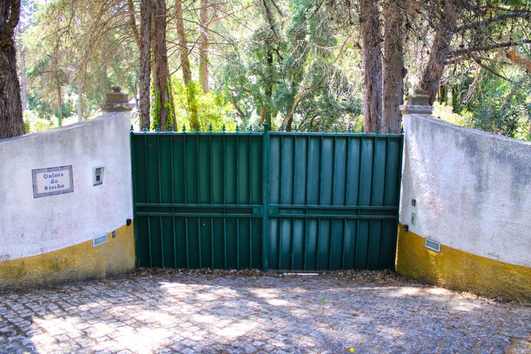
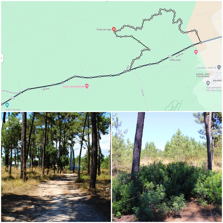
Hello adventurous friends! Today I bring you a new adventure and we are going to walk to a very old village more than 2 thousand years old at 210 meters high on a mountain located in the district of Setubal to photograph the best landscapes of the southern margin of Portugal, this great and difficult odyssey begins in a village called: (Grelhal) and then we will follow a marked path with an extension of 8km circular and we will pass through a Roman road preserved between the years 198-600 before and after Christ, we will learn what the construction process was like. How to enjoy the biodiversity of the Mediterranean.🏰🚩🌍
Hola amigos aventureros! hoy les traigo una nueva aventura y es que vamos a caminar hasta una aldea muy antigua con mas de 2mil anos a 210 metros de altura en una montana ubicada en el distrito de Setubal para fotografiar los mejores paisajes del margen sur de Portugal, esta gran y dificil odisea comienza en una aldea llamada: (Grelhal) y luego seguiremos un camino senalizado con una extension de 8km circular y pasaremos por una carretera Romana preservada entre los anos 198-600 antes y despues de Cristo, aprenderemos como era el proceso de construccion asi como disfrutar de la biodiversidad del mediterraneo.🫅🏻🗺️🌳
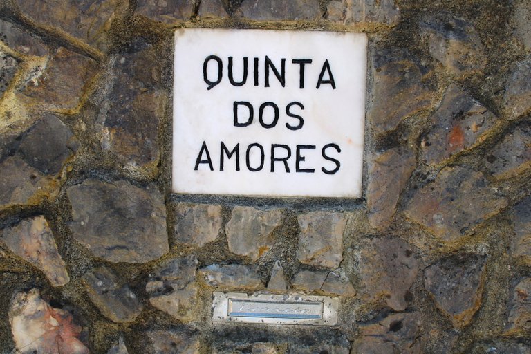
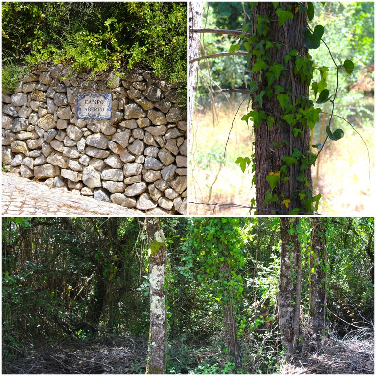
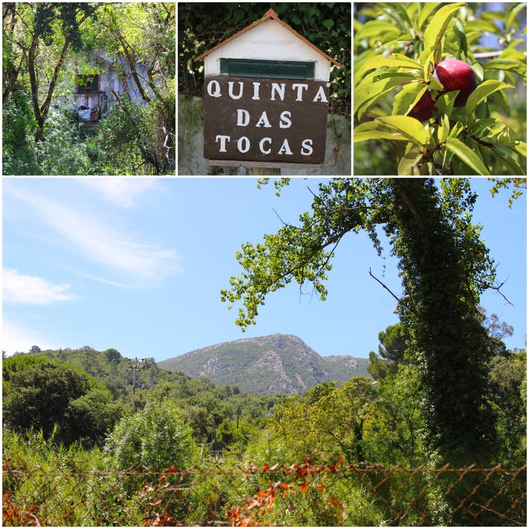
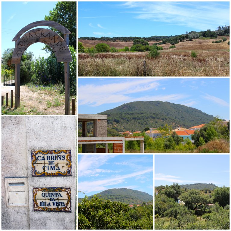
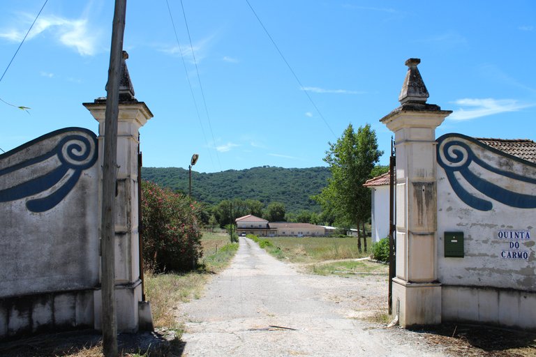
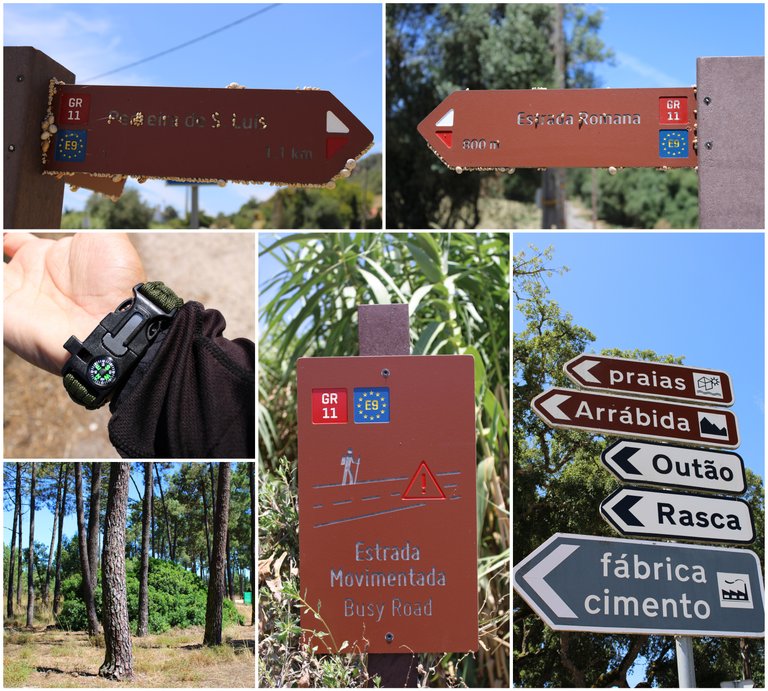
You can vary the beginning of the trail to make your adventure more demanding, for example I started in a village called: "Aldeia Grande" which would increase my walk to more than 15km and it was a good decision because I enjoyed the beautiful landscape, some old country houses and several wine plantations that are abundant in Setubal, as you can see when we join the trail we will get these signs that tell us where to go and how many km we need to get to the site. There is a height where there are only roads and no signs, so I always orient myself with my compass.🌳🗺️
Puedes variar el comienzo del sendero para hacer tu aventura mas exigente, yo por ejemplo empece en una aldea llamada: "Aldeia Grande" lo que aumentaria mi caminata mas de 15km y fue una buena decision porque disfrute del hermoso paisaje, algunas quintas antiguas y varias siembras de vinos que son abundantes en Setubal, como puedes ver cuando nos integramos al sendero conseguiremos estos letros que nos indican hacia donde dirigirnos y cuantos km nos falta para llegar al sitio. Hay una altura donde solo hay caminos y no hay letreros por eso siembre me oriente con mi brujula.🚩🌷
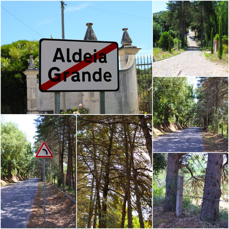
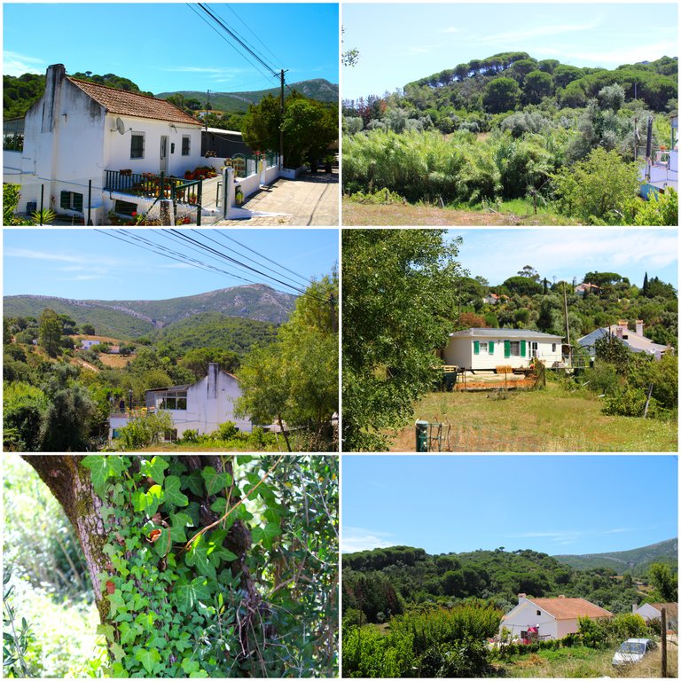
"Aldeia grande" is a small village with less than 20 houses where I started the walk to extend the walk more and increase the intensity of my exercise. I think it is a trail for people with experience first because if you don't know how to orient yourself you will probably have I had to use Gmaps in the village to avoid taking the wrong path, secondly the climate is quite hostile in summer, imagine that now when I walked here there was a risk of fire and the temperature in the sun was more than 40 degrees which made it necessary to maintain a rhythm slow and cool off in the shade of the trees to control my temperature, I wanted to avoid getting sunstroke.🌎🗺️
"Aldeia grande" es una pequena aldea con menos de 20 casas en la que inicie la caminata para extender mas la caminata y aumentar la intensidad de mi ejercicio, creo que es un sendero para personas con experiencia primero porque si no te sabes orientar probablemente tendras que usar Gmaps en la aldea para no tomar algun camino errado, segundo el clima es bastante hostil en verano, imagina que ahora cuando camine por aqui habia riesgo de incendio y la temperatura en el sol eran mas de 40 grados lo que hacia mantener un ritmo lento y refrescarme en la sombra de los arboles para ir controlando mi temperatura queria evitar insolarme. 🌳👨🏻🦯🧎🏻♂️🚵🏻♀️🚴🏻♂️
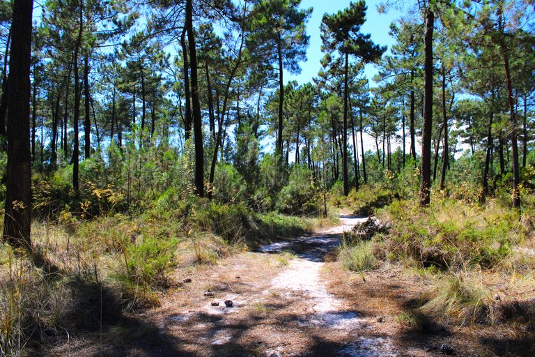
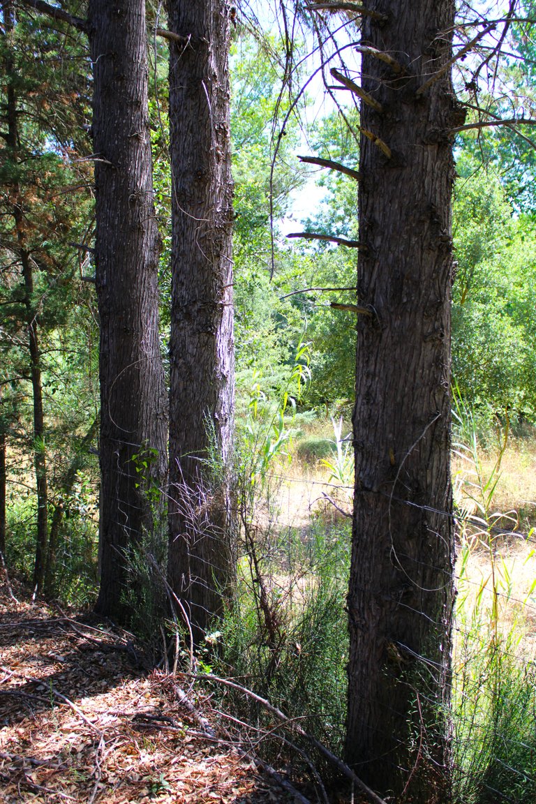
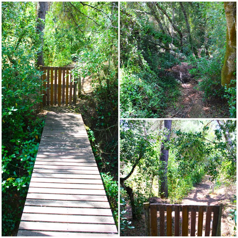
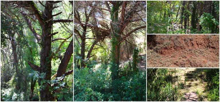
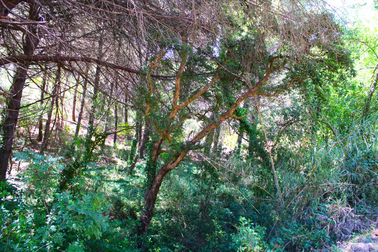
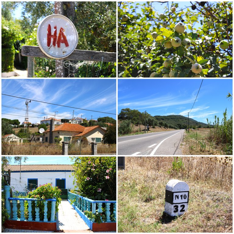
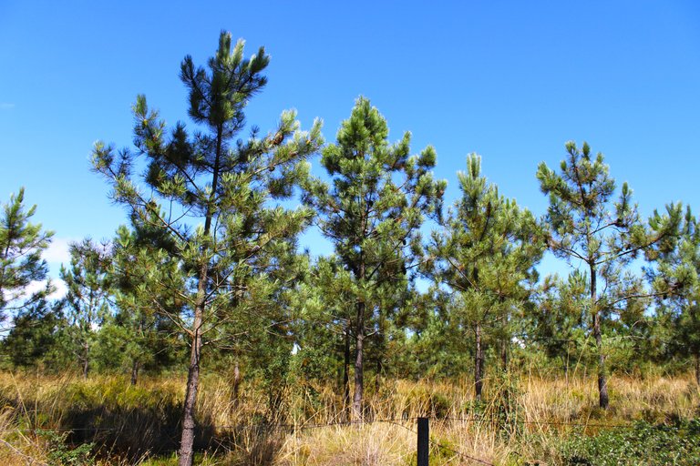
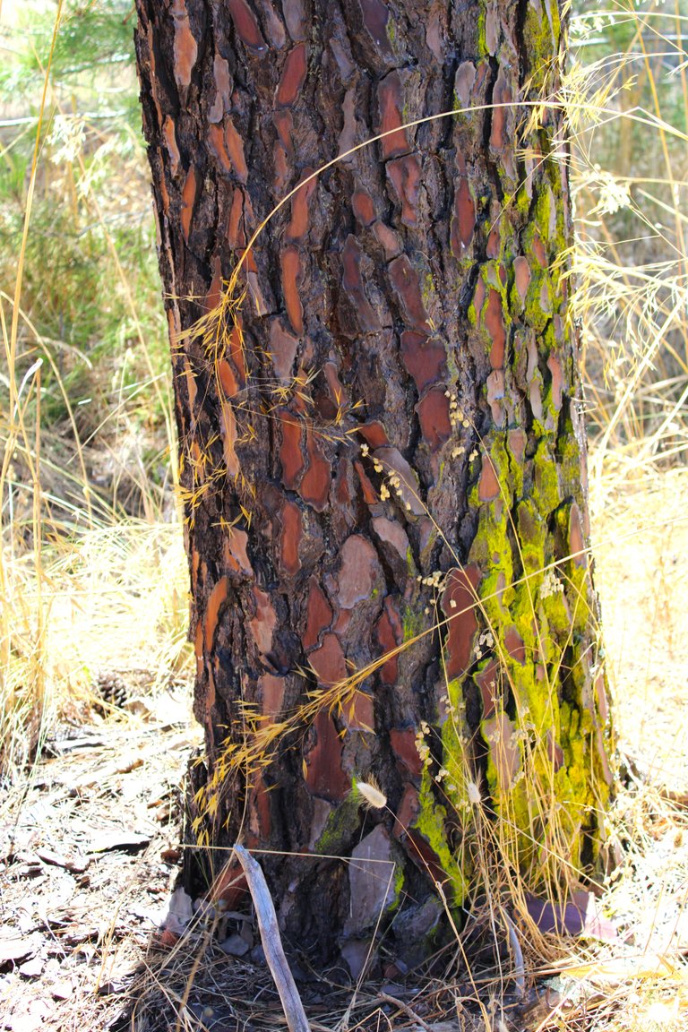
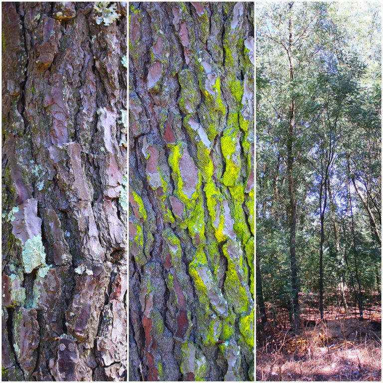
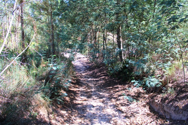
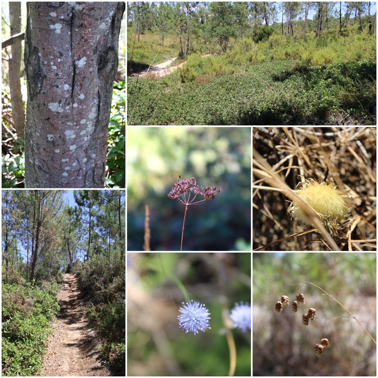
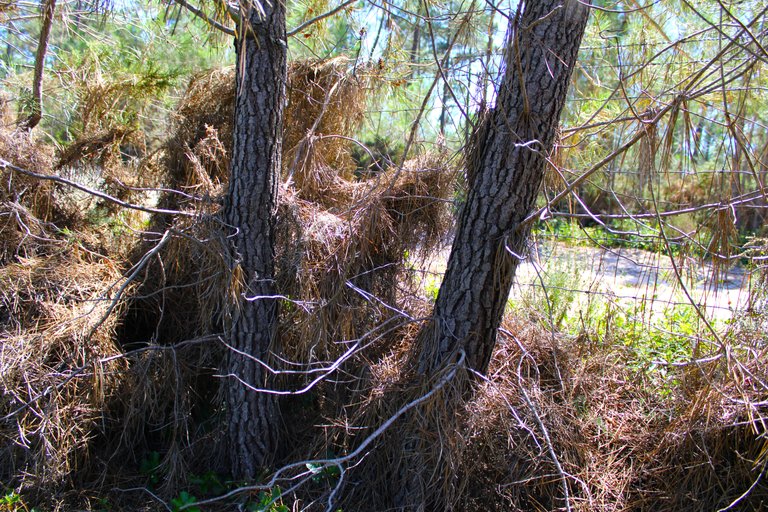
It is not at all easy to know where we are going if we do not have reference points or the path has any signs, while I was walking along these confusing sandy paths I thought: "ok I have to go east" since I have a compass I took the paths of sand until you reach the main road, where you just have to follow until you get the sign that says: "Roman road" and that is where the trail officially begins! I saw that there were many pine trees around here, I suppose it is an important activity for the people who live here.👨🏻🏫🌎
No es nada facil saber hacia donde vamos si no tenemos puntos de referencias o el camino tiene alguna senalizacion, mientras caminaba por estos caminos de arenas tan confusos pense: "ok tengo que ir hacia el este" como tengo una brujula fui tomando los caminos de arena hasta llegar a la carretera principal que alli era solo seguir hasta conseguir el letrero que dice: "carretera romana" y es donde oficialmente comienza el sendero! vi que habian muchos arboles de pino por aqui supongo que es una actividad importante para las personas que viven aqui.🌳⛲🚩🌲
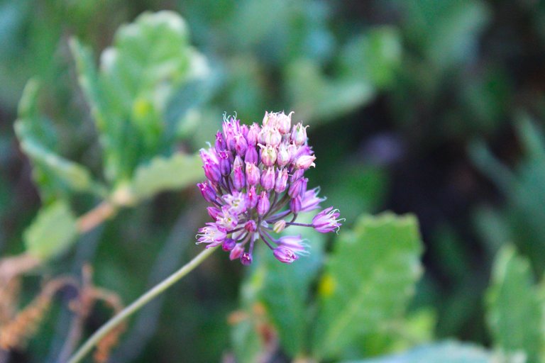
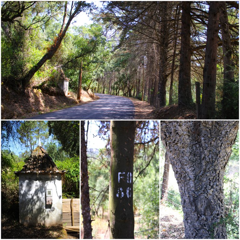
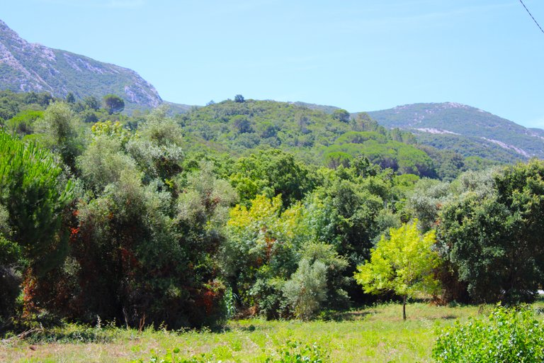
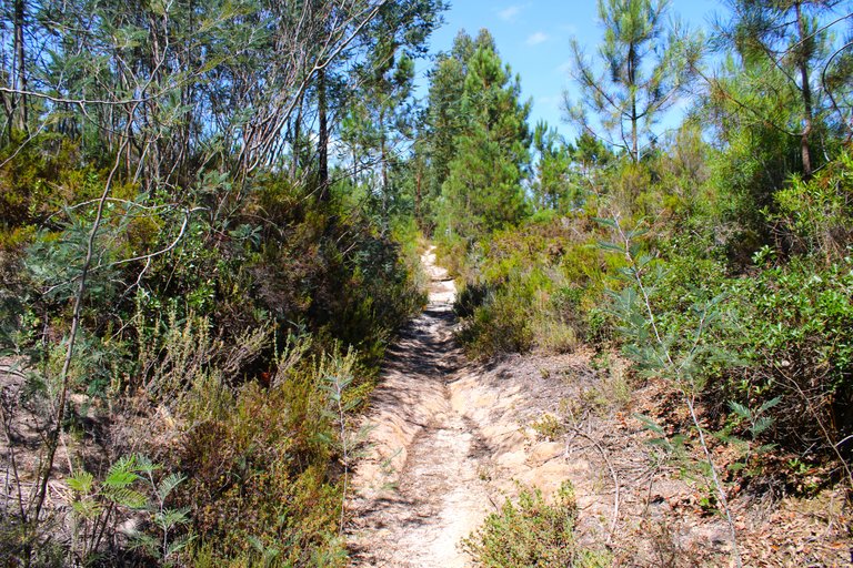
The walk was interesting in this mini undergrowth because I enjoyed photographing various pretty flowers and bushes, some I don't know if they were placed there as an invasive species or are native to the Mediterranean! I do not regret having passed through the village, as we walk to the main street the landscape changes and we see more thorny bushes and fewer large trees, it is an interesting change in the landscape.🧭🌏
La caminata fue interesante en este mini sotobosque porque disfrute de fotografiar varias flores y arbustos bonitos, algunos no se si fueron colocados alli como especie invasora o son nativas del mediterraneo! no me arrepiento de haber pasado por la aldea, mientras caminamos a la calle principal el paisaje va cambiando y ya vemos mas arbustos espinosos y menos arboles grandes, es un cambio interesante del paisaje.🚩🌷

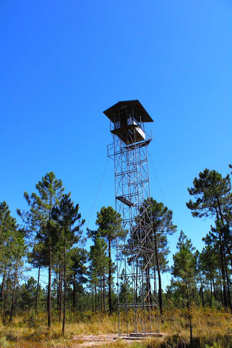
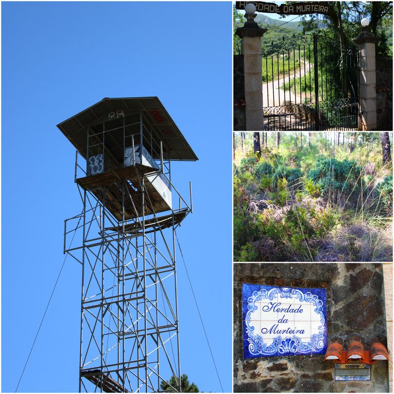
First 2km lookout position🧭🚩 /Primer puesto de vigia 2km🗺️
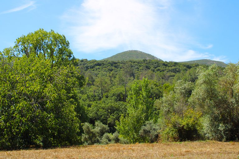
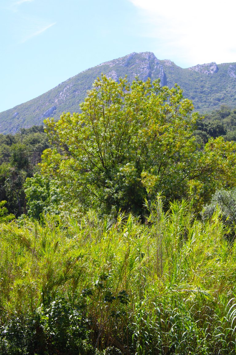
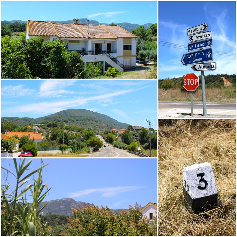
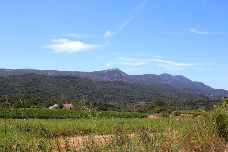
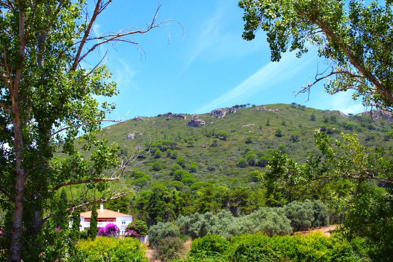
Here we reach the end of the small path of the village, and as a reference point we have this farm, here we already begin to walk on the road and even though we left the forest it is still a beautiful landscape because to our right we have the mountain range from the "arrabida", the destination where we are going, now we have to walk approximately 8km, be careful on the street always give way to cars to avoid accidents!🌳🌲🌎
Aqui llegamos al final del pequeno sendero de la aldea, y como punto de referencia tenemos esta quinta, aqui ya comenzamos a caminar en la carretera y apesar que nos salimos del bosque no deja de ser un hermoso paisaje porque a nuestra derecha tenemos la sierra montanosa de la "arrabida", destino hacia donde vamos, ahora tenemos que caminar unos 8km aproximadamente, cuidado en la calle siempre da paso a los carros para evitar accidentes!🧎🏻♂️👨🏻🦯
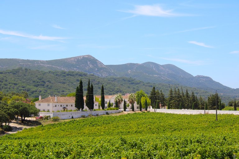
The grape village🧭🍇 /La aldea de las uvas🗺️
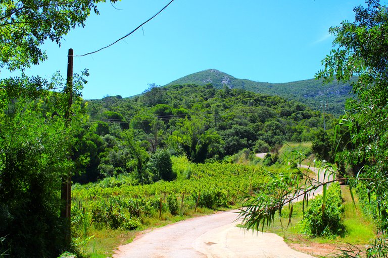
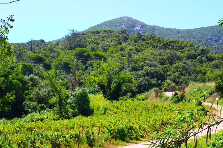
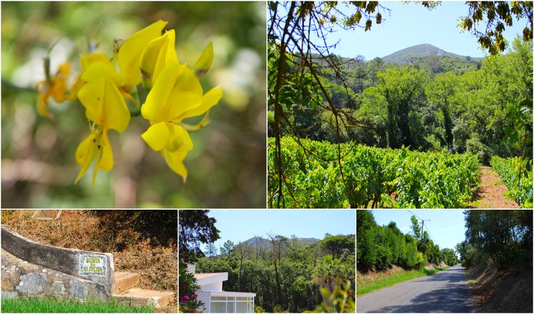

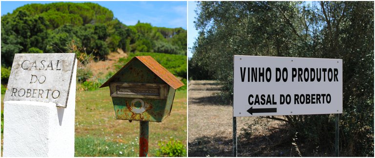
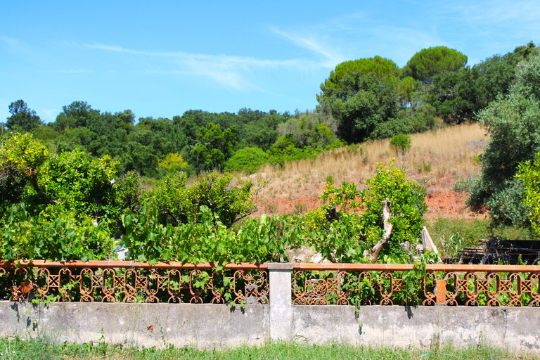
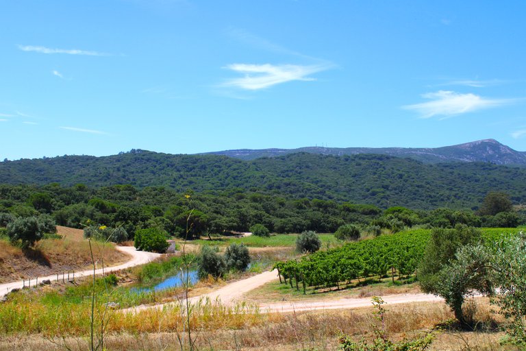
I loved this part of the trail on both sides of the road we see many farms that make local and commercial wines, or simply also for own use, clearly it is an example of how rich these lands are for planting and of course Setubal is known for that In addition to its beautiful beaches that I already showed you in other posts, by the way it is the first time that I am in this area.🌎🌲
Me encanto esta parte del sendero a ambos lados de la carretera vemos muchas quintas que fabrican vinos locales y comerciales, o simplemente tambien para uso propio, claramente es una muestra de lo rica que son estas tierras para la siembra y claro Setubal es conocida por eso ademas de sus lindas playas que en otros post ya te mostre, por cierto es primera vez que ando por esta zona.🍇🍇
Road N10🧭🚩 /Carretera N10🗺️

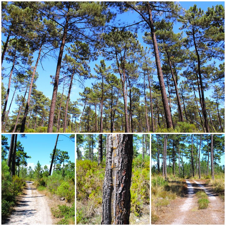
Currently we are going to travel a large section of the national highway 10 or known as (N10), this road has its great history and I will tell you about it now when we reach the Roman highway, for hundreds of years it served as a connection between Lisbon and the southern bank where We include the city of Setubal, Sesimbra, which largely passes through the protected mountain range and gives us the best landscapes. If I'm not mistaken, this same road takes you to the south of the country and the north is famous for that!🌳🍇⛲
Actualmente vamos a recorrer un gran tramo de la carretera nacional 10 o conocida como (N10), esta carretera tiene su gran historia y te la contare ahora cuando lleguemos a la carretera Romana, por cientos de anos sirvio como conexion entre Lisboa y margen sur donde incluimos la ciudad de Setubal, Sesimbra ella pasa en una gran parte por la sierra protegida y nos regala los mejores paisajes. Si no me equivoco esta misma carretera te lleva al sur del pais y al norte es famosa por eso!👨🏻🏫🚴🏻♂️
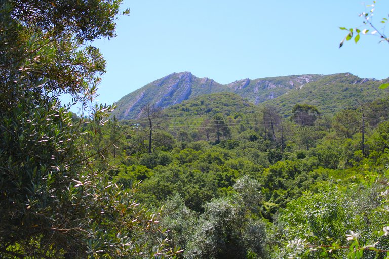
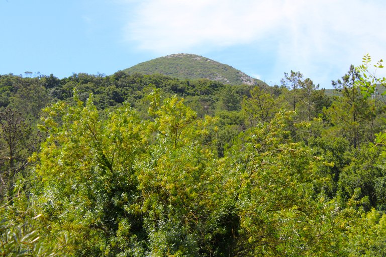
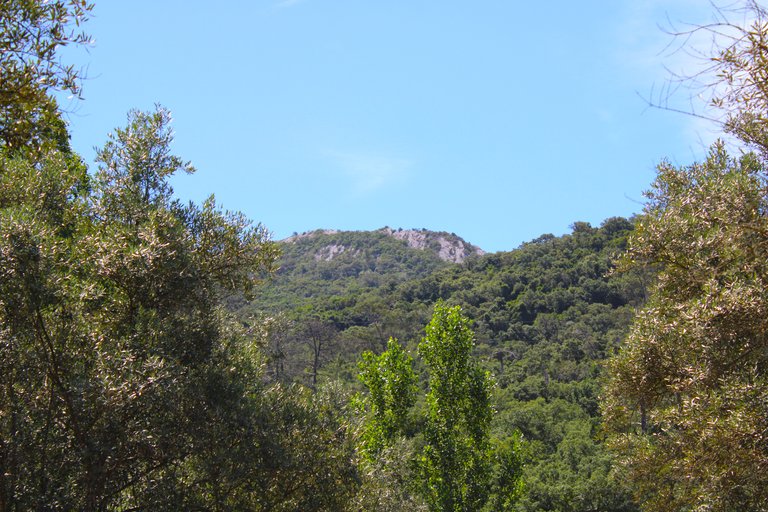
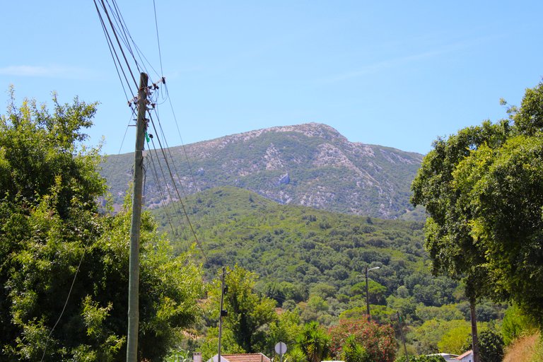
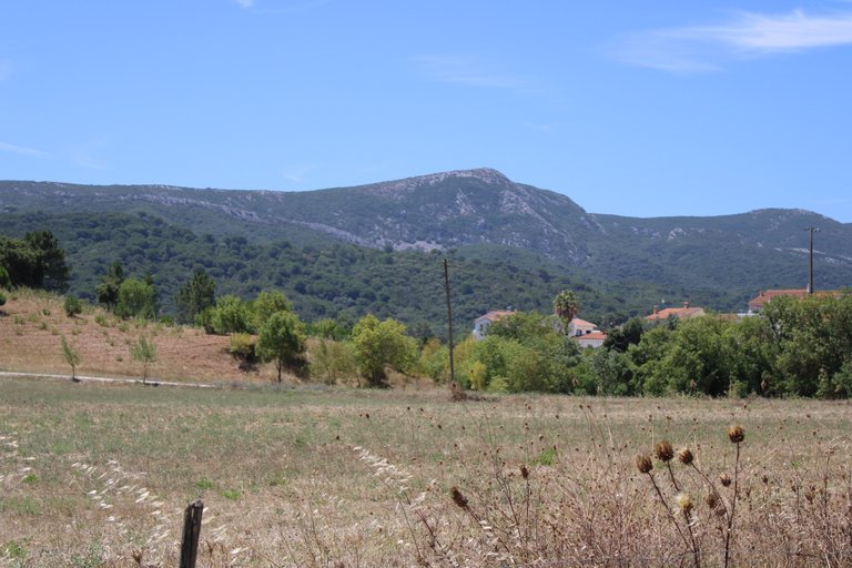
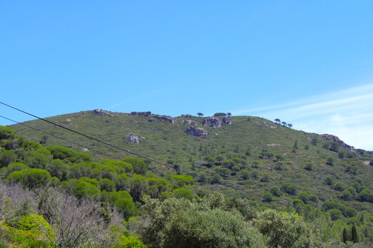
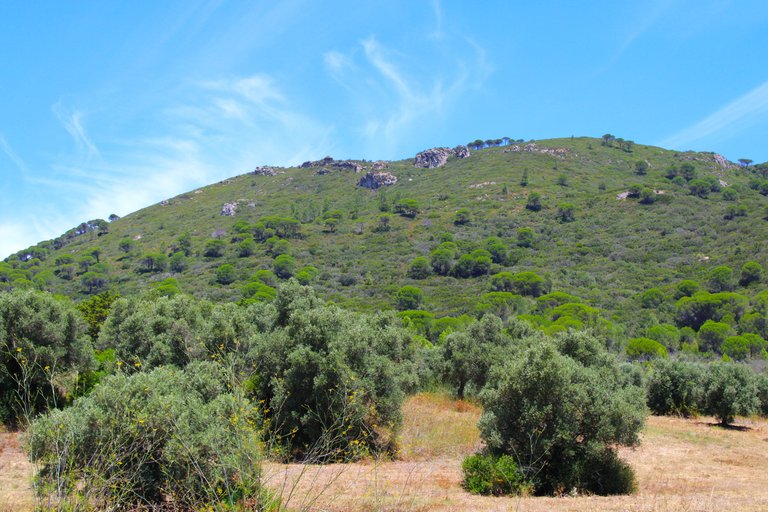
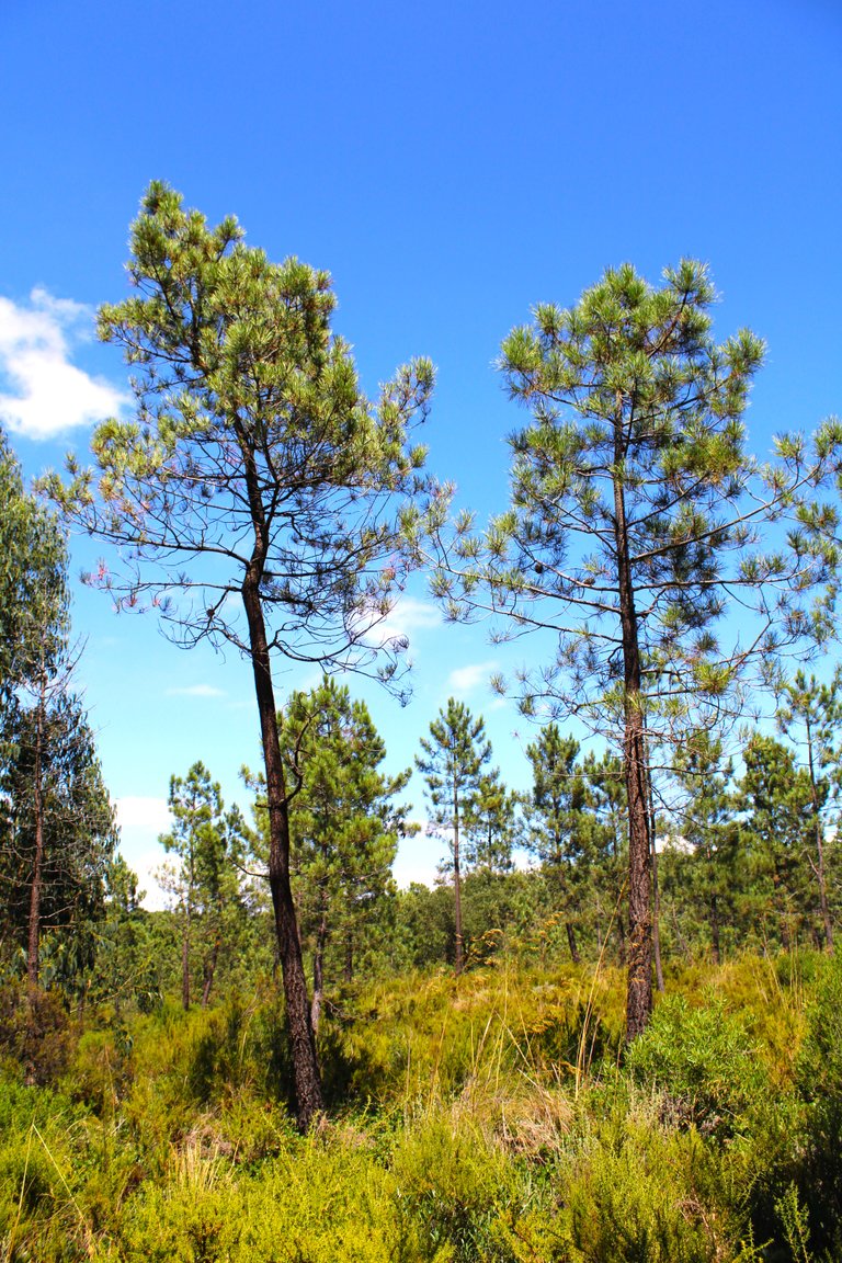
The mountain landscape🧭🚩 /El paisaje de la sierra🗺️
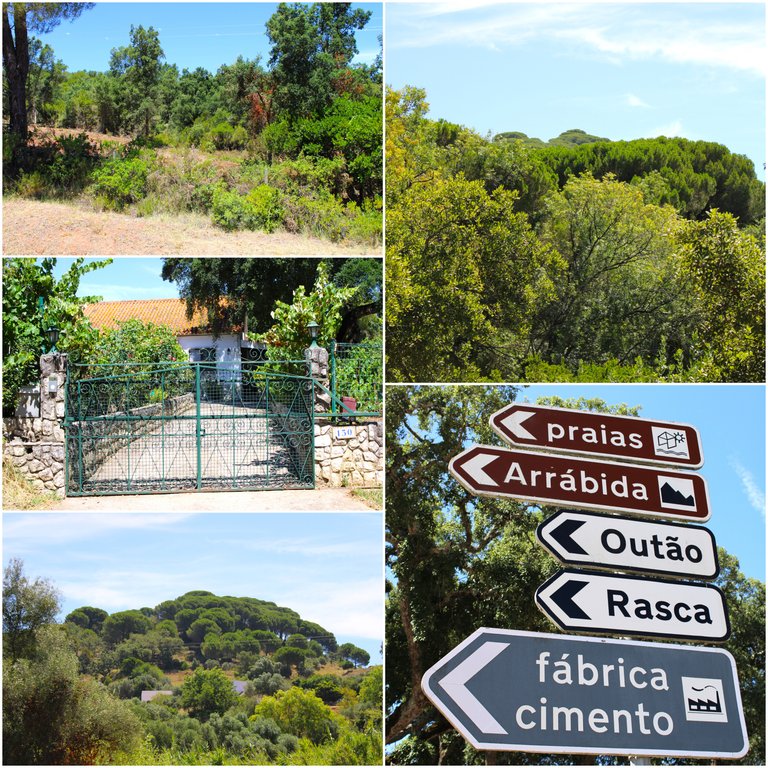
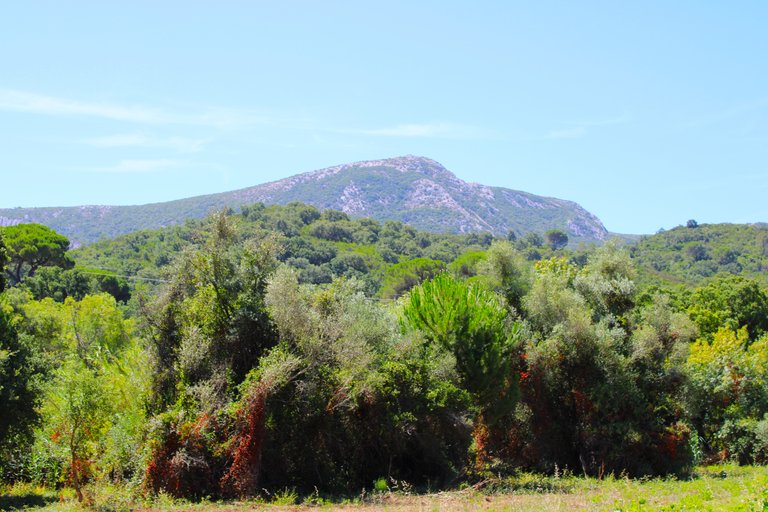
I have already traveled more than 4km and passed through several small, uninteresting villages, but nevertheless the incredible view, all of which have the mountains in the background, even though I haven't reached the beginning of the Roman road trail. One piece of advice is to bring plenty of water and snacks so that you don't pass by a store or supermarket in the 17km.👨🏻🏫🌎🌲
Ya recorri mas de 4km y pase por varias pequenas aldeas nada interesantes pero sin embargo la vista increible todas tienen de fondo las montanas, aun no llegue al inicio del sendero de la carretera romana. Un consejo trae mucha agua, y snaks porque no pase en los 17km por alguna tienda o supermercado.🚴🏻♂️⛲


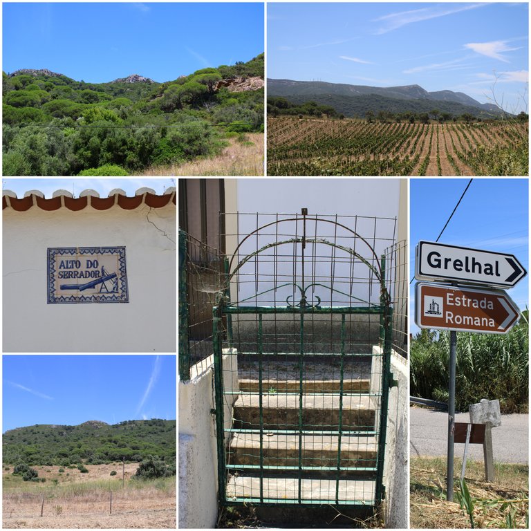
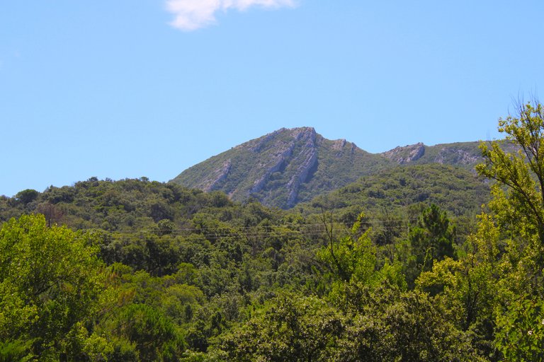
Grelhal Roman street🧭🚩 /Grelhal calle romana🗺️
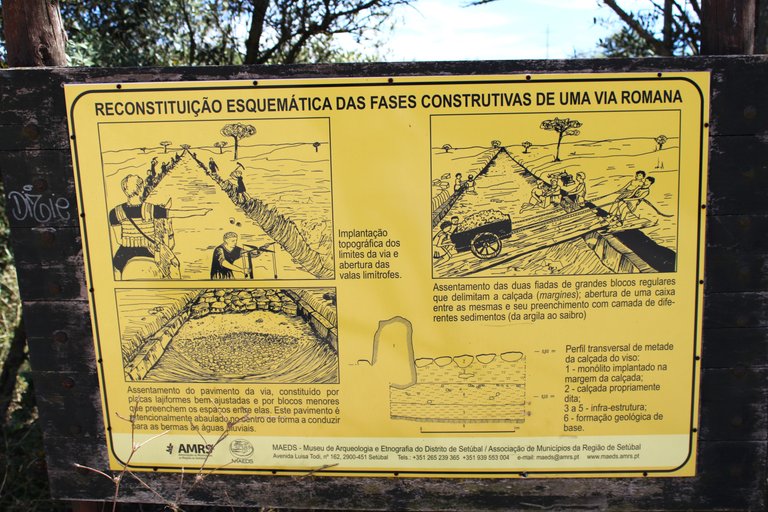
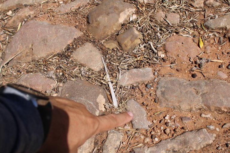
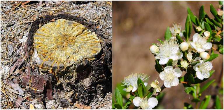
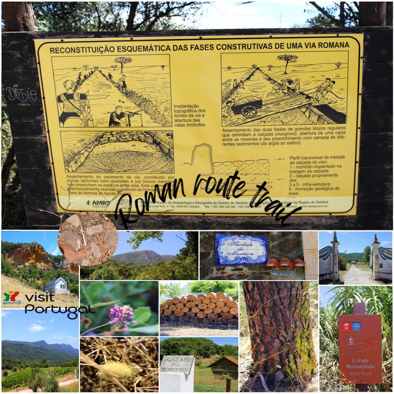
According to historians, the Romans probably arrived in the Setubal area in the 2nd century. They settled there for hundreds of years since Setubal was and still is rich in fishing resources. The Romans knew how to take advantage of the Salar process and look for other minerals such as bronze, it is believed that the constructions of these "roads" or in Portuguese: "causeways", were produced between the 4th to the 8th century, they made an important connection to be able to commercialize all the resources within Lucitania and even be able to bring them to the side of (Celtiberians) which would be modern-day Spain.🌎🚩
Segun los historiadores los Romanos llegaron probablemente en la zona de Setubal en el siglo II, alli se establecieron por cientos de anos ya que Setubal fue y aun es rica en recursos pesqueros, los Romanos supieron aprovechar el proceso de Salar y buscar otros minerales como el bronce, se creen que las construcciones de estas "carreteras" o en portugues: "calzadas", se producieron entre el IV hasta el siglo VIII, hicieron una importante conexion para poder comercializar todo los recursos dentro de Lucitania e inclusive poder llevarlos al lado de (Celtiberos) que seria Espana actual.🍷🍇🏺
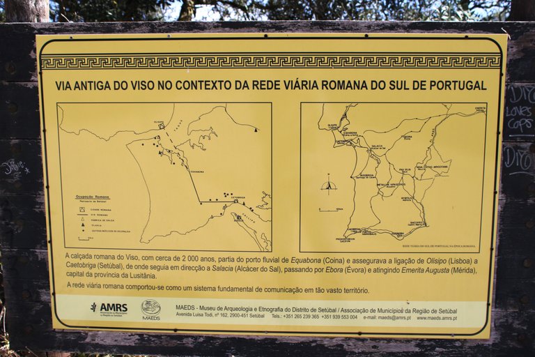
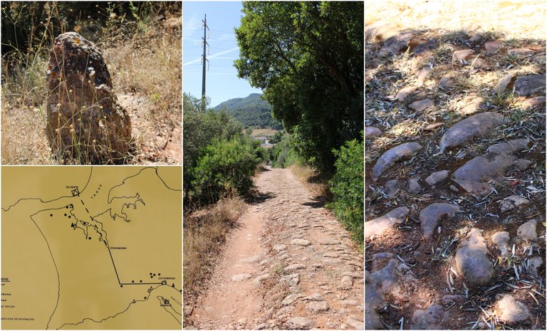
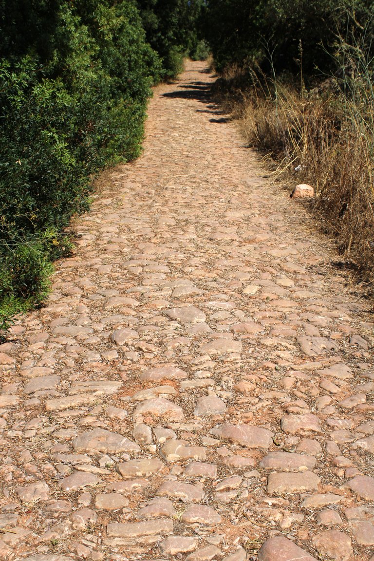
This road is 2,000 years old, whose Roman name is: "Viso", it started from "Equabona", current city of Coina, passed through "Olisipo", current Lisbon, and also connected with Caetrobiga, "current Setubal", where I am now! It was so extensive that it reaches all the way to Merida Spain! It was very important for the transportation and communication of the Romans.👨🏻🦯🧎🏻♂️
2mil anos tiene esta calzada, cuyo nombre Romano es: "Viso", comenzaba desde "Equabona" actual ciudad de Coina, pasaba por "Olisipo" actual Lisboa, y conectaba tambien con Caetrobiga "actual Setubal" donde estoy ahora! era tan extensa que llega hasta Merida Espana! fue muy importante para el transporte y comunicacion de los Romanos.🌎⛲
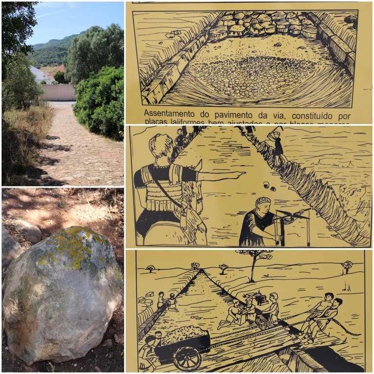
For the construction of the road, precise measurements were first made with instruments of the time, a fence was made that served as a boundary line! First the earth was dug until reaching the base geological formation, then an infrastructure was placed, a mixture of sand and stones, finally the monoliths that would serve as "asphalt" and a set of stones was placed on the sides that would be today "pavement".🌎🚩
Para la construccion de la calzada primero se hacian mediciones precisas con instrumentos de la epoca, se hacia una valla que servia como linea limitrofe! primero se cavaba la tierra hasta llegar a la formacion geologica base, luego se colocaba una infraestructura una mezcla de arenas, piedras, por ultimo los monolitos que servirian como "asfalto" y se colocaba un conjunto de piedras a los lados que seria hoy en dia "acera".👨🏻🏫🚴🏻♂️

DNA is an organization to foster and DENSIFY NATURE-APPRECIATION which aims to establish REPORTS OF BIODIVERSITY DATA that is contributed by all of us Hiveans and subsequently cataloged.
Therefore DNA searches for HIGH-QUALITY posts that aim to DESCRIBE and determine the BIODIVERSITY AROUND YOU with added EXPLANATIONS and INFORMATION. For these informative posts they offer a CURATION SERVICE using the @dna.org account. It is also a CURATION TRAIL. Just add the #dna TAG if you think that any of your posts is what they are looking for.
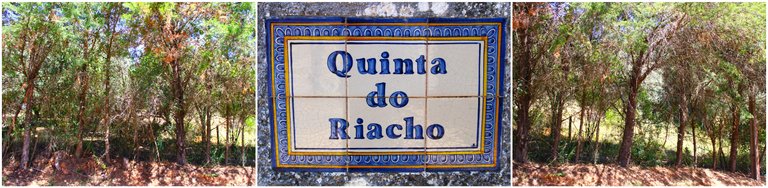
THANKS FOR READING ME (PHOTOS AND VIDEOS OF MY PROPERTY) / GRACIAS POR LEERME FOTOS Y VIDEOS DE MI PROPIEDAD🙂🧠🦾👍


Congratulations, your post has been added to WorldMapPin! 🎉
Did you know you have your own profile map?
And every post has their own map too!
Want to have your post on the map too?
😀 beautiful place
Congratulations @biologistbrito! You have completed the following achievement on the Hive blockchain And have been rewarded with New badge(s)
Your next target is to reach 90000 upvotes.
You can view your badges on your board and compare yourself to others in the Ranking
If you no longer want to receive notifications, reply to this comment with the word
STOPCheck out our last posts:
Hiya, @glecerioberto here, just swinging by to let you know that this post made it into our Top 3 in Travel Digest #2258.
Your post has been manually curated by the @worldmappin team. If you like what we're doing, please drop by to check out all the rest of today's great posts and consider supporting other authors like yourself and us so we can keep the project going!
Become part of our travel community: