Hello fellow travelers and adventurers! Today we travel more than 80km from Lisbon to the village "Sobral de Monte Agraço" and then make a detour by vehicle to one of the most important tourist sites of military interest in the area whose name is "Fort the Great" or in Portuguese : "Forte grande", is a quick adventure, without demanding walking and is dedicated to all ages. I love these visits because in addition to enjoying a beautiful landscape we also learn general culture.🌲🧭🌎
¡Hola compañeros de viaje y aventureros! Hoy recorremos más de 80km desde Lisboa hasta el pueblo "Sobral de Monte Agraço" para luego desviarnos en vehículo hacia uno de los sitios turísticos de interés militar más importantes de la zona cuyo nombre es "Fuerte el Grande" o en portugués: "Forte grande", es una aventura rápida, sin exigencias de caminata y está dedicada a todas las edades. Me encantan estas visitas porque además de disfrutar de un hermoso paisaje también aprendemos cultura general.🌎🚩🧭
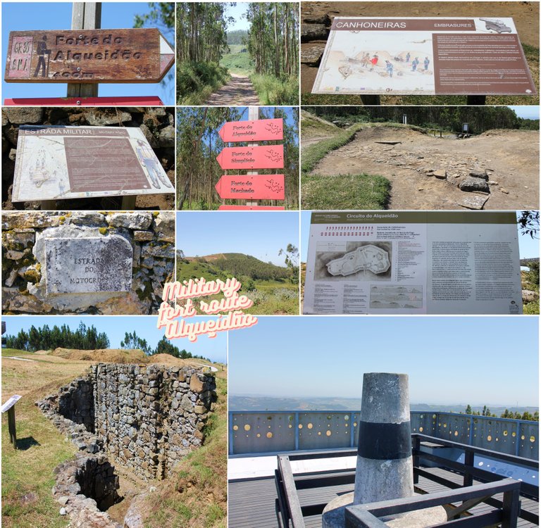
Where do we locate the military fort?🧭🌍🚩


Getting to the military fort "Alqueidão" is very easy, we can do it on foot or by car, public transportation in the area is too complicated so if you come try to do it with a rented vehicle, the coordinates of the place are as follows: (38° 59′ 14″ N, 9° 09′ 04″ W) as you see in my cover photo there is a trail that visits the fort so you can also do that route and you will pass through here! In terms of clothing, I recommend fresh clothing in summer and plenty of water because the area is too hot, bring hiking boots and walking sticks since if you decide to do the trail there are dangerous sections of the route and even more so if you come on rainy days.🚙🌍
Llegar al fuerte militar "Alqueidão" es muy fácil, podemos hacerlo a pie o en coche, el transporte público en la zona es demasiado complicado así que si vienes intenta hacerlo con un vehículo alquilado, las coordenadas del lugar son las siguientes: sigue: (38° 59′ 14″ N, 9° 09′ 04″ W) como ves en mi foto de portada hay un sendero que visita el fuerte así que también puedes hacer esa ruta y pasarás por aquí! En cuanto a la ropa, recomiendo ropa fresca en verano y mucha agua porque la zona es demasiado calurosa, llevar botas de montaña y bastones ya que si decides hacer el sendero hay tramos peligrosos del recorrido y más si vienes. en días lluviosos.🚙🚩

Walk to the fort🧭🌍🚩


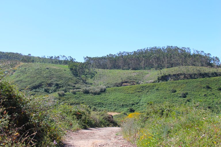
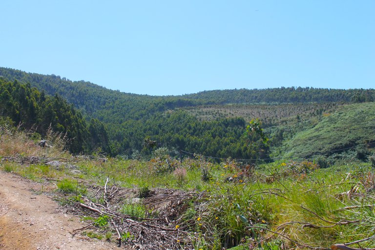
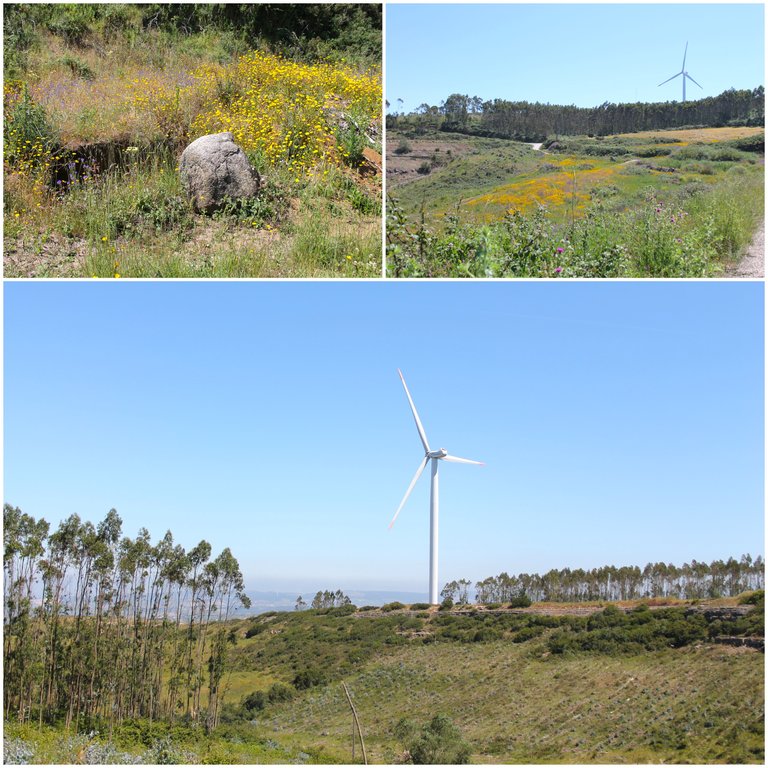
Our walk begins on "motocross" street and its name is a symbol of a track that can be traveled by motorcycle, however it is also designed for walking, at the beginning of the walk it is demanding and there are only climbs, in the end we are going to climb about 150 meters in height, the rest of the route will be in straight and descending lines, from the top of the hill we have beautiful 360 degree views of several villages that are hundreds of km away, remember that the military forts were almost always Built in very high places to increase vision capacity.🌲🌎
Nuestra caminata comienza en la calle "motocross" y su nombre es símbolo de una pista que se puede recorrer en moto, sin embargo también está diseñada para caminar, al inicio de la caminata es exigente y solo hay subidas, al final vamos a subir unos 150 metros de altura, el resto del recorrido será en lineas rectas y descendentes, desde lo alto del cerro tenemos hermosas vistas de 360 grados de varios pueblos que se encuentran a cientos de km, recuerda que los militares Los fuertes casi siempre se construyeron en lugares muy altos para aumentar la capacidad de visión.🚙🌎


The landscape is common in Portugal, normally the tall tree that predominates is the pine but due to the constant fires in summer they have been replaced by the eucalyptus which has a faster growth rate. On this walk we will pass through several paths full of Eucalyptus trees that allow us to protect ourselves from the sun, which by the way was quite intense today! I would say that from the starting point to arriving it is about 40 minutes, approximately 2km!🌍🚙
El paisaje es común en Portugal, normalmente el árbol alto que predomina es el pino pero debido a los constantes incendios en verano han sido reemplazados por el eucalipto que tiene un ritmo de crecimiento más rápido. En esta caminata pasaremos por varios senderos llenos de Eucaliptos que nos permiten protegernos del sol, que por cierto estuvo bastante intenso hoy! Yo diría que desde el punto de partida hasta llegar son unos 40 minutos, ¡aproximadamente 2km!🚙🧭
Landscape from the viewpoint🧭🌍🚩
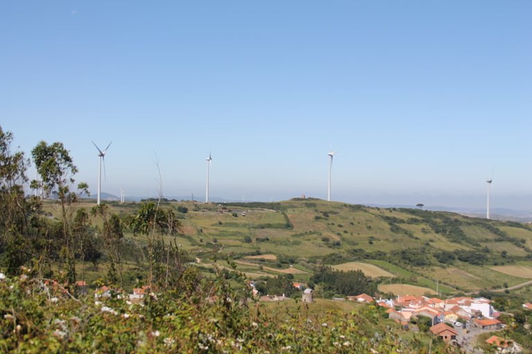


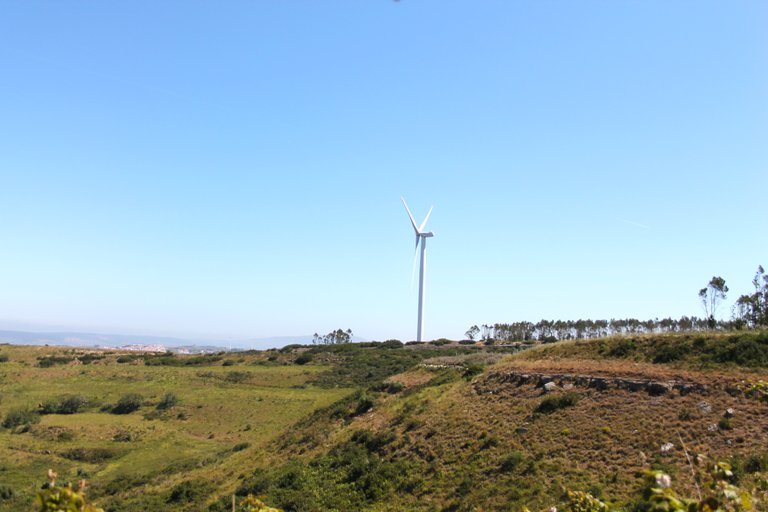
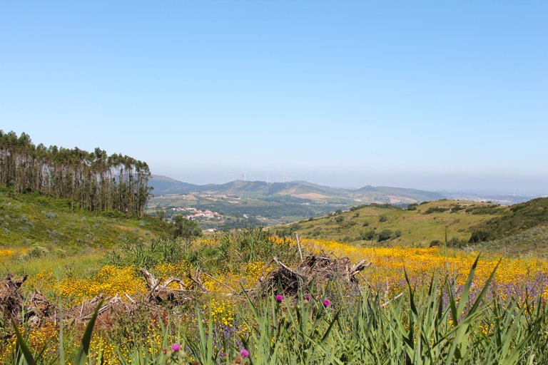
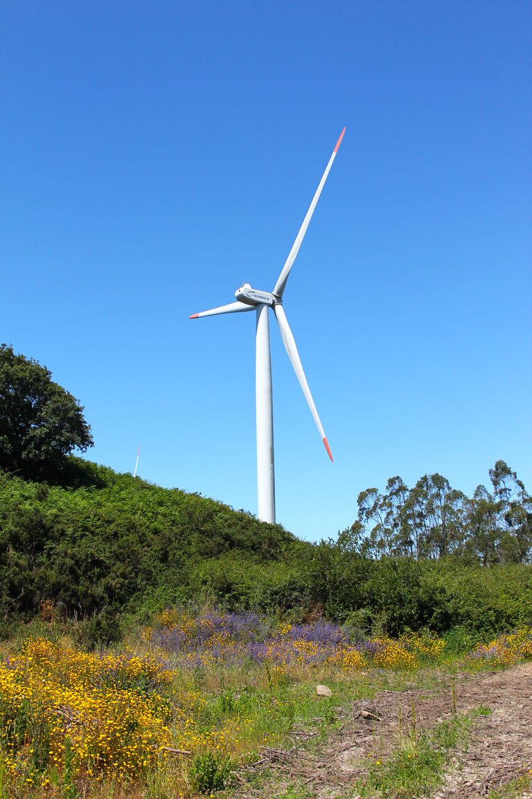
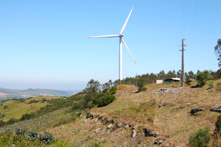
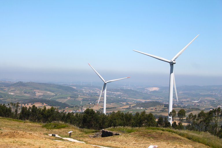
This is one of my favorite parts of the trail, it is when we reach the top of the hill at almost 200 meters high, although unlike sea level it must be much higher, from here we see several towns and villages in a field of vision of 180 degrees, here at this altitude the breeze is intense and the atmosphere much cooler, at this point I would say that we are 1.5km from our final destination, so far the experience has been quite interesting and as you can see in the background you can see some pretty old windmills!🌎🌲
esta es una de mis partes preferidas en el sendero, es cuando llegamos al tope de la colina a casi 200 metros de altura, aunque en diferencia del nivel del mar debe ser mucho mas, desde aqui vemos varios pueblos y aldeas en un campo de vision de 180 grados, aqui a esta altura la brisa es intensa y el ambiente mucho mas fresco, en este punto diria que estamos a 1.5km de nuestro destino final, hasta ahora la experiencia ha sido bastante interesante y como puedes ver en el fondo se ven algunos molinos de viento bastante antiguos!🚩🏡
Most beautiful landscapes🧭🌍🚩


rock formation in the area🌎🚩
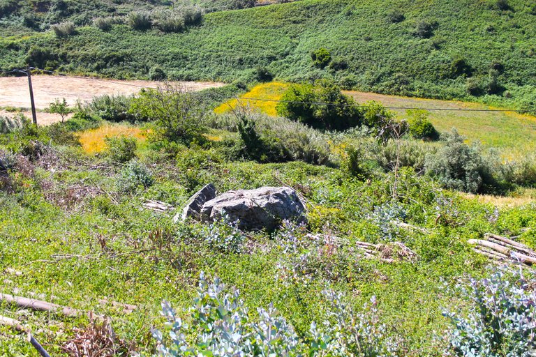
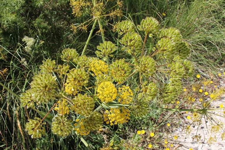
Something interesting to note is the typical Mediterranean landscape, at this point we are still in spring, very close to summer and we can come across some light rains, this makes the local flora and fauna still green and colorful, we can see many insects and flowers, around here if we are lucky we see some wild orchids.🧭🌏
algo interesante para denotar es el paisaje tipico mediterranico, a esta altura aun estamos en primavera muy cerca de verano y nos podemos topar con una que otras lluvias leves, esto hace que la flaura y la flora local este aun verde y colorida podemos ver muchos insectos y flores, por aqui si tenemos suerte vemos algunas orquideas silvestres.🌎🌷🌼🌻

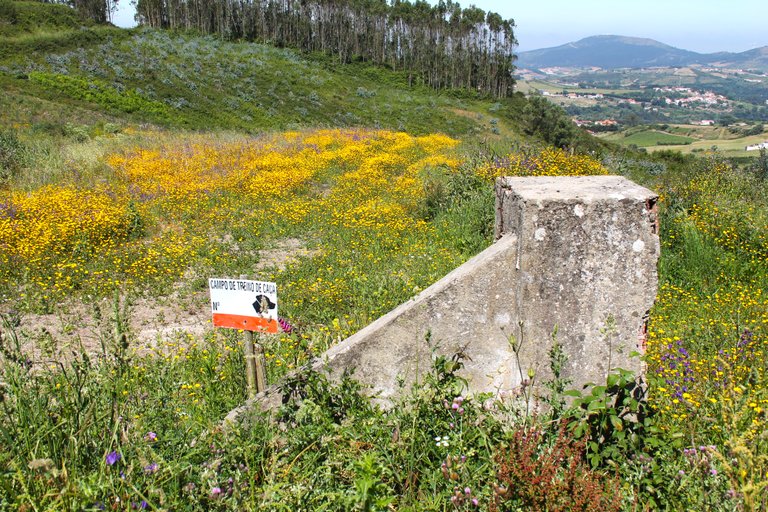


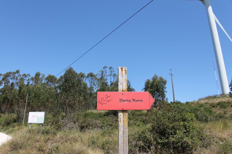
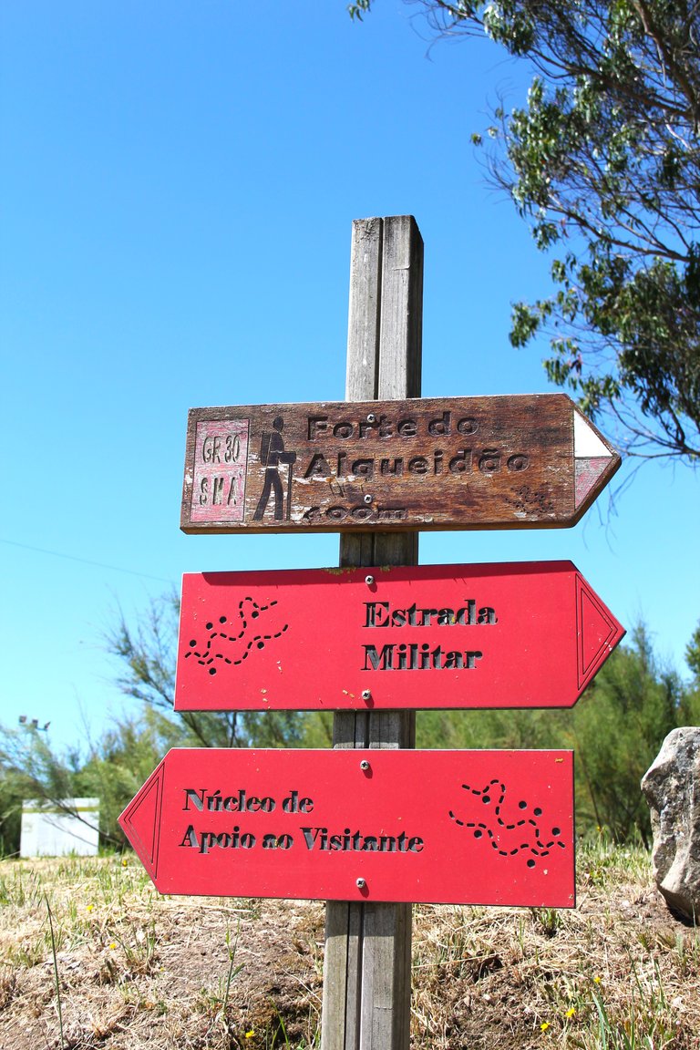
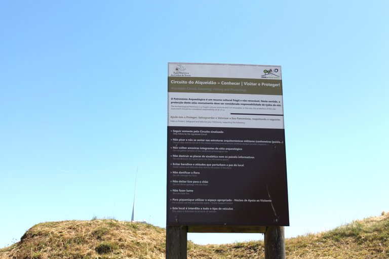
As you can see here we come across a series of signs that are actually trails, each one takes us to a different military fort! I mean, if you want to visit them all in one day, you will probably spend more than 18 hours walking since there are more than 30, the signs are practical because they help us not to get lost!🌲🚙
Como puedes ver aqui nos topamos con una serie de letreros que en realidad son senderos, cada uno nos lleva a un fuerte militar diferente! osea si en un dia quieres visitarlo todos posiblemente pasaras mas de 18h caminando ya que son mas de 30, los letreros son practicos porque nos ayudan a que no nos perdamos!🌎🧭
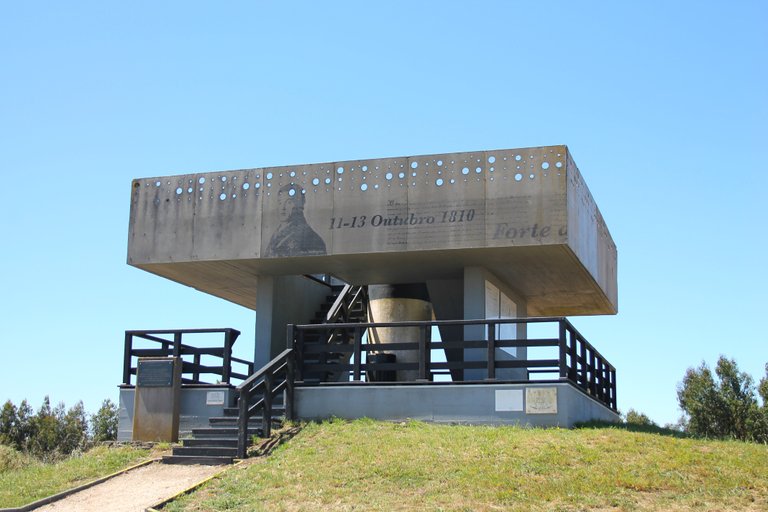
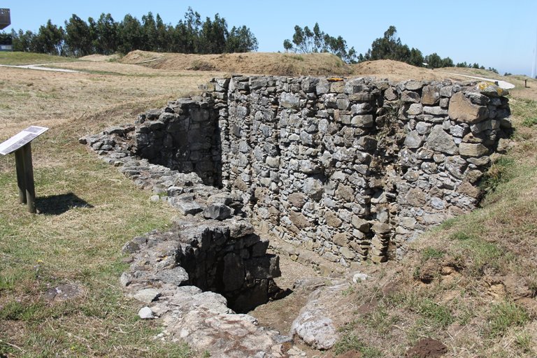
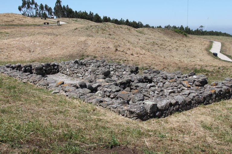
"Novo" military fort🧭🌍🚩
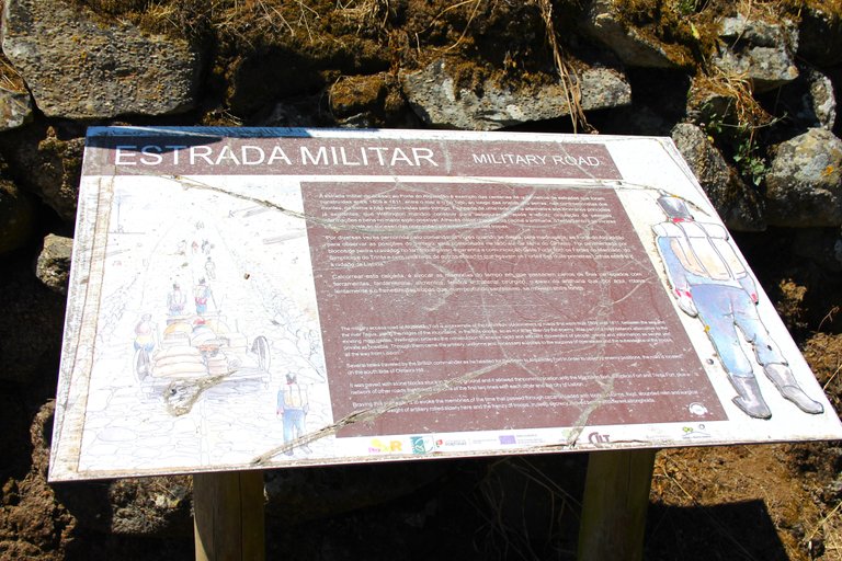
When we finally arrived at our final destination we came across this military street built in the year 1809, quite old and it was also built together with the fort since this area was where supplies were taken to the fort which is 800 meters up the hill. , it was important that the street be a stone road because heavy things would have been buried in common sand in the rain, food, war material, cannons, oxen passed through here.🌎🚩
cuando llegamos por fin a nuestro destino final nos topamos con esta calle militar construida en el ano 1809 bastante antigua y fue construida tambien junto con el fuerte ya que por esta zona era que se llevaban suministros al fuerte que esta a 800 metros arriba de la colina, era importante que la calle sea una calzada de piedra porque en arena comun en lluvia se hubiesen enterrado cosas pesadas, por aqui pasaba alimento, material de guerra, canones, bueyes.🌻🌲
https://pt.wikipedia.org/wiki/Forte_do_Alqueid%C3%A3o
What is the second defensive line?🧭🌍🚩

This is when we immerse ourselves in the history of Portugal, during the 18th century the Portuguese territory with the British allies created a defensive line of three divisions called: "defensive line towers" this defensive line was located 80km in the north of Portugal and constituted a fortification of more than 150 military forts with a minimum of 4 cannons each, the fort where I am heading is on the second defensive line.🚩🌎
aqui es cuando nos sumergimos en la historia de Portugal, durante el siglo XVIII el territorio Portugues con los aliados britanicos crearon una linea defensiva de tres divisiones llamada: "linea defensiva torres" esta linea defensiva estaba hubicada a partir de 80km en el norte de Portugal y constituyo a una fortifiacion de mas de 150 fuertes militares con un mino de 4 canones cada uno, el fuerte hacia donde me dirijo esta en la segunda linea defensiva.🧭🌍


History of the fort🧭🌍🚩


Commander Wellington was in charge of commanding the Portuguese-British troops during the era of the Napoleonic invasion, in total the defensive line had 152 military forts arranged in a straight line to the border of Spain! In total within the municipality there were 8 forts, this one in particular is in the mountain range of "Monte Agraço", it was in 1807-1814 when the great Napoleon in complicity with Spain allowed the entry of the French army into Portuguese territory but this decision would make Napoleon You would pay dearly for trying to invade a country that the Spanish never could for hundreds of years of history! and what is not told in history is that Napoleon withdrew from Portugal with a crushing defeat and there was no need for him to pass through the third defensive line!🌎🚩
el comandante Wellington fue quien estuvo a cargo de comandar las tropas lusos-britanicas durante la era de la invasion napoleonica, en total la linea defensiva conto con 152 fuertes militares dispuestos en linea recta hasta la frontera de espana! en total dentro del municipio habian 8 fuertes, este en particular esta en la sierra de "Monte Agraço", fue en 1807-1814 cuando el gran Napoleon en complicidad con Espana permitieron la entrada del ejercito frances al territorio Portugues pero esta decision haria que Napoleon pagase muy caro el intentar invadir un pais que los Espanoles nunca pudieron por cientos de anos de historia! y lo que no se cuenta en la historia es que Napoleon se retiro de Portugal con una aplastante derrota y no hubo ni necesidad de que el pasase por la tercera linea defensiva!💂🏻♀️💂🏻♂️
https://pt.wikipedia.org/wiki/Forte_do_Alqueid%C3%A3o


DNA is an organization to foster and DENSIFY NATURE-APPRECIATION which aims to establish REPORTS OF BIODIVERSITY DATA that is contributed by all of us Hiveans and subsequently cataloged.
Therefore DNA searches for HIGH-QUALITY posts that aim to DESCRIBE and determine the BIODIVERSITY AROUND YOU with added EXPLANATIONS and INFORMATION. For these informative posts they offer a CURATION SERVICE using the @dna.org account. It is also a CURATION TRAIL. Just add the #dna TAG if you think that any of your posts is what they are looking for.
THANKS FOR READING ME (PHOTOS AND VIDEOS OF MY PROPERTY) / GRACIAS POR LEERME FOTOS Y VIDEOS DE MI PROPIEDAD🙂🧠🦾👍
Congratulations, your post has been added to the TravelFeed Map! 🎉🥳🌴
Did you know you have your own profile map?
And every post has their own map too!
Want to have your post on the map too?
- Go to TravelFeed Map
- Click the create pin button
- Drag the marker to where your post should be. Zoom in if needed or use the search bar (top right).
- Copy and paste the generated code in your post (any Hive frontend)
- Or login with Hive Keychain or Hivesigner and click "create post" to post to Hive directly from TravelFeed
- Congrats, your post is now on the map!
PS: You received this comment because you used the Pinmapple code snippet. Pinmapple is closing down and we are continuing Pinmapple's legacy. You can also import your previous Pinmapple posts to the TravelFeed map.Opt Out
Congratulations, your post has been added to Pinmapple! 🎉🥳🍍
Did you know you have your own profile map?
And every post has their own map too!
Want to have your post on the map too?
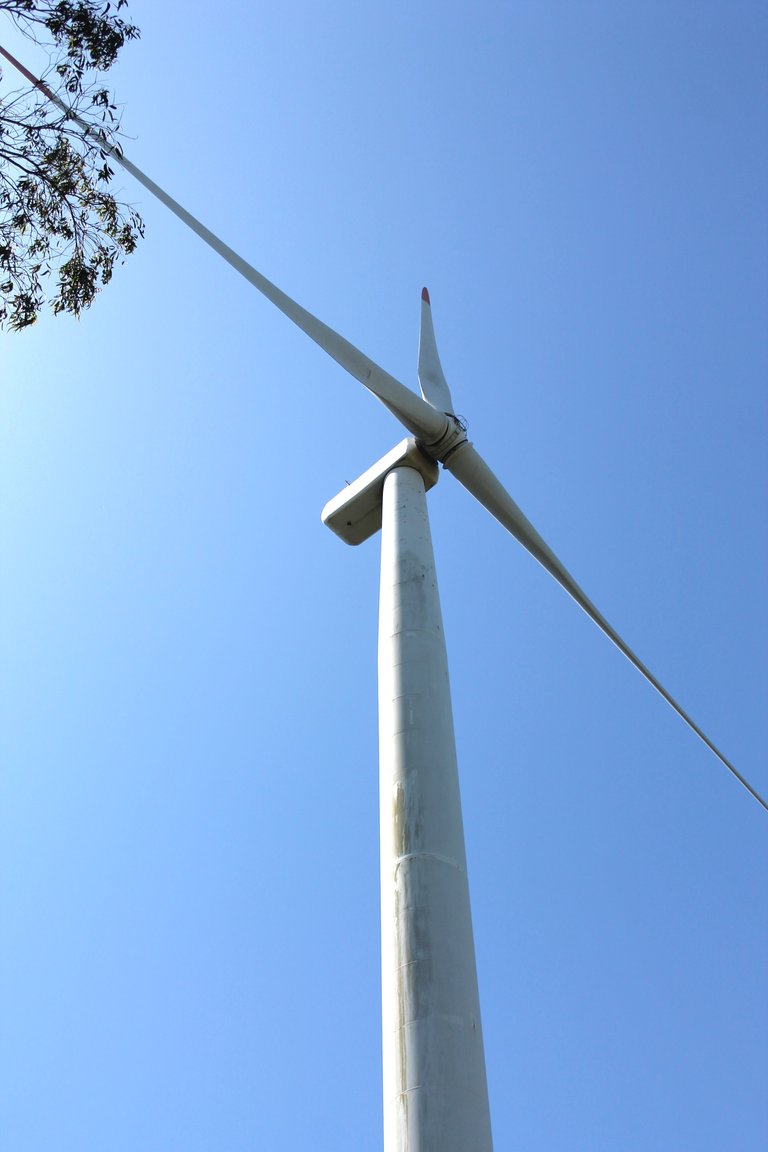
Keep the drone at distance from those windmills!
It's a military area hehe I couldn't pilot
Thanks for your contribution to the STEMsocial community. Feel free to join us on discord to get to know the rest of us!
Please consider delegating to the @stemsocial account (85% of the curation rewards are returned).
You may also include @stemsocial as a beneficiary of the rewards of this post to get a stronger support.
Congratulations, your post has been added to WorldMapPin! 🎉
Did you know you have your own profile map?
And every post has their own map too!
Want to have your post on the map too?
Congratulations @biologistbrito! You received the biggest smile and some love from TravelFeed! Keep up the amazing blog. 😍 Your post was also chosen as top pick of the day and is now featured on the TravelFeed front page.
Thanks for using TravelFeed!
@for91days (TravelFeed team)
PS: Have you joined our Discord yet? This is where over 1000 members of the TravelFeed come together to chat. Join us!