Hello adventurous friends! Today I bring you a new hike, we are in one of the mountains of the "Arrabida" to do a new trail (not official) which is called "fio dental", the translation into English is (dental floss) and I am quite curious about its name and of course when you start to do it you notice that the path is quite rudimentary and too narrow which supposes the reason for the name, we are going to enjoy in this experience the nature of the southern margin of Lisbon and the mountains of "setubal" and "palmela", as well as photograph the best landscapes that Portugal has to offer us.⛰️🌎
Hola amigos aventureros! hoy les traigo una nueva caminata, estamos en una de las montanas de la "Arrabida" para realizar un nuevo sendero (no oficial) el cual lleva como nombre "fio dental", la traduccion al ingles es (hilo dental) y me da bastante curiosidad su nombre y claro cuando comienzas a realizarlo observas que el camino es bastante rudimentario y demasiado angosto lo que supone del porque el nombre, vamos a disfrutar en esta experiencia de la naturaleza del margen sur de Lisboa y las montanas de "setubal" y "palmela", asi como fotografiar los mejores paisajes que Portugal tiene para ofrecernos.🚵🏻♀️🚙
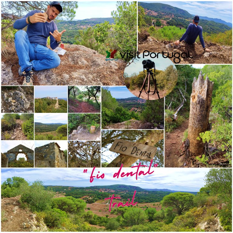
Description of the trail🚙⛰️ /Descripcion del sendero🌎🚩
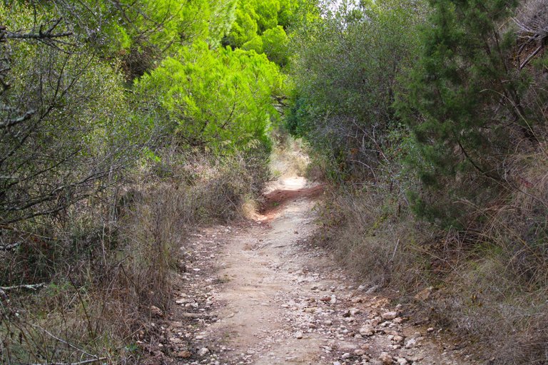
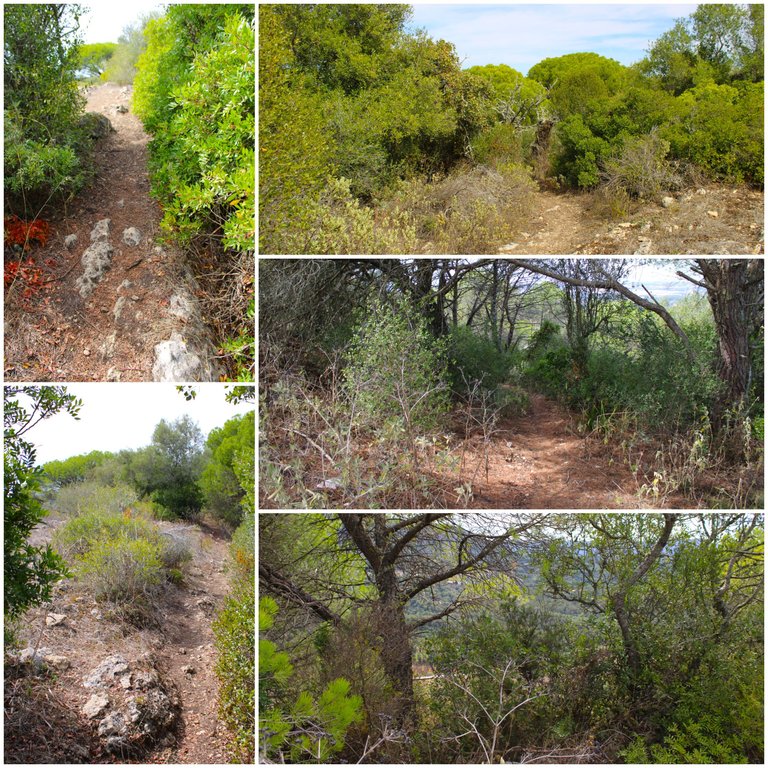
Taking advantage of the last hot days of this summer I did this trail for the first time, the trail is not official which means that there are no signs to guide you where you have to go, therefore it is likely that if you do not use Gmaps you will end up getting lost or going around in circles, normally unauthorized trails are not very safe and are for people with hiking experience, if you are careful on the paths that are narrow and you try not to slip using the sticks you will probably have a good time, there is nothing dangerous here! I do not recommend it for children or elderly people! Be very careful on rainy days, I do not recommend it either.🚵🏻♀️🌎
Aprovechando los ultimos dias calurosos de este verano realice este sendero por primera vez, el sendero no es oficial lo que significa que no hay letreros que te guien hacia donde tienes que ir, por tanto es probable que si no usas Gmaps te acabes por perder o dar vueltas en circulo, normalmente los senderos no autorizados no son muy seguro y son para persona con experiencia en senderismo, si tienes cuidado por los caminos que son angostos y tratas de no resbalarte usando los bastones probablemente la pases bien, no hay nada peligroso aqui! no lo recomiendo para ninos o personas mayores! muchisimo cuidado en dias lluviosos tampoco te recomiendo.⛰️🚩

For nature lovers🚙⛰️ /Para los amantes de la naturaleza🌎🚩
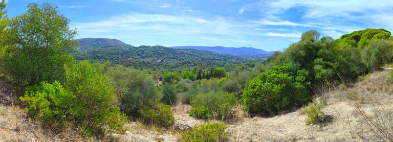
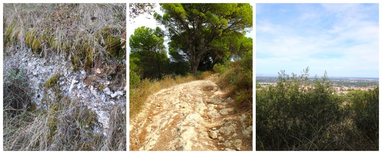
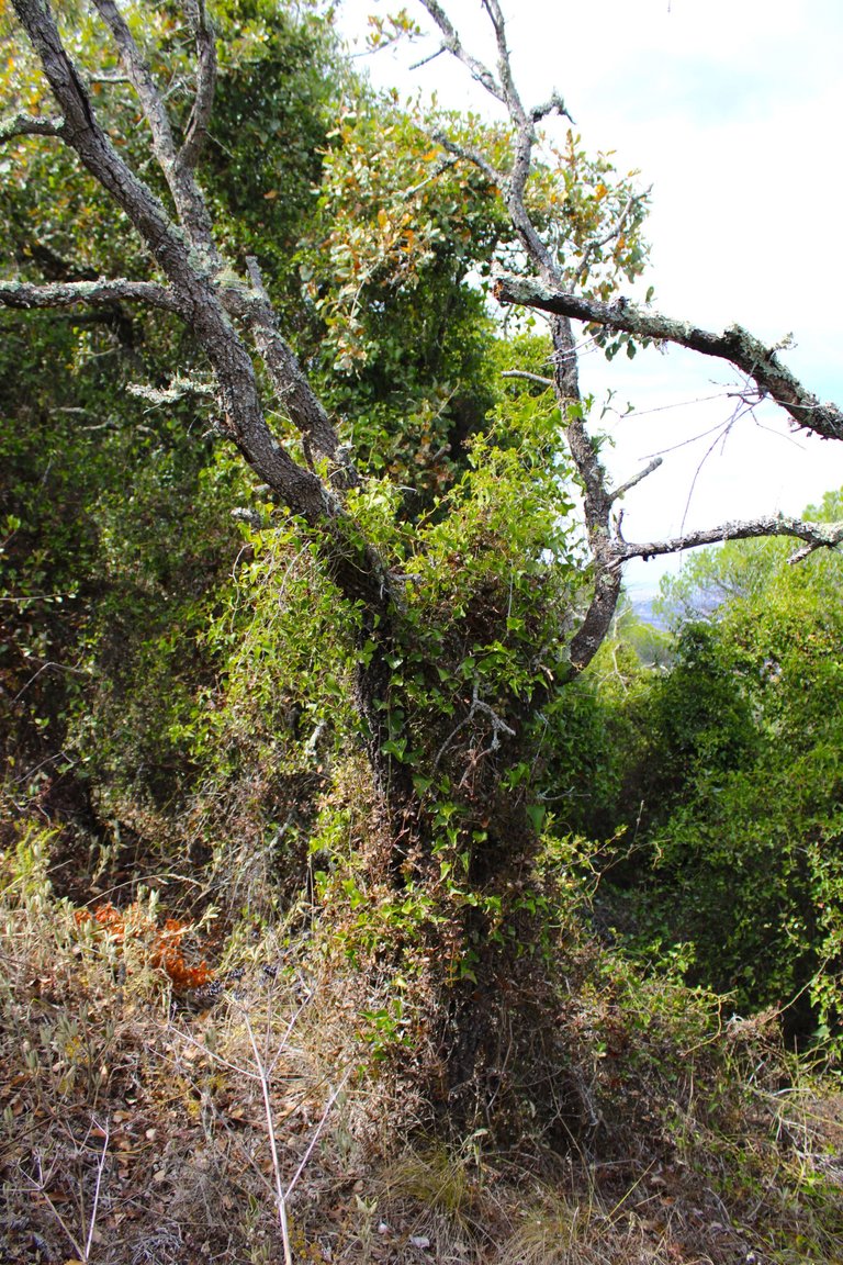
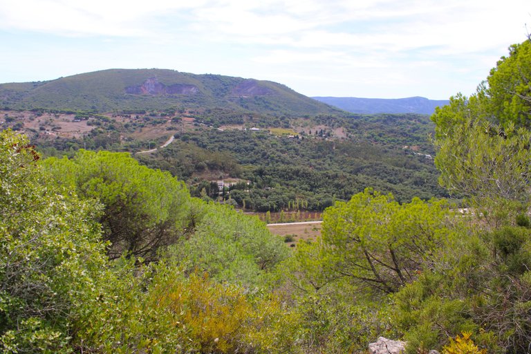
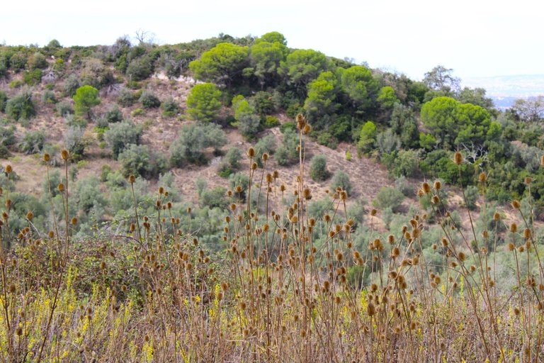
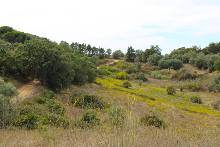
Unlike my last adventure, this trail is super rustic, wild and natural. There are no tourist attractions or historical points of interest to visit! However, it doesn't matter, the landscape is fantastic and worth it. Initially, we will climb a mountain for about 5-8 km and reach a height of 320 meters. The ecology of the mountain is typical of a Mediterranean forest. Later, we will enter a dense forest.🚵🏻♀️🌎
A diferencia de mi aventura pasada este sendero es super rustico, salvaje y natural no hay atracciones turisticas o algun punto de interes historico para conocer! sin embargo no importa el paisaje es fantastico vale la pena, inicialmente vamos a subir una montana unos 5-8km llegaremos a una altura de 320 metros, la ecologia de la montana es la tipica de un bosque mediterranico, posteriormente entraremos en un bosque denso.⛰️🚙
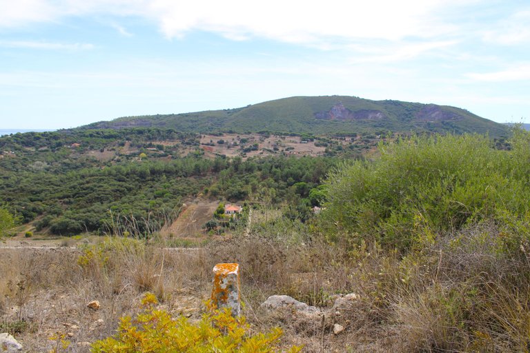
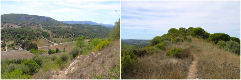
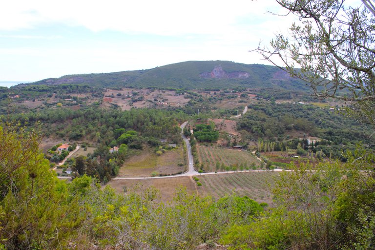
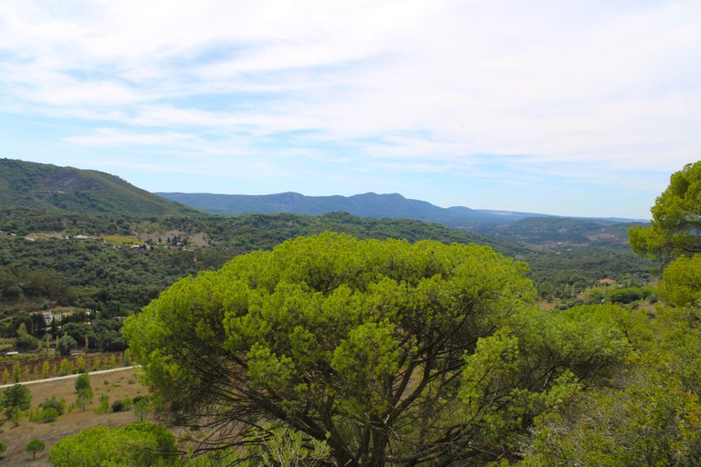
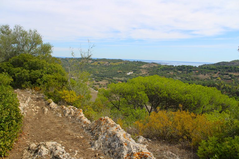
I am at the highest point of the mountain, we have already reached 395 meters and in the distance we can enjoy other mountain ranges of the Arrabida, this area is an area of ecological protection due to its great biodiversity and history! This is interesting because everything we will see is intact and has never been manipulated by people, the only thing are the paths left on the ground by the people who pass by regularly.🌎🚵🏻♀️
Estoy en el punto mas alto de la montana, ya alcanzamos los 395 metros a lo lejos podemos disfrutar de otras sierras de la arrabida, esta zona es una area de proteccion ecologica debido a su gran biodiversidad e historia! eso es interesante porque todo lo que iremos viendo esta intacto y nunca fue manipulado por las personas, lo unico son los caminos que quedan en el suelo por la gente que pasa regularmente.🚩⛰️
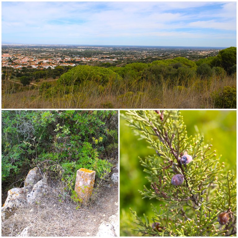
"Fio Dental" peak viewpoint🚙⛰️ /Mirador pico "fio dental"🌎🚩
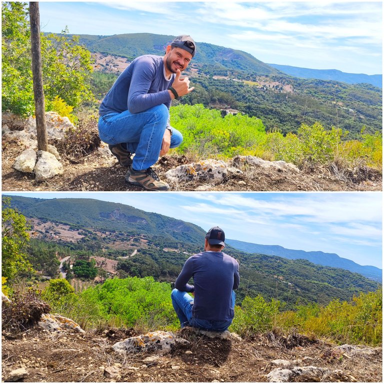
A minute of rest⛲🚩
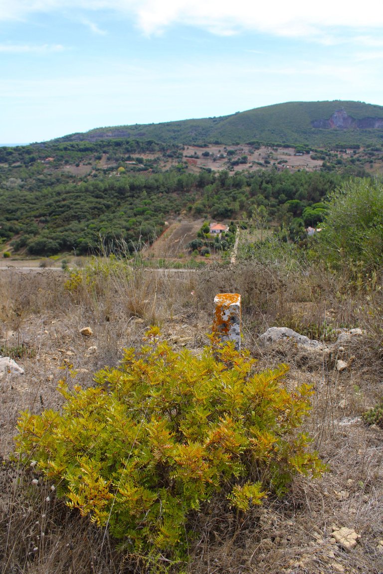
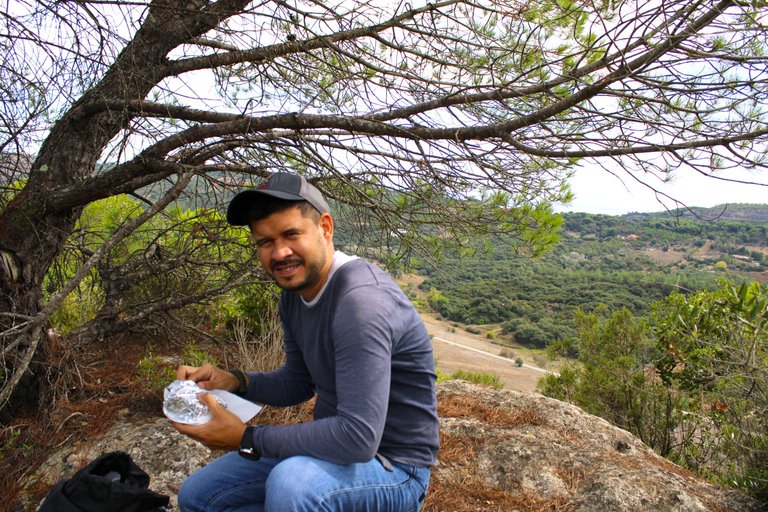
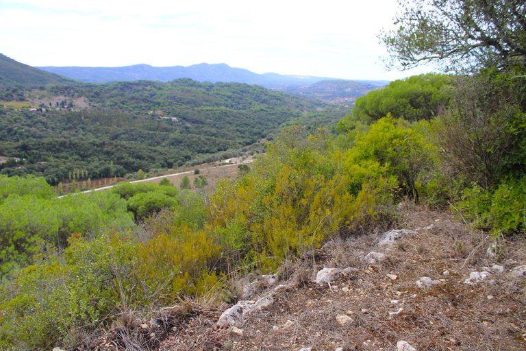
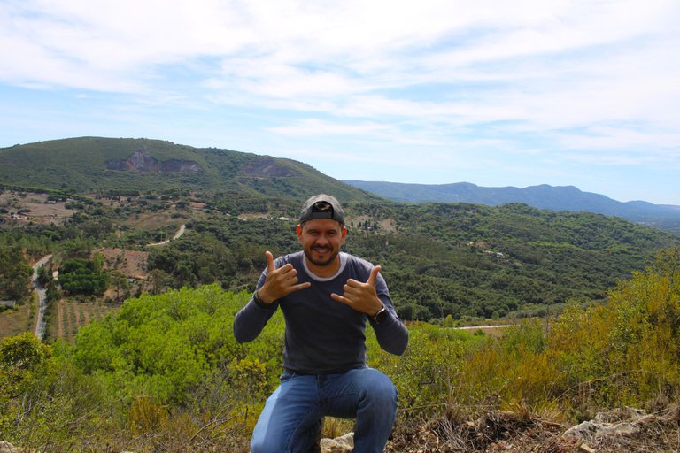
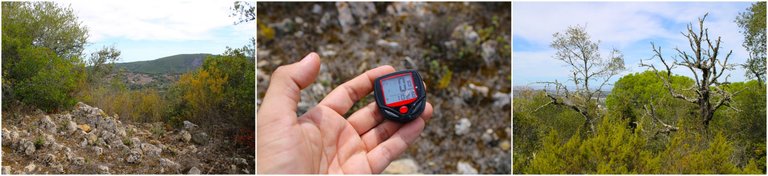
After about three kilometers of walking I decided to take a break to rest a little and hydrate myself, of course it was better to do it on the edge of the mountain enjoying one of the best views of the area, for me these moments are of peace and with them I release all the stress of my daily life, the trail in total is about 12km which we can go interspersing other trails to extend our walk, we could end in the city of Palmela or in the Arrabida which is Setubal it is your choice.🧭📸
Luego de unos tres kilometros de caminata decidi hacer una pausa para descansar un poco e hidratarme, claro que mejor haciendolo en el borde de la montana disfrutando de una de las mejores vistas de la zona, para mi estos momentos son de paz y con ellos liberto todo el estress de mi dia a dia, el sendero en total tiene unos 12km los cuales podemos ir intercalando otros senderos para extender nuestra caminata, podriamos terminar en la ciudad de Palmela o en la Arrabida que es setubal es tu eleccion.⛲
A little energy and continue🚙⛰️ /Un poco de energia y a continuar🌎🚩
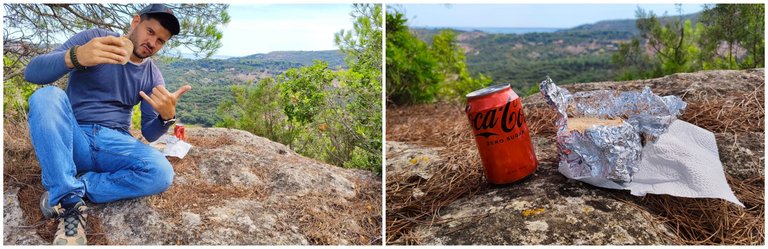
It is always good to come with a snack or something to eat, we need energy to be able to walk 20km, there are no shops or anything in the area so if you run out of water it will be a problem.
Es bueno siempre venir con algun snack o algo para comer, necesitamos energia para poder caminar 20km, no hay tiendas ni nada por la zona por tanto si te quedas sin agua sera un problema.
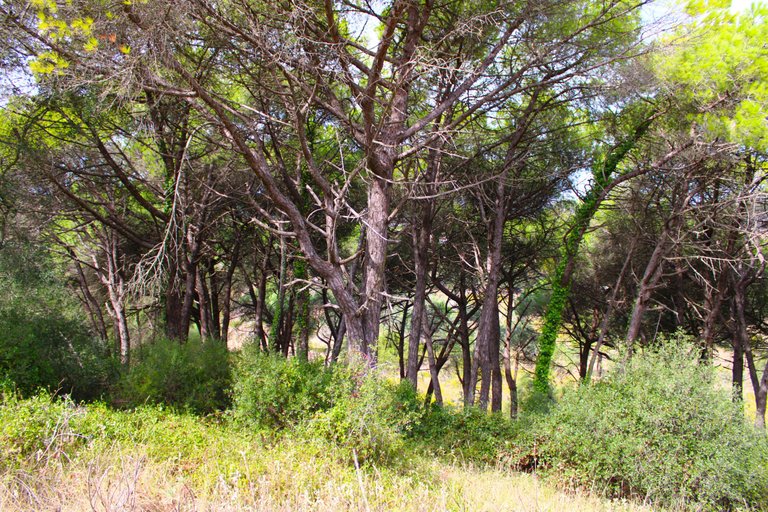
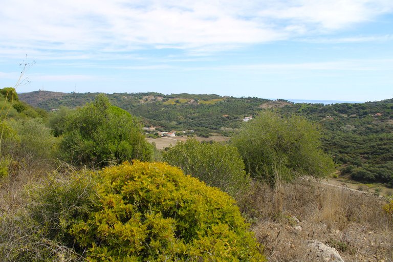
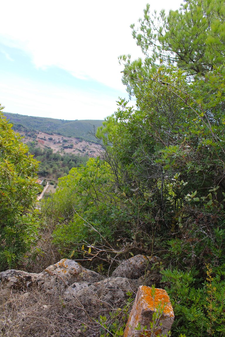
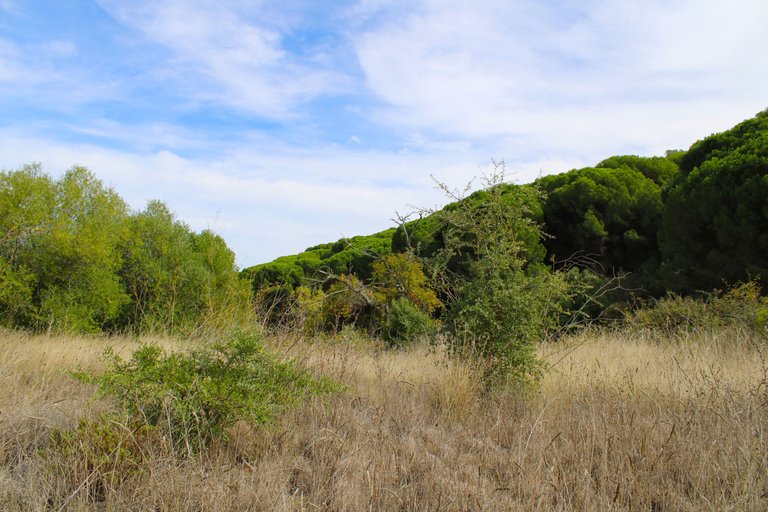
Road to the dense forest🚙⛰️ /Camino al bosque denso🌎🚩
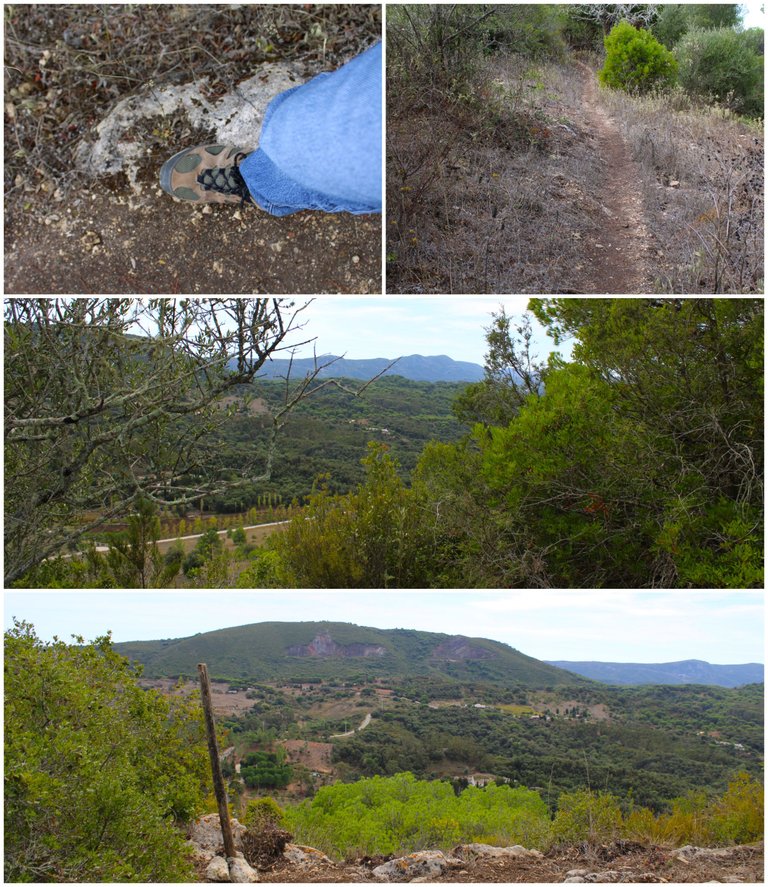
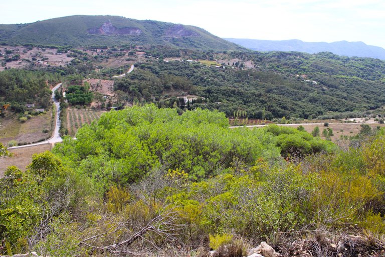
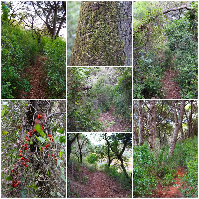
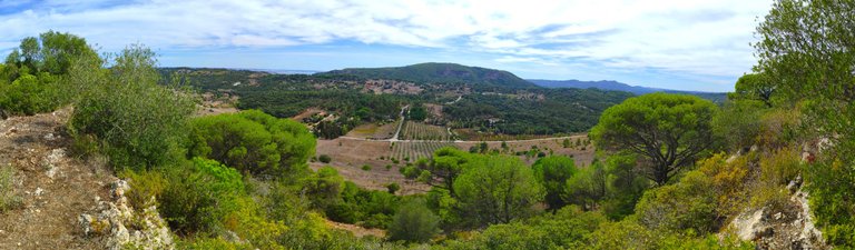
What a fantastic change of environment on this trail. We went from beautiful views at the peak to entering a dense forest full of different species of trees. Here we have to be careful because the path is slippery and steep! At this point we have already walked more than 4km, maybe 5, and we are almost halfway through the hike.🚩🌷🌻🧭
que fantastico el cambio de ambiente en este sendero pasamos de unas hermosas vistas en el pico a entrar en un bosque denso lleno de diferentes especies de arboles, aqui tenemos que tener cuidado porque el camino es resbaloso y empinado! en este punto ya caminamos mas de 4km quizas 5 y vamos a casi la mitad de la caminata.🚵🏻♀️⛰️
Abandoned village🚙⛰️ /Aldea abandonada 🌎🚩
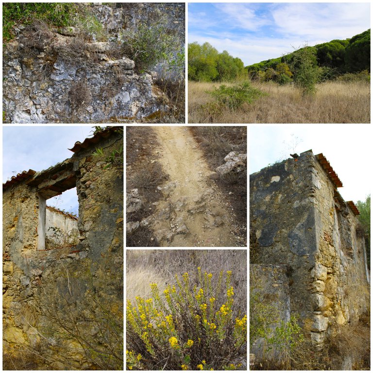
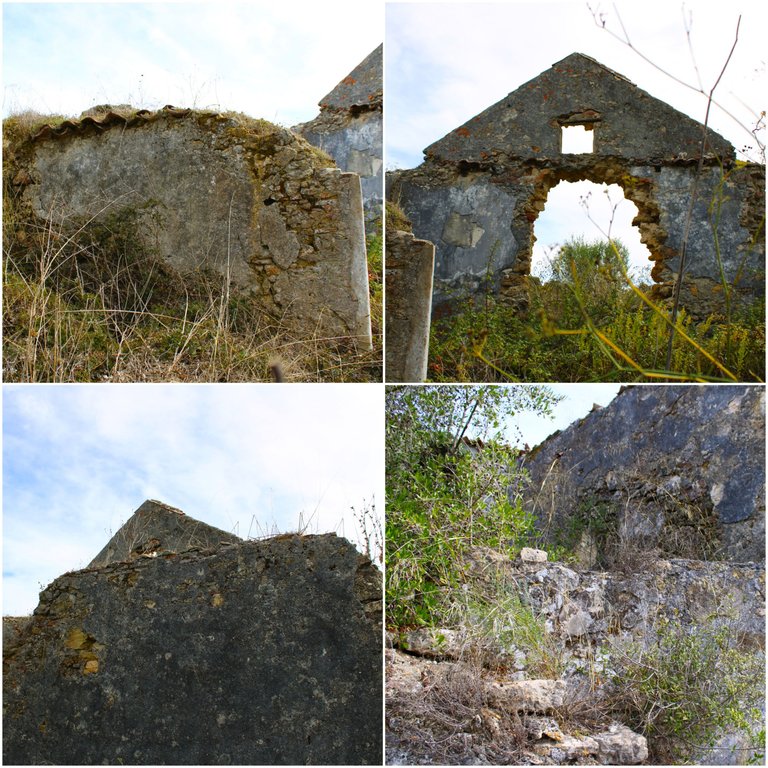
I was doing some research and I was fooled. The trail goes through something interesting. This point of historical interest is a village built in 1750. Its name doesn't even appear on Gmaps. Apparently it was abandoned in the early 19th century due to low economic activity. There was no work at the time! Some were rebuilt and restored.🌻🚩
Estuve investigando y me engane el sendero pasa por algo interesante este punto de interes historico es una aldea construida en 1750 ni siquiera figura su nombre en Gmaps, aparentemente fue abandonada en principios del siglo XIX por la baja actividad economica no habia trabajo en la epoca! algunas fueron reconstruidas y restauradas.⛰️🚙
End of the trail🚙⛰️ /Fin del sendero🌎🚩
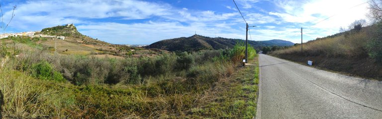
Here our journey ends friends, if you want to continue exploring you can walk along these sandy paths through the bush which will take you to the village "qta do anjo", that is, you would have to walk another 5km. I really enjoyed the trail, the landscapes, the history of the abandoned village are worth repeating on a weekend vacation or a week in Setubal and Palmela. It is recommended for those who like to do these adventures! The costs are low, the food and there are cheap hotels in the middle of nature for 40 euros a night.⛰️🚩
Aqui termina nuestro recorrido amigos, si quieres continuar explorando puedes recorrer estos caminos de arena entre el matorral los cuales te llevaran a la aldea "qta do anjo", osea tendrias que caminar mas 5km, disfrute mucho el sendero los paisajes, la historia de la aldea abandonada son de aquellos que merecen repetirse un fin de semana de vacaciones o una semana en setubal y palmela es recomendado para quienes les gustan hacer estas aventuras! los costos son bajos, la comida y hay hoteles economicos en medio de la naturaleza por 40 euros la noche.🧭🌻

DNA is an organization to foster and DENSIFY NATURE-APPRECIATION which aims to establish REPORTS OF BIODIVERSITY DATA that is contributed by all of us Hiveans and subsequently cataloged.
Therefore DNA searches for HIGH-QUALITY posts that aim to DESCRIBE and determine the BIODIVERSITY AROUND YOU with added EXPLANATIONS and INFORMATION. For these informative posts they offer a CURATION SERVICE using the @dna.org account. It is also a CURATION TRAIL. Just add the #dna TAG if you think that any of your posts is what they are looking for.
THANKS FOR READING ME (PHOTOS AND VIDEOS OF MY PROPERTY) / GRACIAS POR LEERME FOTOS Y VIDEOS DE MI PROPIEDAD🙂🧠🦾👍
//:# (//:# (!worldmappin 38.52449 lat -8.97144 long d3scr))
Congratulations, your post has been added to WorldMapPin! 🎉
Did you know you have your own profile map?
And every post has their own map too!
Want to have your post on the map too?
!discovery 30
😸thanks
This post was shared and voted inside the discord by the curators team of discovery-it
Join our Community and follow our Curation Trail
Discovery-it is also a Witness, vote for us here
Delegate to us for passive income. Check our 80% fee-back Program
the mountain view really makes the hike more enjoyable 🤗
Hiya, @glecerioberto here, just swinging by to let you know that this post made it into our Honorable Mentions in Travel Digest #2342.
Your post has been manually curated by the @worldmappin team. If you like what we're doing, please drop by to check out all the rest of today's great posts and consider supporting other authors like yourself and us so we can keep the project going!
Become part of our travel community:
👏👏👏👏👏