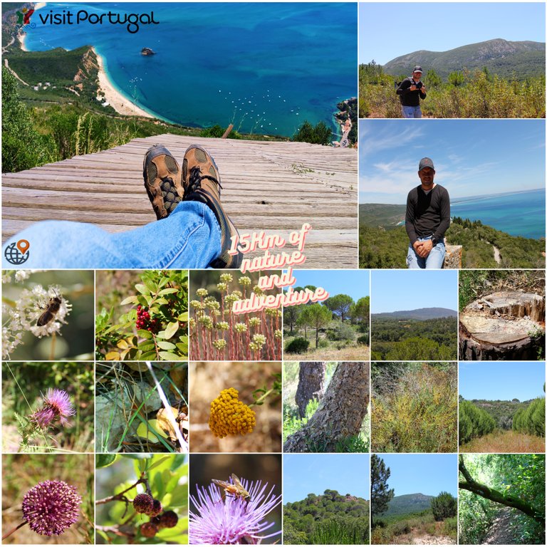
15Km of nature and adventure🌍🚩🧭 (En-Es)

Hello traveling friends? Are you ready for a new adventure? Today was a day of a lot of walking but every meter was worth it because the landscapes I photographed today are amazing. Today I am in Setubal south of Lisbon to do a trail called: "Oleiros", but no It would be a not easy hike because I made a 5km detour to make the trail quite a challenge, I went through some dirt roads and even climbed 600 meters of mountain, I hope you like my experience.🌎🚙

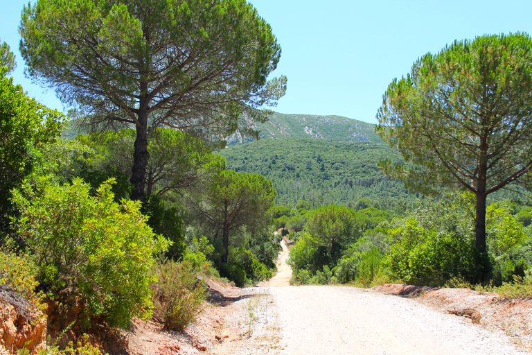
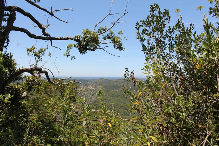
Hola amigos viajeros? preparados para una nueva aventura?, hoy fue un dia de mucha caminata pero cada metro valio la pena porque los paisajes que fotografie hoy son asombrosos, me encuentro hoy en Setubal al sur de Lisboa para hacer un sendero llamado: "Oleiros", pero no seria una caminata nada facil porque hice un desvio de 5km para hacer el sendero todo un reto, pase por algunos caminos de tierra e inclusive subi 600 metros de montana, espero que te guste mi experiencia.⛵🏔️🌄

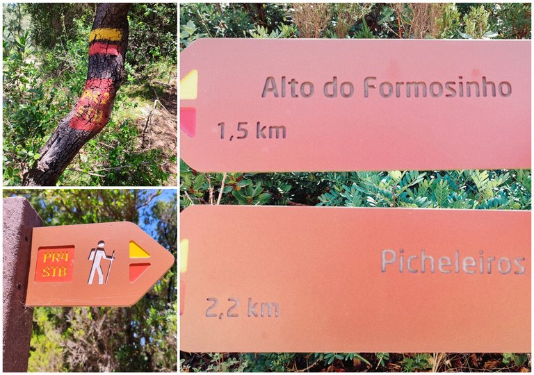
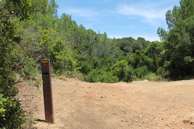
Trail starting point🧭 / Punto de inicio del Sendero🌍🚩

To start the trail we must locate the following coordinate in Gmaps: (38.500199, -9.029251) it is not located on the internet so you can only start it with the coordinate that I left you in the information, the trail has a duration with the detour of 15km and yes If you want to do it you have to have experience in hiking because it is too demanding and is not suitable for people with disabilities or any illness, literally if you are in summer with 34 degrees we are going to push our body to the limit and even more so in climbing. Recommendation? Do it in spring when the temperature is tolerable, bring plenty of water, a hat, hiking poles and boots, and of course food.🚙🌎
Para comenzar el sendero debemos ubicar la siguiente coordenada en Gmaps: (38.500199, -9.029251) no esta ubicada en internet asi que solo puedes iniciarlo con la coordenada que te dejo en la informacion, el sendero tiene una duracion con el desvio de 15km y si deseas hacerlo tienes que tener experiencia en senderismo porque es demasiado exigente y no es apto para personas con discapacidad o alguna infermedad, literal si estas en verano con 34 grados vamos a llevar el cuerpo al limite y mas en la escalada. Recomendacion? hazlo en primavera cuando la temperatura es tolerable, trae mucha agua, un sombrero, bastones de excursion y botas, y claro comida.🚩🌲🌳🌻🌼

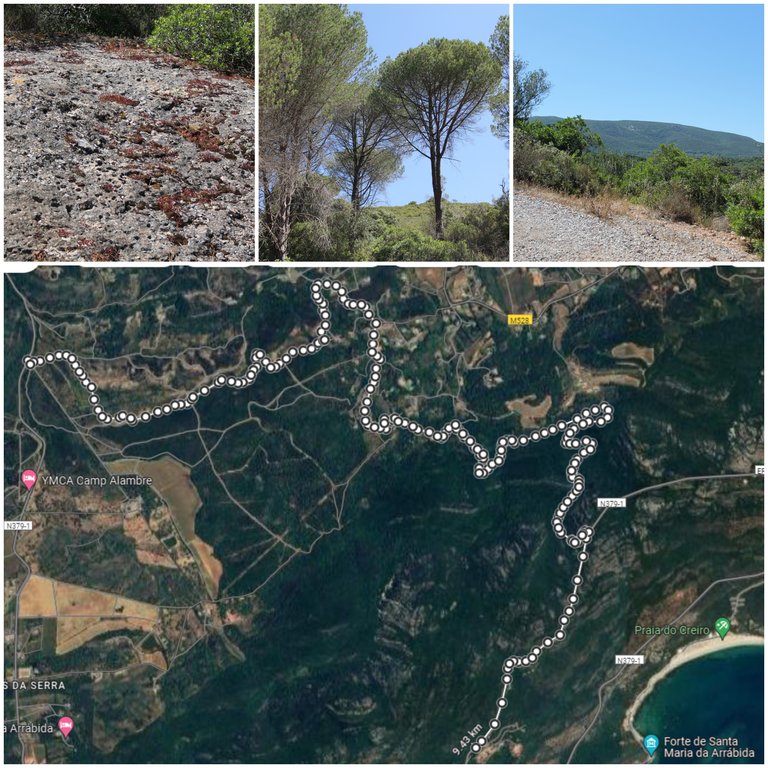
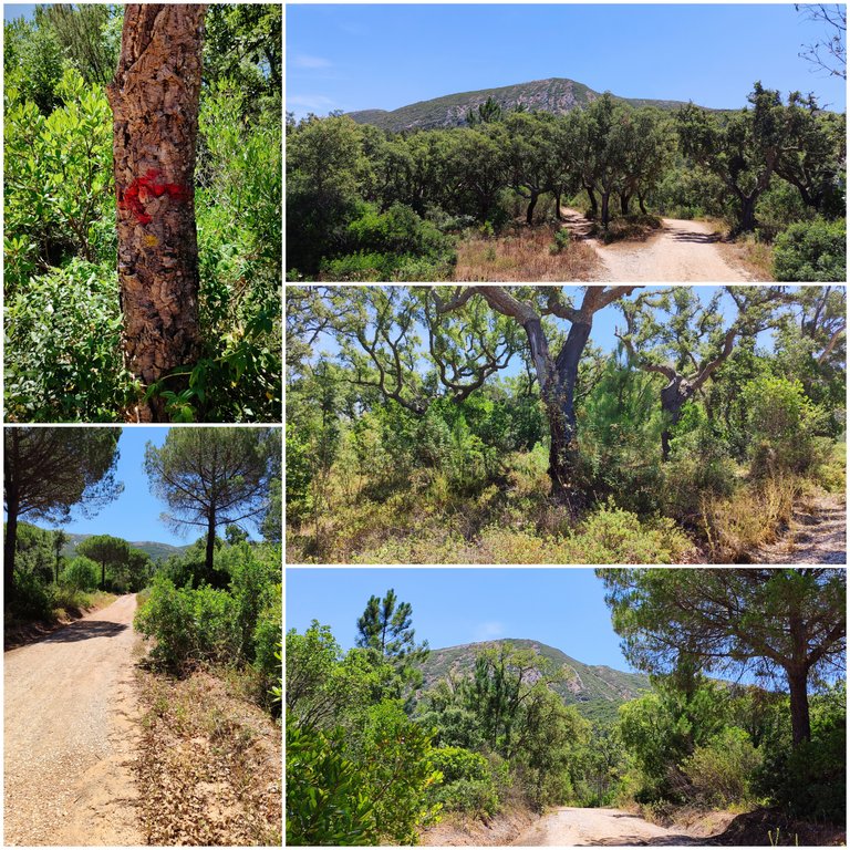
Custom mapped route🧭 / Ruta mapeada personalizada🌍🚩

Normally the "Oleiros" trail, which I have already done on one occasion, is only 2km as I know the area like the back of my hand, I can create alternative routes like this one with Gmaps to do more difficult adventures and get to know the landscape better trying to discover new places, This area is protected so we have to have preservation behavior and not contaminate. If you come to Portugal they surely recommended you come to: "Serra da Arrabida" its beaches are the best and I will show them to you now. If you want to recreate my journey, I'll leave you the route there. It reaches a height where it will be signposted so you won't get lost.🌳🌲🚩
Normalmente el sendero "Oleiros" que ya lo hice en una ocasion son solo 2km como conozco la zona como la palma de mi mano, puedo crear rutas alternativas como esta con Gmaps para hacer aventuras mas dificiles y conocer mejor el paisaje intentando descubrir lugares nuevos, esta zona es protegida asi que tenemos que tener una conducta de preservacion y no contaminar. Si vienes a Portugal seguramente te recomendaron venir a: "Serra da Arrabida" sus playas son de lo mejor ya te las muestro ahora. Si quieres recrear mi travesia alli te dejo la ruta llega una altura donde estara senalizada por lo que no te vas a perder.🧭🗺️

Adventure start🧭 / Inicio de aventura🌍🚩

That mountain is the one I intend to climb, but this marked route will not take you there, so you have to make the detour where I show you on the map, and you will go down a small slope. At the moment you start walking towards the mountains, then you will go. Well, you can take other alternative routes, almost all of them will take you there but be careful, you must avoid taking the path that says: "Alto do formosinho" this is too complicated and dangerous, we will avoid that sign, on the contrary we will look for the one that says "Aldeia pichileiros". What I like about the trail is that in spring you can still see many flowers and animals, there is great biodiversity.🧭🚩
Esa montana es la que pretendo subir, pero esta ruta senalada no te llevara alli asi que tienes que hacer el desvio donde te muestro en el mapa, y vas a bajar por una pequena ladera en el momento que comienzas a caminar hacia la sierra entonces vas bien, puedes tomar otras rutas alternativa casi todas te llevaran alli pero cuidado debes evitar hacer el sendero que dice: "Alto do formosinho" este es demasiado complicado y peligroso evitaremos esa senal, al contrario buscaremos la que dice "Aldeia pichileiros". Lo que me gusta del sendero es que en primavera aun se ven muchas flores y animales hay una gran biodiversidad.🏔️🌄

Some variety of Mediterranean biodiversity🚩🌼

As you can see, the vegetation is typical of the Iberian Peninsula and the biodiversity of the Mediterranean forest predominates where we will see many pine trees and other plants with beautiful flowers that decorate the landscape in the spring season, which for me is the best time to do the trail. a combination of green and blue, it has some of the most difficult trails in Portugal so coming here is always a challenge for me and every time I try to push my resistance to the limit clearly in a responsible way, it may seem crazy to you but the trail is suitable for do it at night.🧭🌏

Como puedes ver la vegetacion es tipica de la peninsula iberica y predomina esa biodiversidad de bosque mediterranico donde veremos muchos pinos y otras plantas con bonitas flores que decoran el paisaje en la estacion de la primavera donde para mi es la mejor epoca para hacer el sendero, una combinacion de verde y azul, tiene algunos senderos de los mas dificiles de Portugal por eso venir aqui es siempre un reto para mi y cada vez trato de llevar al limite mi resistencia claramente de forma responsable, te parecera loco pero el sendero es apto para hacerlo de noche.🌻🌳

Until now we are going to follow the signs but you must be attentive because on the right side we are going to see a graffiti with an Let's go down where the X is painted on the tree and there our real adventure will begin because we will let ourselves be carried away by the experience and Gmaps to arrive near the main mountain in search of the other sign: "Pichileiros".🚩🌄🏔️
Hasta ahora vamos a seguir las senalizaciones pero debes estar atento porque al lado derecho vamos a ver una pintada con una X, esa dice que por alli no puedes ir si quieres continuar hacia la aldea de "Oleiras" obviamente no nos interesa la aldea por eso vamos a bajar donde esta la X pintada en el arbol y alli comenzara nuestra verdadera aventura porque nos dejaremos llevar por la experiencia y Gmaps para llegar cerca de la montana principal en busca de la otra senal: "Pichileiros".🌲

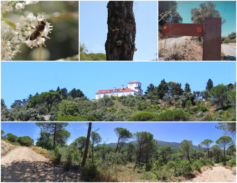
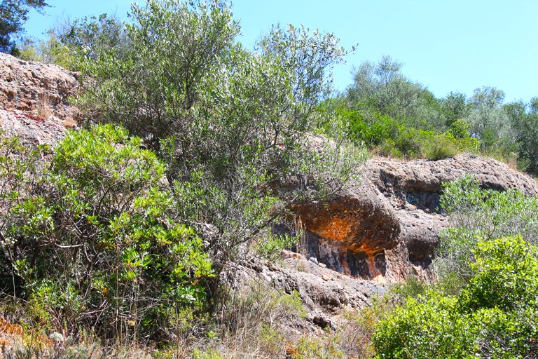
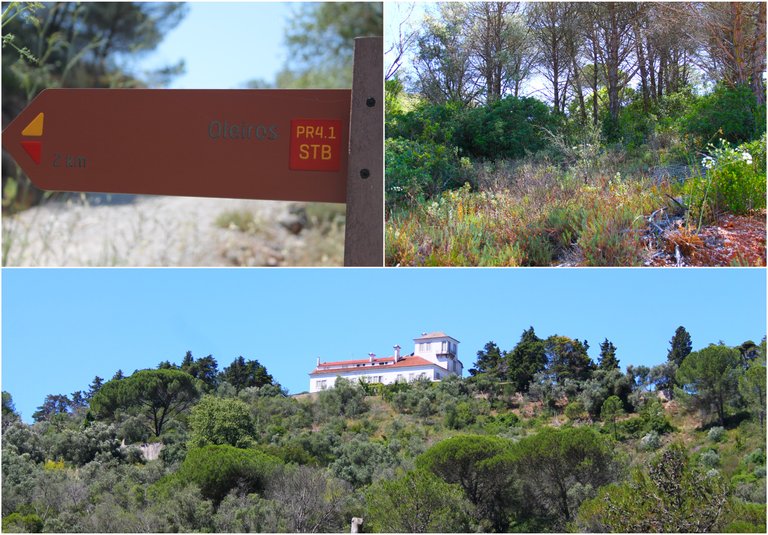
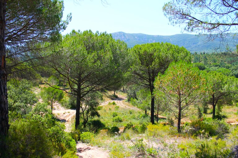
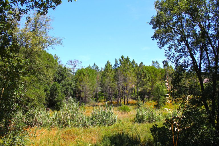
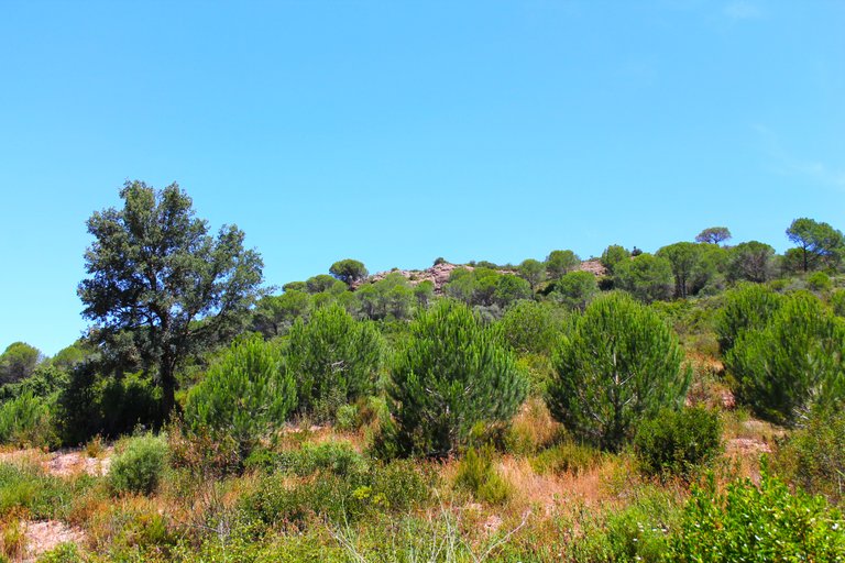
Entering the parish of São Lourenço🧭 /Entrando en la freguesia de São Lourenço🌍🚩

The parish of São Lourenço, as you can see, stands out for its great biodiversity of fauna and insects. By the way, there are many small birds but I cannot photograph them without a telephoto lens. When I tell you that you have to have experience in hiking, it is because if you look at the first photos there are many paths and you won't know which one to take if you don't look for the map but how do you know where to go? So always use this as a reference: "Aldeia dos pichileiros" the main road passes there where we will take the other path.🌎🗺️🧭
La freguesia de São Lourenço como puedes ver destaca por su gran biodiversidad de fauna e insectos, por cierto hay muchas aves pequenas pero no consigo fotografiarlas sin una teleobjetiva, cuando te digo que tienes que tener experiencia en senderismo es porque si te fijas en la primera fotos hay muchos caminos y no sabras cual tomar si no buscas el mapa pero como saber a donde ir? entonces siempre usa como referencia esto: "Aldeia dos pichileiros" alli pasa la carretera principal donde cogeremos el otro sendero.🚙⛵🌄

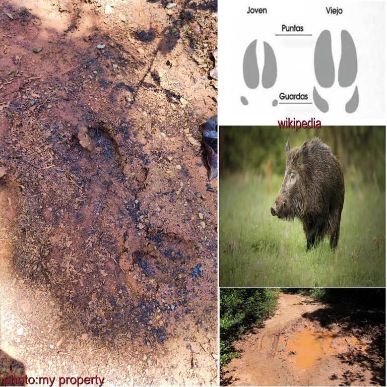
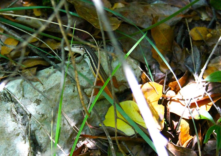
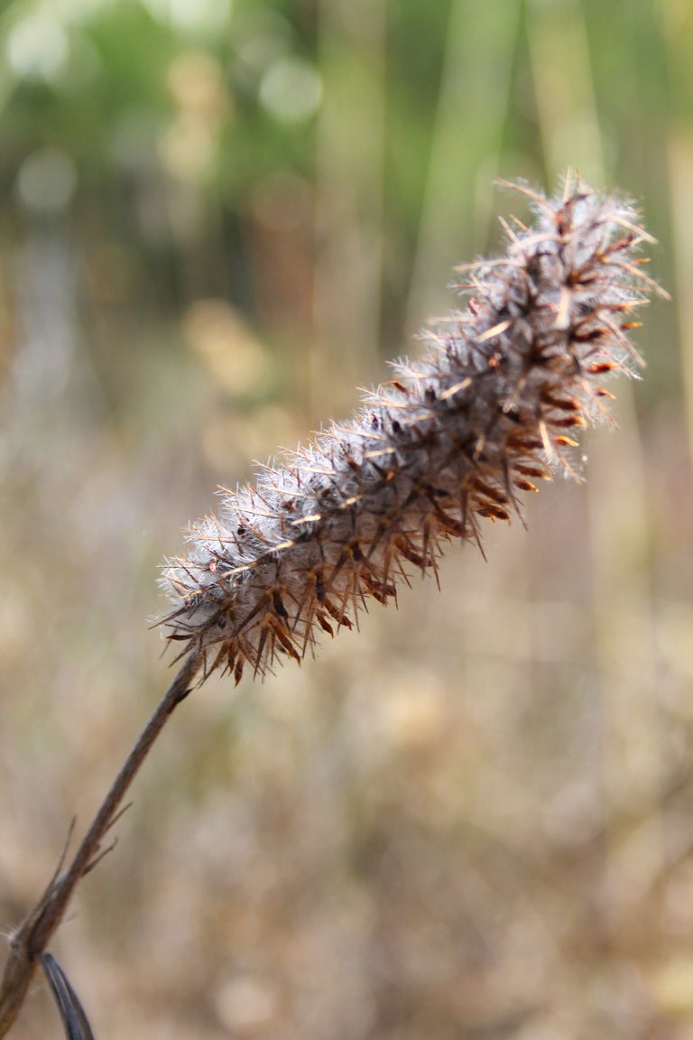
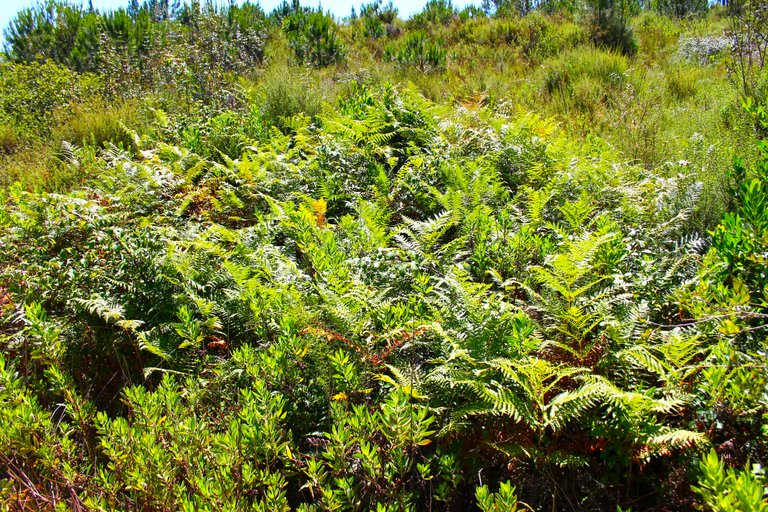
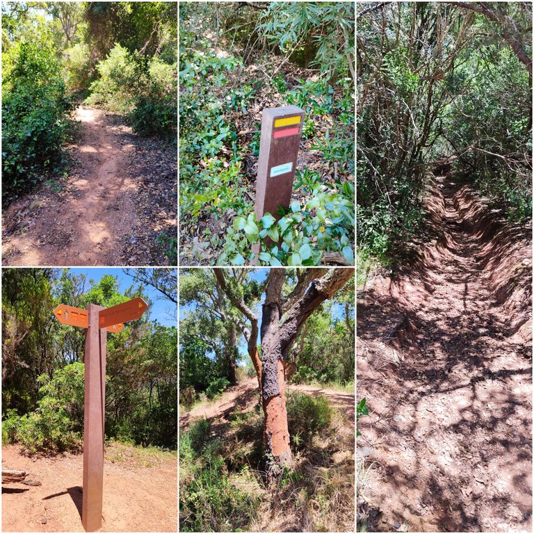
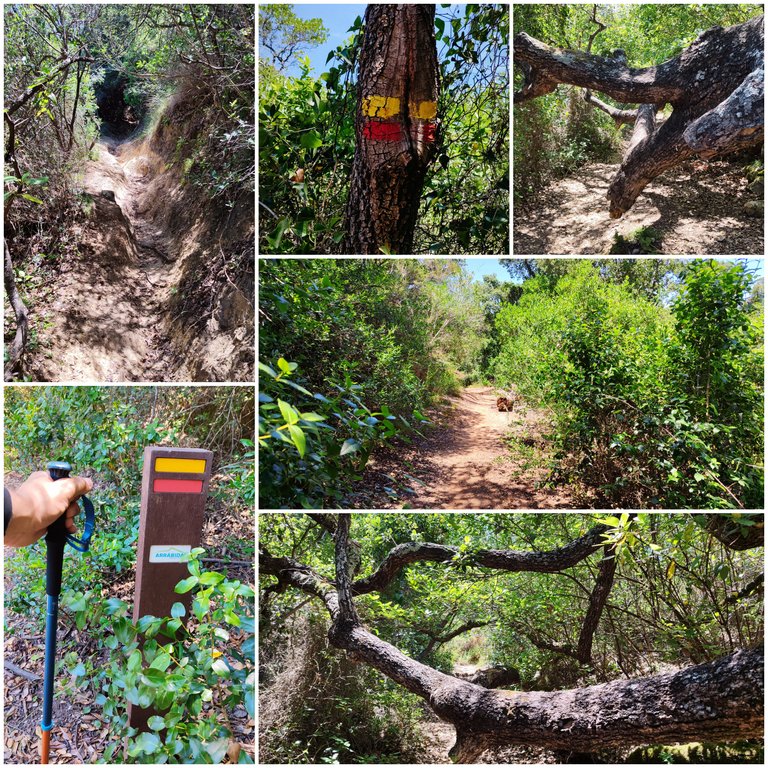
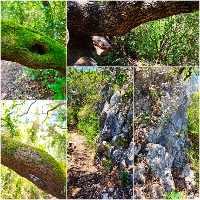
As you can see, if you pay attention to where you are stepping, you will see footprints of all types of animals and if you are a good tracker you could reach their lairs, although many of them are nocturnal, at night these paths are a different world.🦡🦨🦎🦉

Como puedes ver si te fijas donde vas pisando veras huellas de todo tipo de animales y si eres un buen rastreador podrias llegar a sus guaridas, aunque muchos de ellos son de habito nocturno en la noche estos caminos son un mundo diferente.🌎🌲

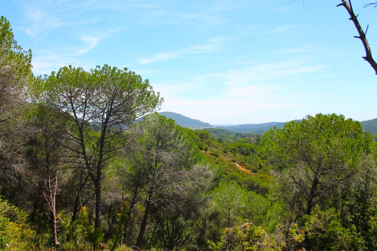
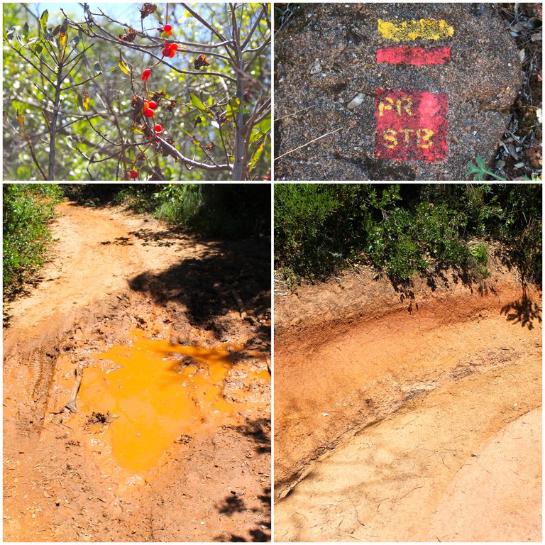
Passing 2km🧭 /Pasando los 2km🌍🚩

We start to climb🚩🌼

When we start to reach 2km the terrain changes completely and we stop going down to start going up because we are going to enter a phase of small hills, up to this point I have not felt heat and tiredness, maybe I was lucky because there was a pleasant breeze.🧭🌏

Cuando comenzamos a llegar los 2km el terreno cambia totalmente y dejamos de bajar para comenzar a subir pues vamos a entrar a una fase de pequenas colinas, hasta este punto no e sentido calor y cansancio quizas tuve suerte esta una brisa agradable.🌻🌳


4km and a break🧭 /4km y una pausa🌍🚩

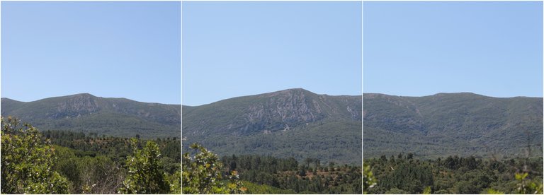
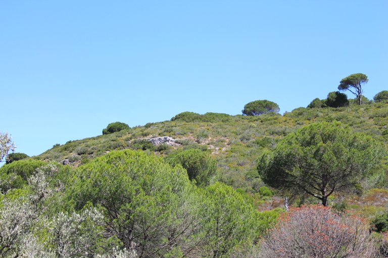
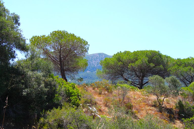
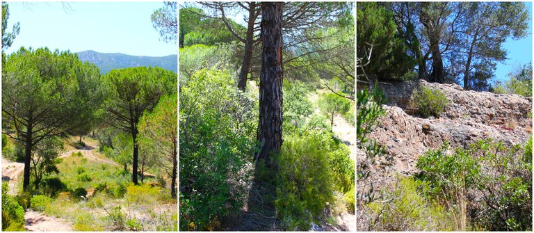
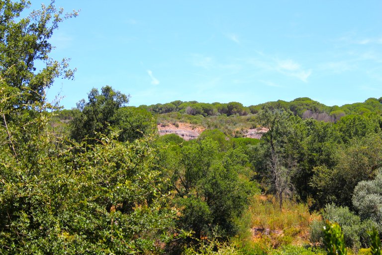
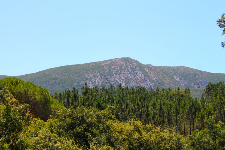
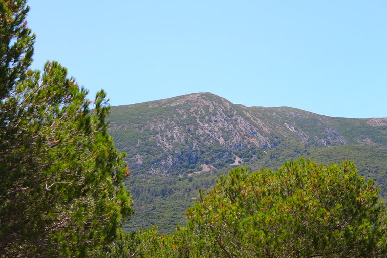
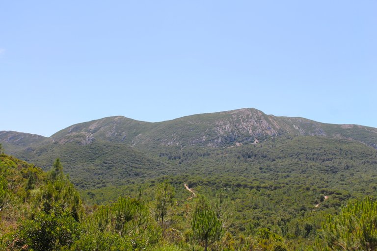
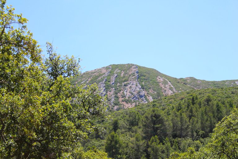
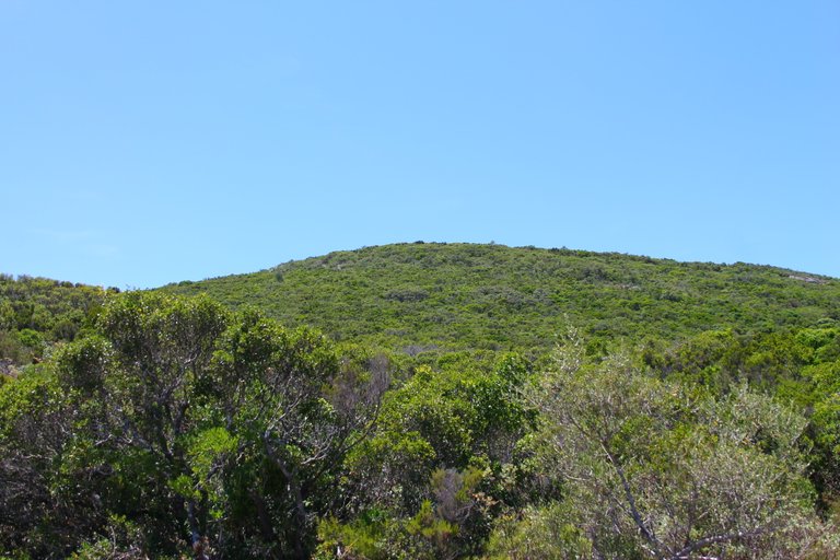
After 4km of walking it was already about 29 degrees and I was starting to feel the heat so I decided to stop to cool off and enjoy the landscape. Did you notice that the mountain is getting closer? and this is a sign that we are on the right track.🗺️🧭

A los 4km de caminata ya estaba haciendo unos 29 grados y comenzaba a sentir el calor asi que decidi parar para refrescarme y disfrutar el paisaje notaste que cada vez esta la montana mas cerca? y esto es senal que vamos en buen camino.🏔️🌄

32 degrees ufff🧭 /32 grados ufff🌍🚩

My God!!! The heat here is horrible, I don't know how to describe, I think the body sensation must be around 40 degrees, this is where we take the body to its maximum capacity, there are meters and meters directly in the sun where we must take advantage of a little shade to cool off and continue. The hard part hasn't started yet...🧭🗺️
Mi Dios!!! el calor aqui es horrible no se como describir creo que la sensacion corporar debe rondar los 40 grados, aqui es donde llevamos el cuerpo a la maxima capacidad, son metros y metros directo al sol donde debemos aprovechar un poco de sombra para refrescarnos y seguir. Aun no comienza lo dificil...🌲🌎

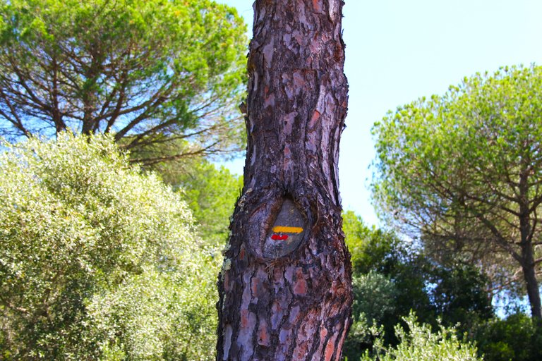
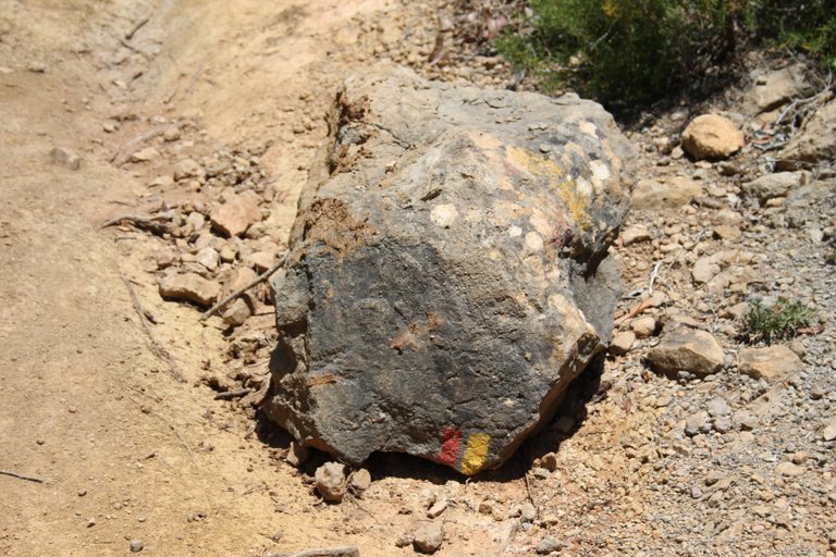
After 6km or so we see the signs again and here we understand that we were not lost hehe, we are close to the main street.🗺️🧭

A los 6km mas o menos vemos de nuevo las senalizaciones y aqui entendemos que no nos perdimos jeje, estamos cerca de la calle principal.🌲🌄

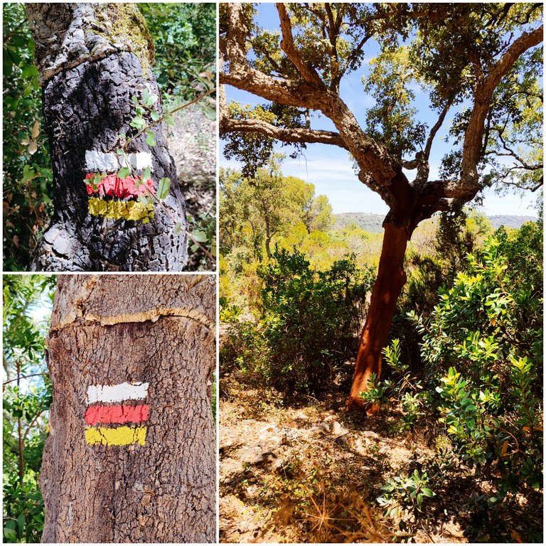
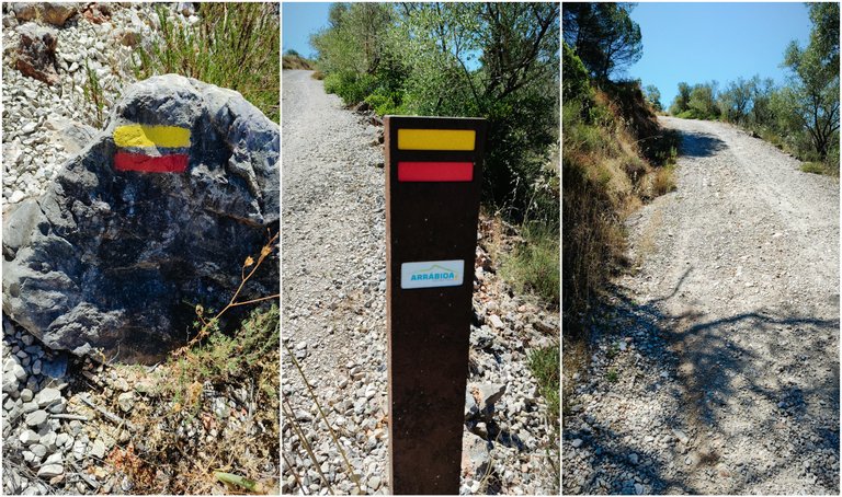
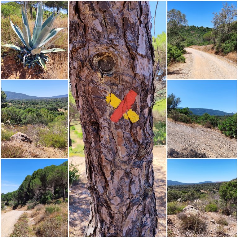
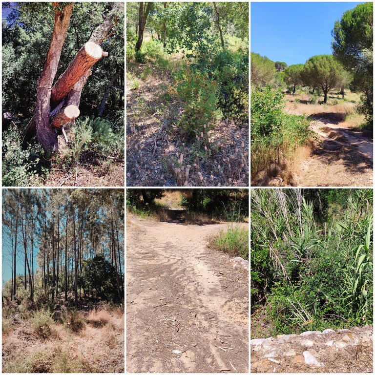
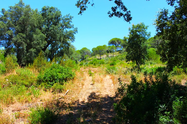
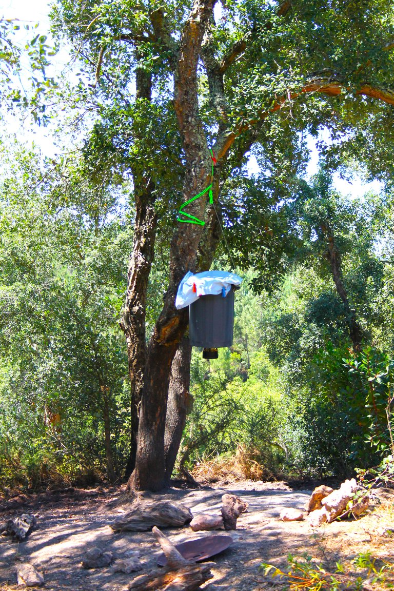
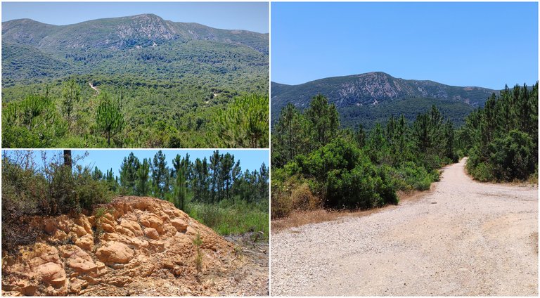
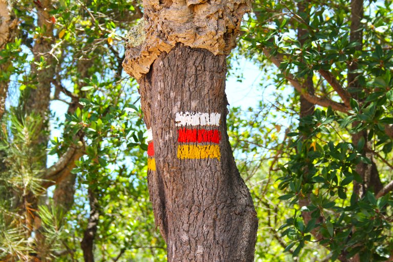
"Pichileiros" trail intersection🧭 /Intercepcion sendero "Pichileiros"🌍🚩

After more than six kilometers we are going to come across this sign that tells us: "Pichileiros" at 2.2km we are going to follow it along with its signs, here we are lucky that the temperature drops a little because you see much more vegetation and of course We are at the base of that mountain that we saw very far away at the beginning, imagine everything I have walked until now.🌎🏔️
Luego de mas de unos seis kilometros nos vamos a topar con este letrero que nos dice: "Pichileiros" a 2,2km lo vamos a seguir junto con sus senalizaciones, aqui tenemos suerte que la temperatura baja un poco porque ves mucha mas vegetacion y claro estamos en la base de aquella montana que la veiamos muy lejos en el inicio, imagina todo lo que camine hasta ahora.🌲🧭🚙

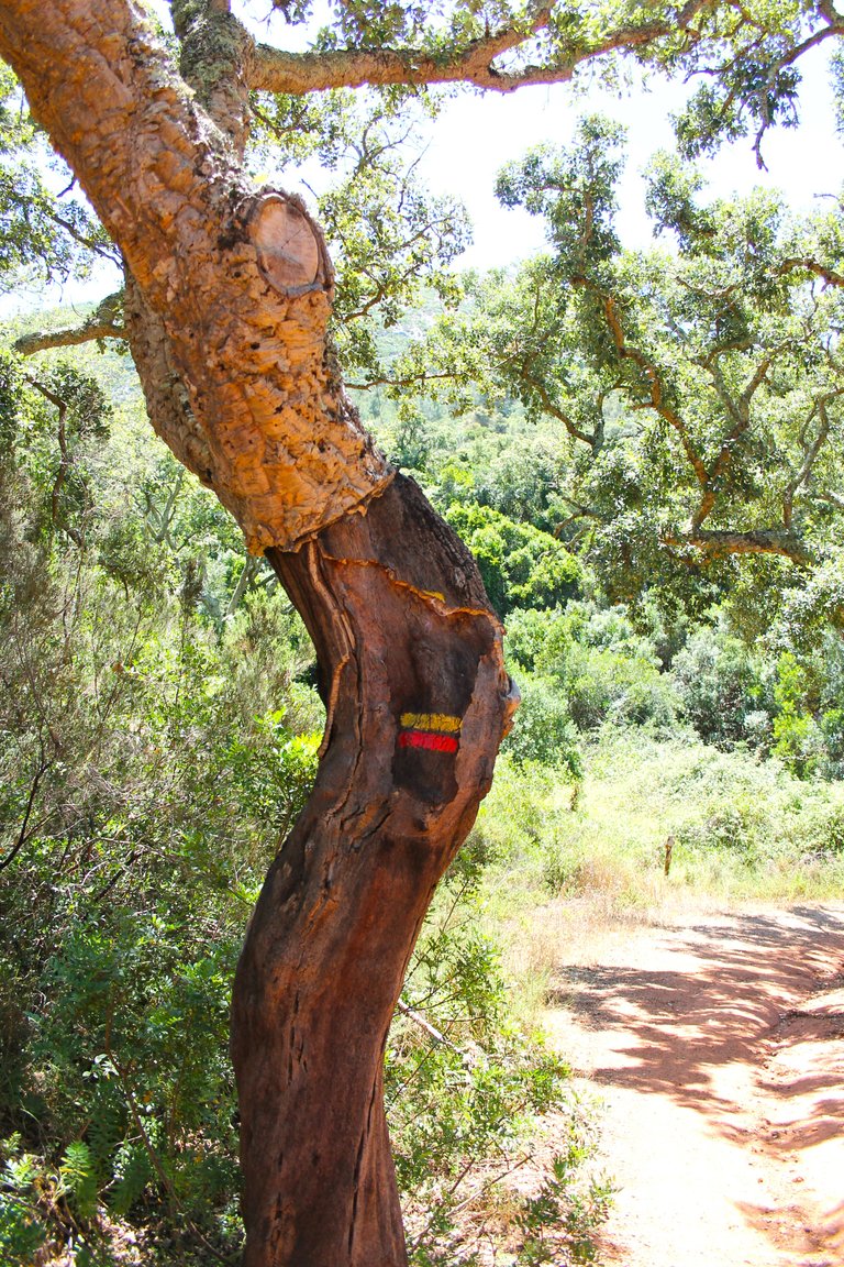
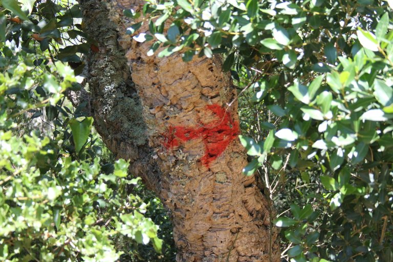
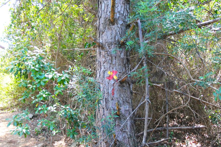
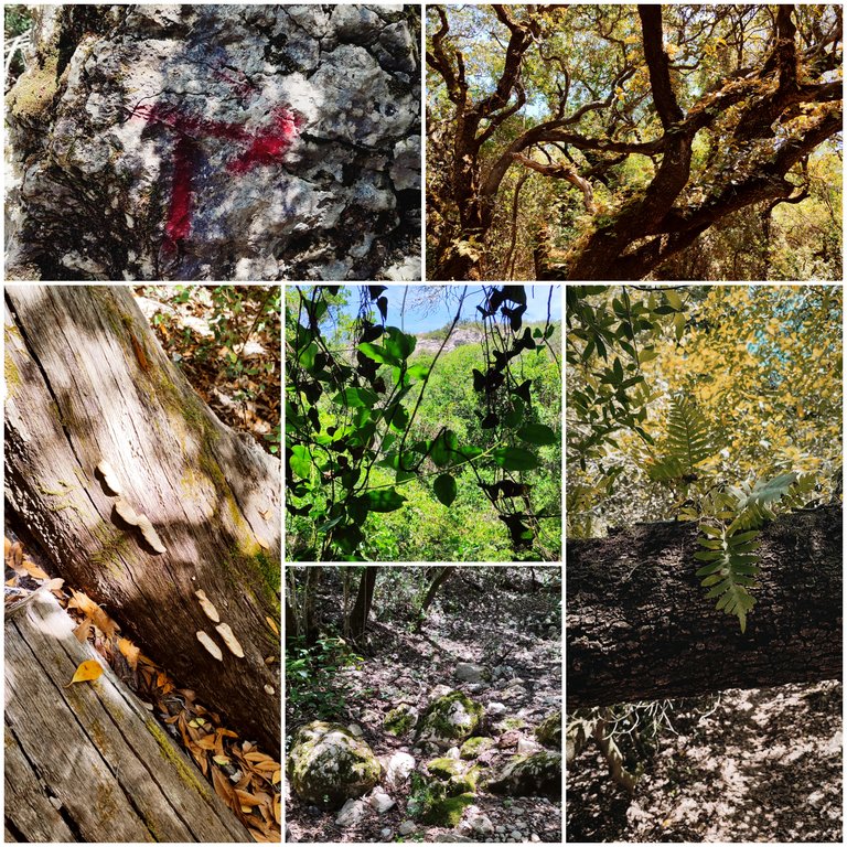
This photo is important because in the tree marked with the cross there is a climb to your right that you must take if you want to start climbing the mountain and if you go in front then you reach the village, remember the village we are not interested in if not climbing the mountain ! and this is where we are going to test our body...🚙🗺️

Esta foto es importante porque en el arbol marcado con la cruz hay una subida a tu derecha que debes tomar si quieres comenzar a subir la montana y si vas en frente entonces llegas a la aldea, recuerda la aldea no nos interesa si no escalar la montana! y aqui es donde vamos a poner a prueba nuestro cuerpo...🦾🫀🫁🦿

An important tip: maintain a rhythm, do not speed up and do not take long breaks or your circulation will slow down and it will be difficult for you to start again to get into rhythm, do a climb walking at a decent pace and take breaks to drink a little water. If you intend to climb this jogging or running, it is very dangerous because of the heat and the slippery nature, pay attention to the dirt and stone paths.🌄🌎
Un consejo importante manten un ritmo, no aceleres y tampoco hagas pausas largas o tu circulacion bajara el ritmo y te costara comenzar de nuevo a entrar en ritmo, haz una subida caminando a ritmo decente y haz pausas para beber poca agua. Si pretendes subir esto trotando o corriendo es muy peligroso por el calor y lo resbaladizo fijate como son los caminos tierra y piedra.🧭🌄

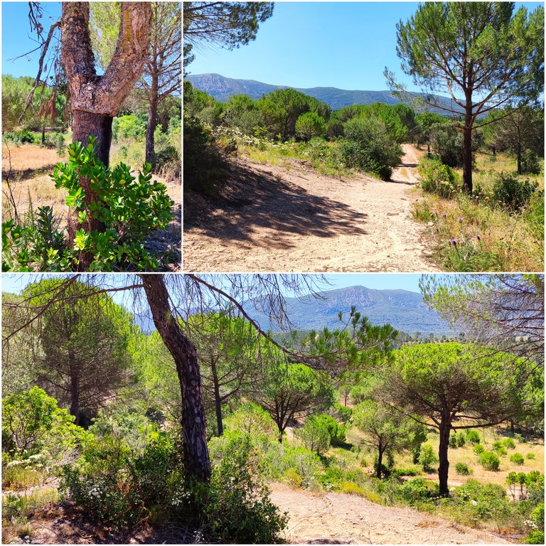
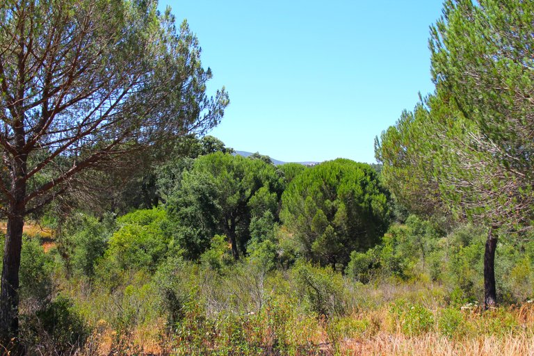
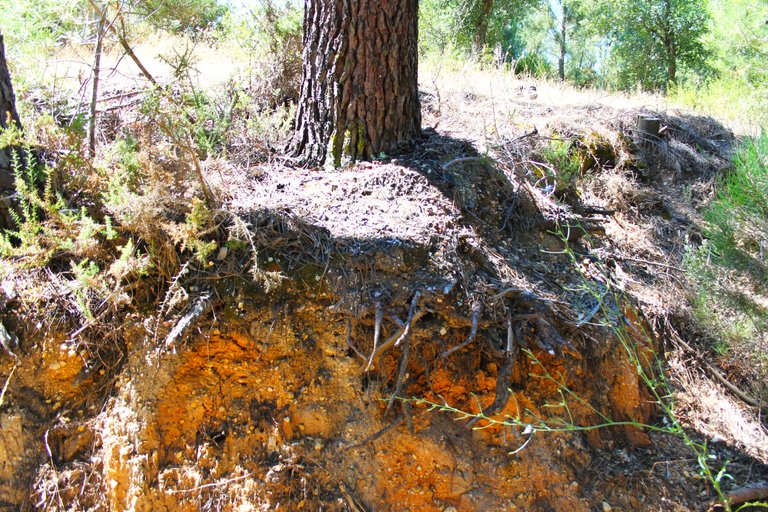
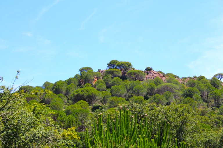
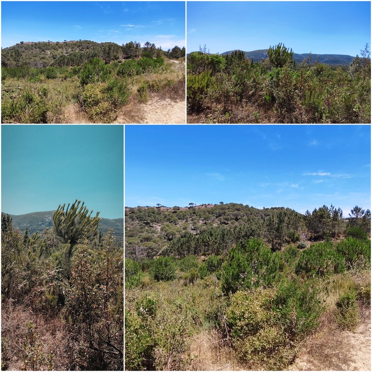
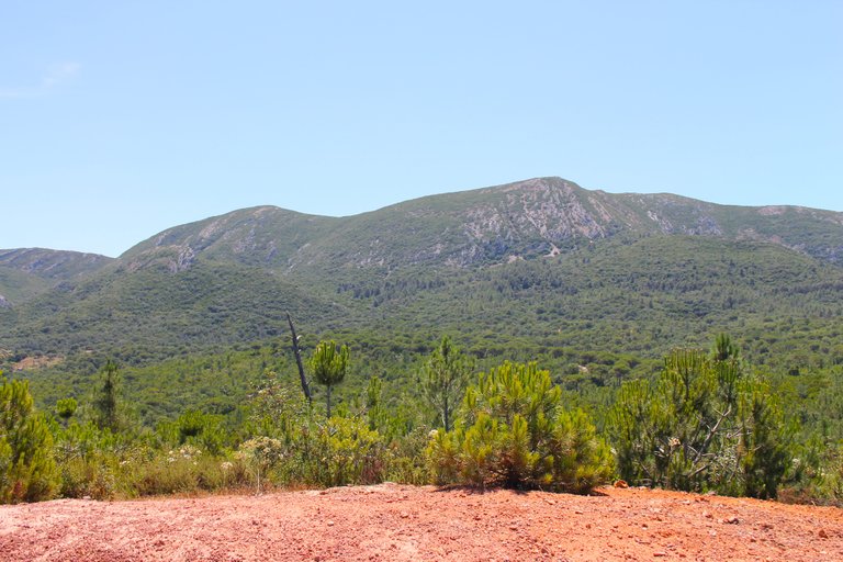
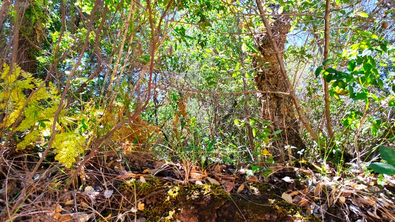
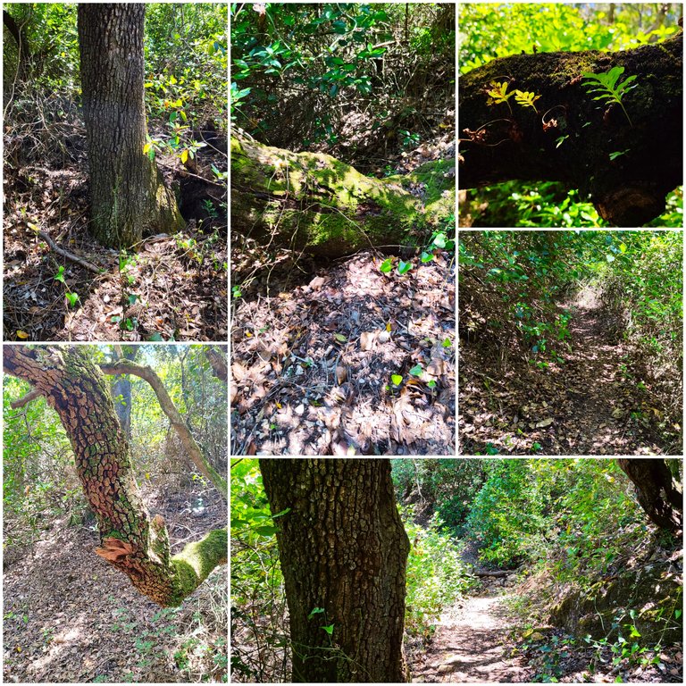
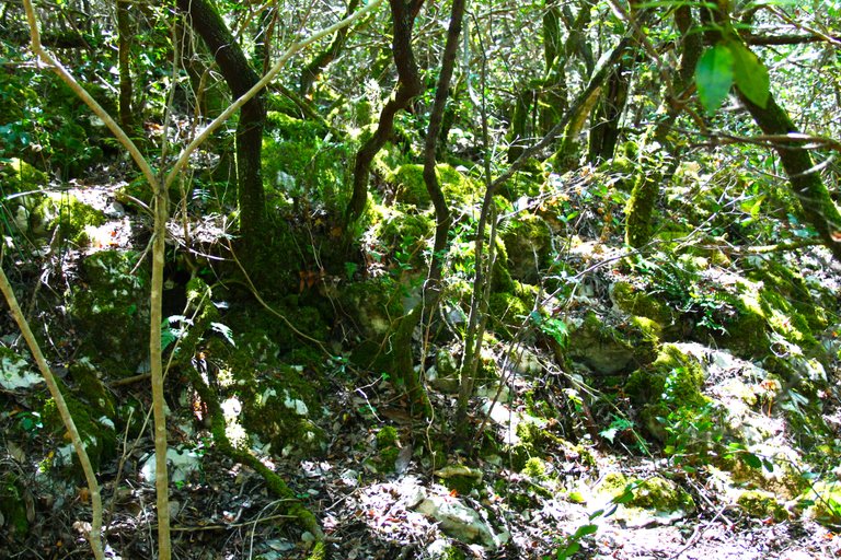
Last kilometers in the mountains🧭 /Ultimos kilometros en la montana🌍🚩

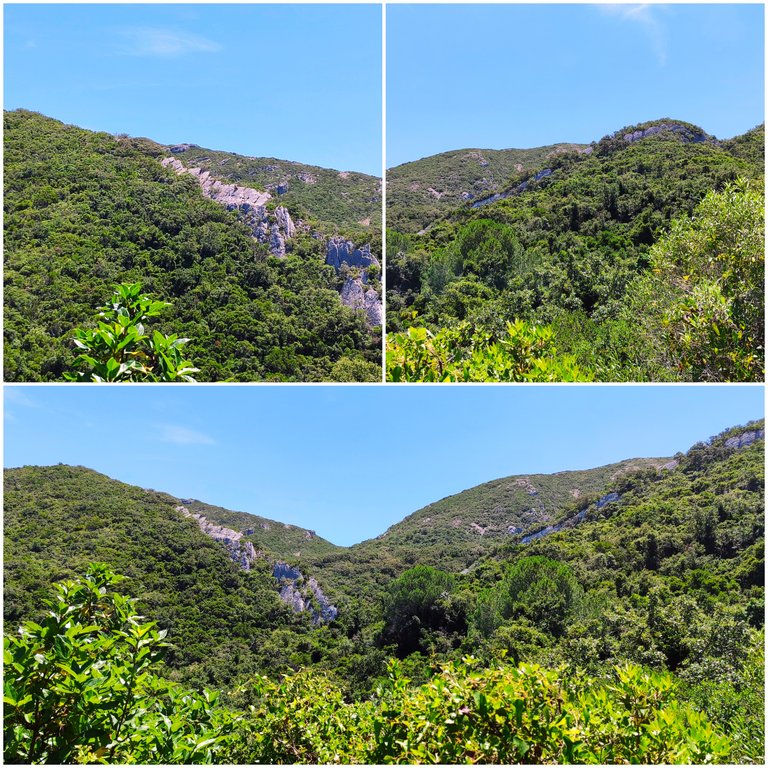
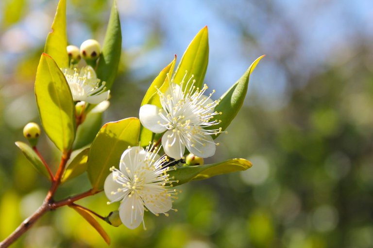
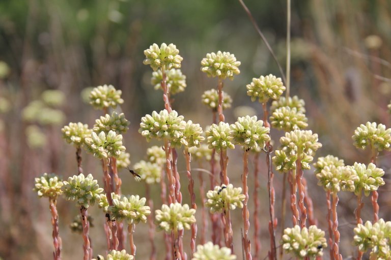
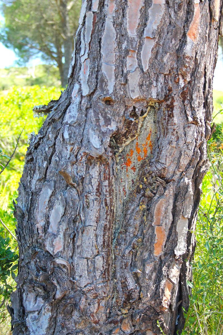
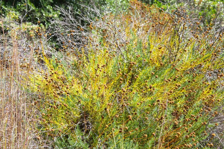
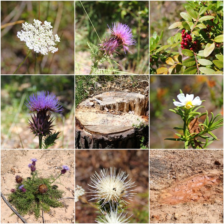
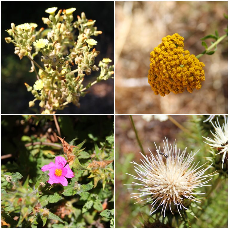
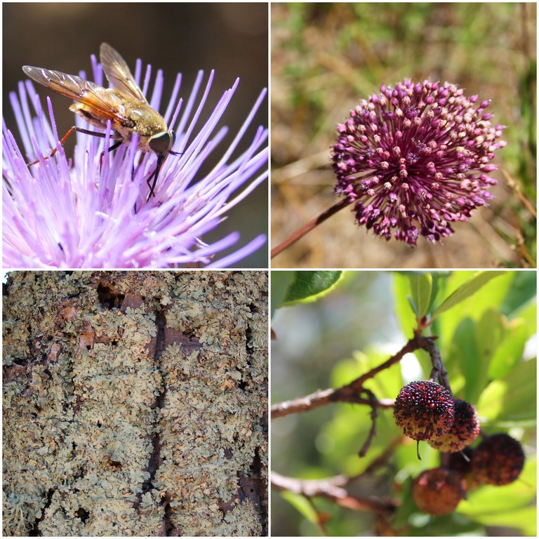
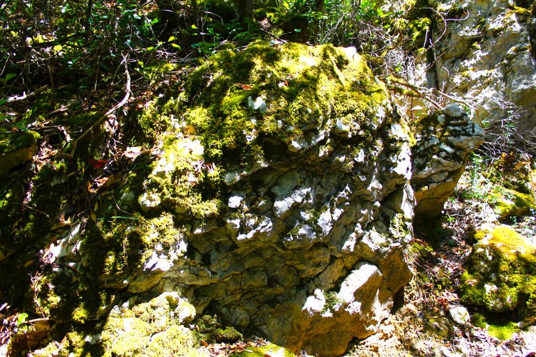
This is a protected area, here it is only walking, do not take anything from nature and do not leave garbage due to the quality and importance of the local vegetation and animals that protected this area.🗺️🌎

Esta es area protegida, aqui es solo caminar, no tomes nada de la naturaleza y no dejes basura debido a la calidad e importancia de la vegetacion y animales locales protegieron esta zona.🌲🦉🏔️

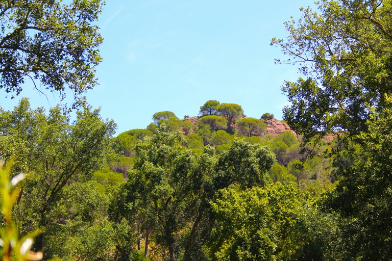
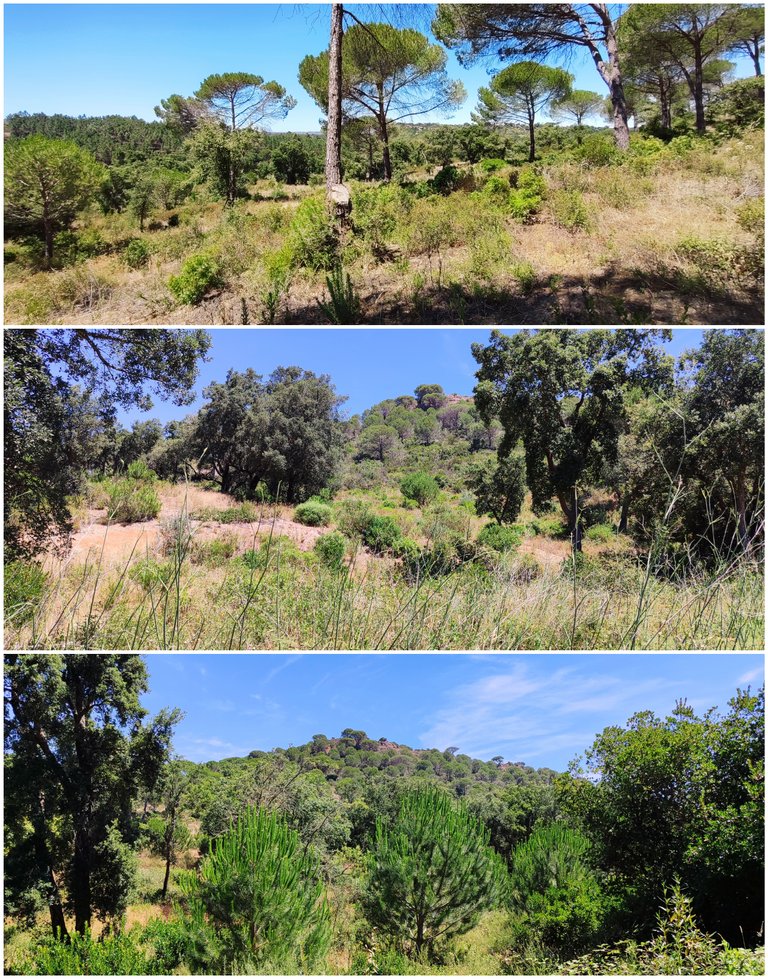
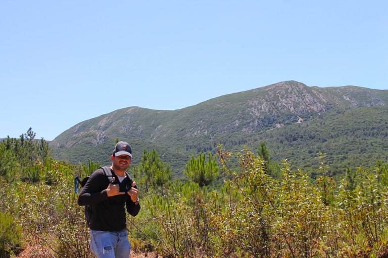
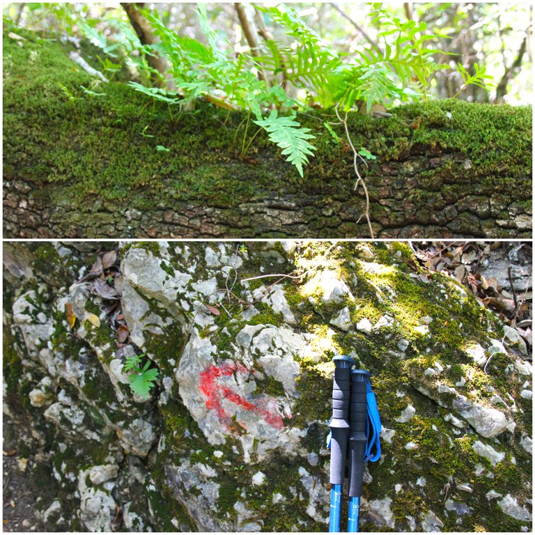
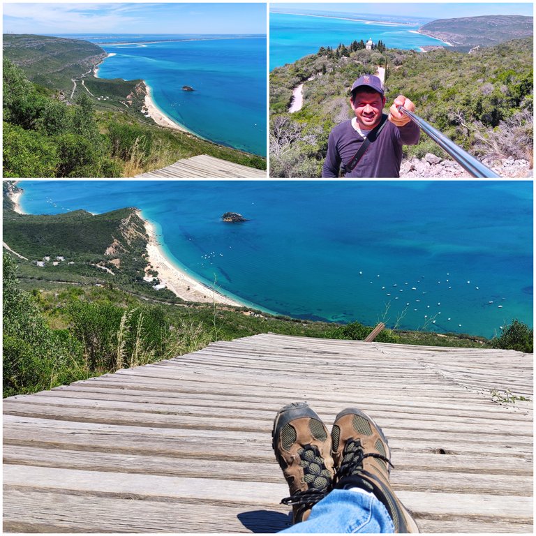
Mission complete🧭 /Mision completa🌍🚩

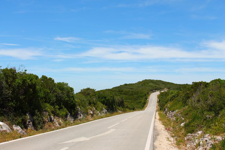
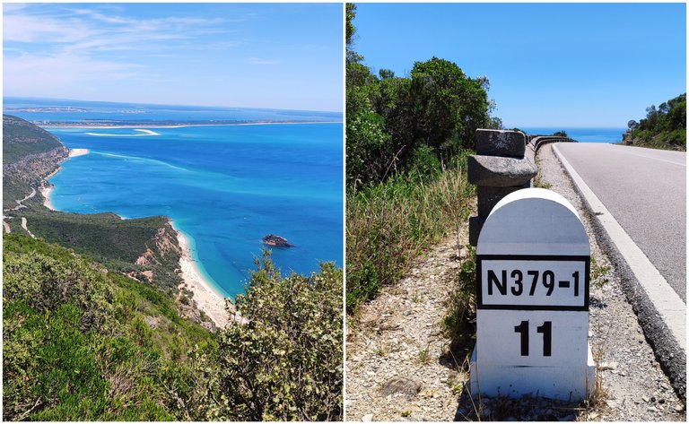
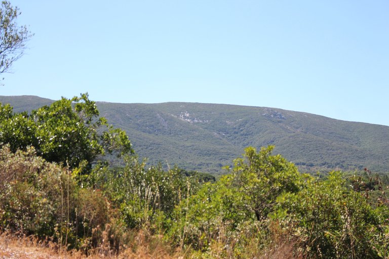
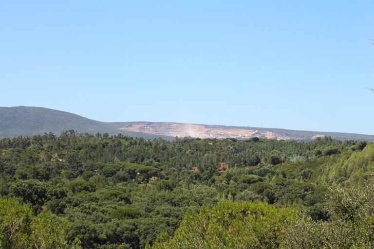
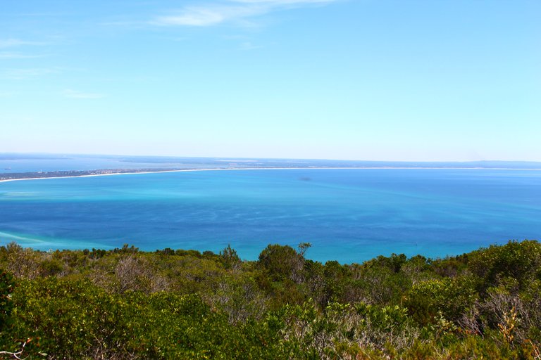
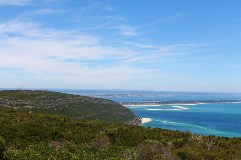
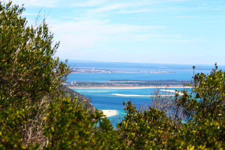
The path takes us to the top of the road, which is about 400 meters high, I think maybe a little more, here we have a beautiful view of the Atlantic and many beaches of Setubal. Here we could leave the car and take the tour.🌲🌎🗺️

El camino nos lleva a lo alto de la carretera que son como 400 metros de altura creo quizas un poco mas, aqui tenemos una hermosa vista hacia el atlantico y muchas playas de Setubal. Aqui podriamos dejar el carro y hacer el recorrido.🌄🧭🚙

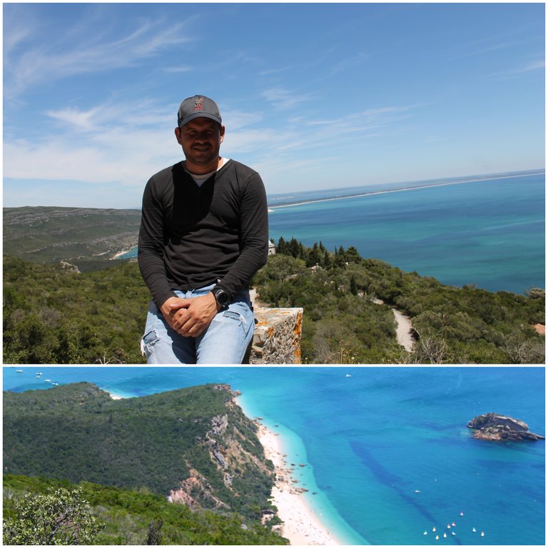
Opinion on the trail🧭 / Opinion sobre el sendero🌍🚩

There are no excuses here, you don't want to stay in the middle of the mountain or halfway without water, I carried 4 liters and I ran out of water in the final stretch, I was already dehydrated and up there the heat is even worse, so on another better hike I have extra water that I lack! but as you can see it was a "brutal" experience the landscape along the entire way deserves 5/5 stars. Would you dare to do it?🌄🌎

No hay excusas aqui, no quieres quedarte en medio de la montana o a mitad de camino sin agua, lleve 4litros y me quede sin agua en la recta final, ya estaba deshidratado y alla arriba el calor es aun peor, por eso en otra caminata mejor que me sobre agua que me falte! pero como puedes ver fue una experiencia "brutal" el paisaje a lo largo de todo el camino merece 5/5 estrellas. Te animarias hacerlo?🌲🗺️

46aP2QbqUqBqpx5c7Zikd2HFMqywJNqDeZVr22vYLLq3mmDMvC912rHcgZVsjPXr3wLjkA8LKLBDRLTxVkouUowGoPo3.gif

DNA is an organization to foster and DENSIFY NATURE-APPRECIATION which aims to establish REPORTS OF BIODIVERSITY DATA that is contributed by all of us Hiveans and subsequently cataloged.

Therefore DNA searches for HIGH-QUALITY posts that aim to DESCRIBE and determine the BIODIVERSITY AROUND YOU with added EXPLANATIONS and INFORMATION. For these informative posts they offer a CURATION SERVICE using the @dna.org account. It is also a CURATION TRAIL. Just add the #dna TAG if you think that any of your posts is what they are looking for.

THANKS FOR READING ME (PHOTOS AND VIDEOS OF MY PROPERTY) / GRACIAS POR LEERME FOTOS Y VIDEOS DE MI PROPIEDAD🙂🧠🦾👍


0
0
0.000
16 comments
avatar

Congratulations, your post has been added to the TravelFeed Map! 🎉🥳🌴

Did you know you have your own profile map?
And every post has their own map too!

Want to have your post on the map too?

  • Go to TravelFeed Map
  • Click the create pin button
  • Drag the marker to where your post should be. Zoom in if needed or use the search bar (top right).
  • Copy and paste the generated code in your post (any Hive frontend)
  • Or login with Hive Keychain or Hivesigner and click "create post" to post to Hive directly from TravelFeed
  • Congrats, your post is now on the map!
PS: You can import your previous Pinmapple posts to the TravelFeed map.
map
Opt Out

0
0
0.000
avatar

Que hermoso todo!! Parece que pasaste muy bien y viste un monton de flores bellas 🌼🌻🌷

0
0
0.000
avatar

Con el sólo hecho de ver esta belleza natural, es una gran aventura para disfrutar de la naturaleza, saludos amigo.

0
0
0.000
avatar

Congratulations, your post has been added to WorldMapPin! 🎉

Did you know you have your own profile map?
And every post has their own map too!

Want to have your post on the map too?

  • Go to WorldMapPin
  • Click the get code button
  • Click on the map where your post should be (zoom in if needed)
  • Copy and paste the generated code in your post (Hive only)
  • Congrats, your post is now on the map!

0
0
0.000
avatar

Congratulations @biologistbrito! You received the biggest smile and some love from TravelFeed! Keep up the amazing blog. 😍 Your post was also chosen as top pick of the day and is now featured on the TravelFeed front page.

Thanks for using TravelFeed!
@for91days (TravelFeed team)

PS: Why not share your blog posts to your family and friends with the convenient sharing buttons on TravelFeed?

0
0
0.000
avatar

Hiya, @ybanezkim26 here, just swinging by to let you know that this post made it into our Honorable Mentions in Travel Digest #2235.

Your post has been manually curated by the @worldmappin team. If you like what we're doing, please drop by to check out all the rest of today's great posts and consider supporting other authors like yourself and us so we can keep the project going!

Become part of our travel community:

0
0
0.000
avatar

Seems quite scenic!

!discovery 47

0
0
0.000
avatar

Thank you for your witness vote!
Have a !BEER on me!
To Opt-Out of my witness beer program just comment STOP below

0
0
0.000
avatar
Connect

Trade


☕️ Hello @! Your post has been recognized by the cXc Music team!

Experience our music map at cXc.world 🔗🌳. Peep plans 👀 in our DHF proposal 👉

0
0
0.000