OpenStreetMap: a free use alternative to Google Maps [ENG-ESP]
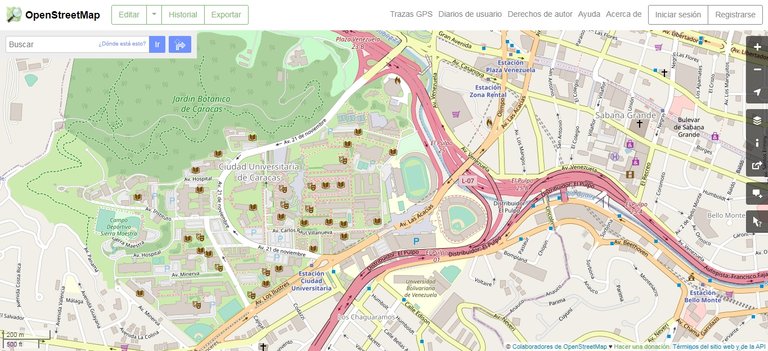
Recently I decided to create a post in which I needed to take pictures of satellite maps. In addition to this, I also needed to make drawings over, or modifications to the capture taken. Reviewing the copyright of Google Maps, it seems that it is not possible to do this, at least not for commercial purposes.
To avoid any inconvenience, I decided to look for alternatives that would allow the free use of their images. I quickly came across OpenStreetMap, which provides satellite maps for free use to the public under an open license called "Open Database License" (ODbL). In addition, the maps are available under a CC BY-SA 2.0 license.
Recientemente decidí crear un post en el cual necesitaba tomar capturas de mapas satelitales. Además de esto, también necesitaba realizar dibujos encima, o modificaciones a la captura tomada. Revisando los derechos de autor de Google Maps, aparentemente no es posible realizar esto, al menos no para propósitos comerciales.
Para evitar algún incoveniente, decidí buscar alternativas que permitan el libre uso de sus imágenes. Rápidamente me topé con OpenStreetMap, que proporciona mapas satelitales de libre uso al público bajo una licencia abierta llamada "Licencia Abierta de Bases de Datos" (en inglés ODbL). Además, los mapas están disponibles bajo una licencia CC BY-SA 2.0.

OpenStreetMap is a project where users can freely register and contribute information using GPS, they also have editing tools to create and contribute data provided by the community. This is a good application for the public, especially knowing that public geographic information is not free to use.
The following map shows the countries where a greater number of edits have been made since 2011 (in darker color), I suppose that would be the countries where there is more cartographic information in this application.
OpenStreetMap es un proyecto donde los usuarios pueden registrarse libremente y aportar información mediante GPS, además cuentan con herramientas de edición para crear y aportar datos que suministra la comunidad. Esto es una buena aplicación para el público, sobre todo sabiendo que la información geográfica pública no es de libre uso.
En el siguiente mapa se muestra los países en donde se han hecho un mayor número de ediciones desde 2011 (en color más oscuro), Supongo que serían los países donde existe mayor información cartográfica en esta aplicación.

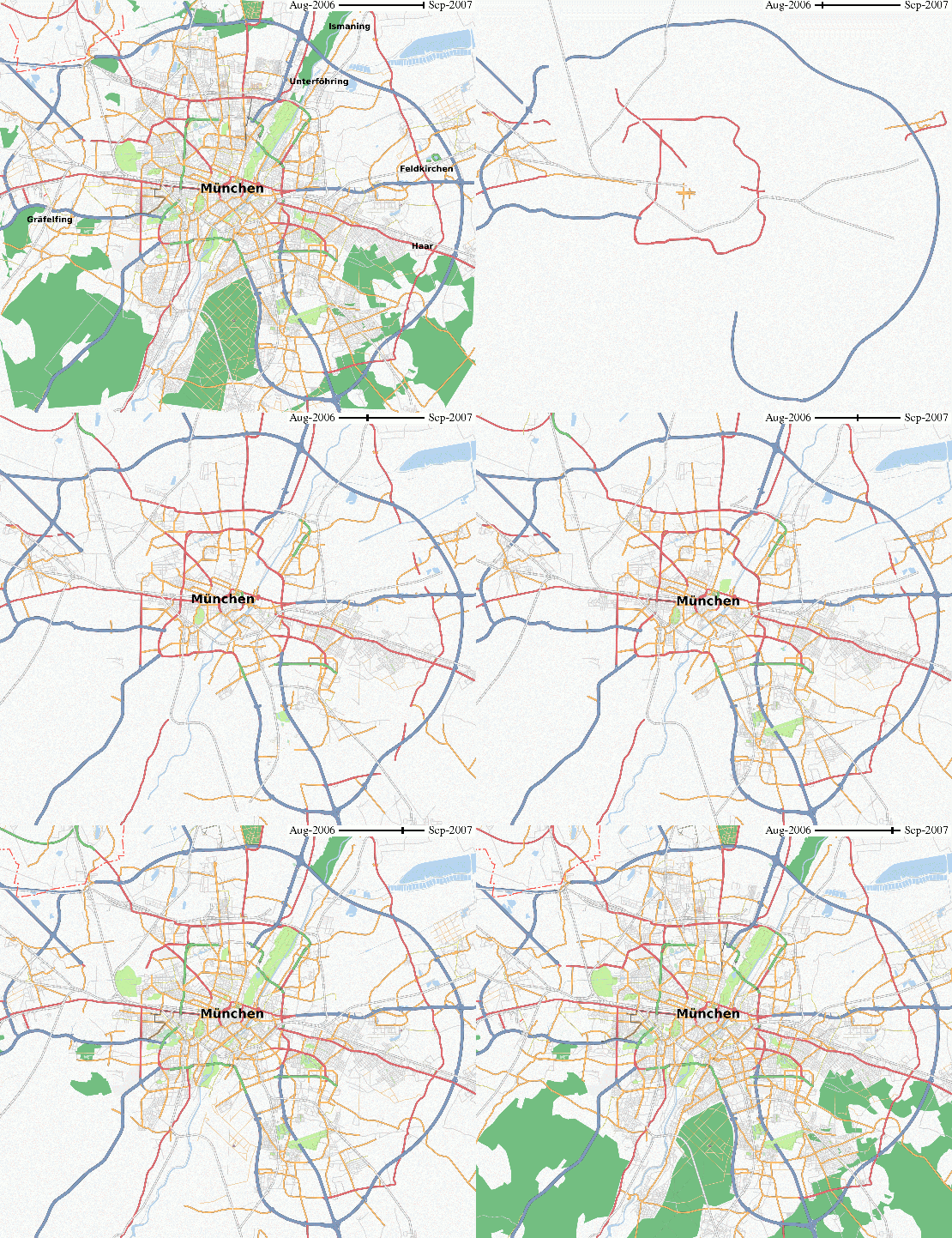
This project has been growing since its creation in 2004. By 2006, they were already starting to map the city of Munich (Germany). The following animation shows the progress made in 1 year:
Este proyecto ha estado creciendo desde su creación en el año 2004. Ya para el año 2006, estaban empezando a realizar el cartografiado de la ciudad de Munich (Alemania). En la siguiente animación se muestra el progreso realizado en 1 año:

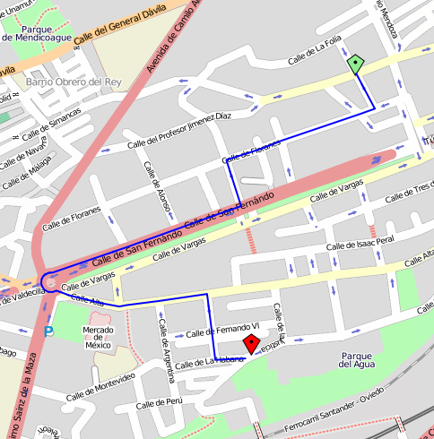
The application also allows the calculation of optimal routes, although according to the information available, this function is not fully developed. When using the application, I realize that it does allow to draw optimal routes, but it does not have the function of measuring distances, which Google Maps does.
La aplicación también permite el cálculo de rutas óptimas, aunque según la información disponible, esta función no está totalmente desarrollada. Al usar la aplicación, me doy cuenta de que efectivamente permite trazar rutas óptimas, pero no tiene la función de mediar distancias, cosa que si hace Google Maps.

Another thing it does not have either, is satellite view, although this would be much more difficult to reproduce for free use by the public. In conclusion, I think OpenStreetMap is an excellent tool, especially for educational and informational use, and also for platforms like Hive, where you may need free cartographic images to create a post.
Otra cosa que tampoco posee, es vista satelital, aunque esto ya sería mucho más difícil de reproducir para un libre uso por parte del público. En conclusión, OpenStreetMap me parece una herramienta excelente, sobre todo para uso educativo e informativo, y también para plataformas como Hive, donde se puedan requerir imágenes cartográficas de libre uso para realizar algún post.
Sources
•Open Database License (ODbL) by Wikipedia
Translated to English with the help of DeepL.com.
| ¡Thanks for visiting!..  |
Posted with STEMGeeks
https://twitter.com/acontcivil/status/1326627540312657921